This article needs additional citations for verification .(January 2022) |
Richland, Pennsylvania | |
|---|---|
Borough | |
 View of West Main Street looking towards Race Street | |
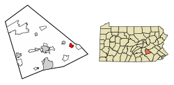 Location of Richland in Lebanon County, Pennsylvania. | |
 Richland Location of Richland in Pennsylvania  Richland Richland (the United States) | |
| Coordinates: 40°21′26″N76°15′26″W / 40.35722°N 76.25722°W | |
| Country | United States |
| State | Pennsylvania |
| County | Lebanon |
| Incorporated | 1906 |
| Government | |
| • Type | Borough Council |
| Area | |
• Total | 1.39 sq mi (3.59 km2) |
| • Land | 1.39 sq mi (3.59 km2) |
| • Water | 0 sq mi (0.00 km2) |
| Population | |
• Total | 1,496 |
| • Density | 1,079.1/sq mi (416.66/km2) |
| Time zone | UTC-5 (Eastern (EST)) |
| • Summer (DST) | UTC-4 (EDT) |
| ZIP code | 17087 |
| Area code | 717[223] |
| FIPS code | 42-64560 |
| Website | https://richlandborough.org/ |
Richland is a borough in Lebanon County, Pennsylvania. It is part of the Lebanon County, Pennsylvania metropolitan statistical area. The population was 1,490 at the 2020 census. [3]
Contents
Richland has an active railroad crossing that intersects the town square. The two streets that comprise the square, Main Street and Race Street, are the only streets linking the northern and southern portions of the borough. As a result, the crossing can divide the entire town. This quirk has earned Richland mentions in Ripley's Believe It or Not! books and on the televised game show, Jeopardy! . [4]

