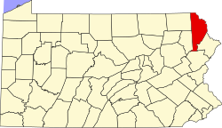
Rileyville, Pennsylvania | |
---|---|
Village of Rileyville | |
Coordinates: 41°42′56″N75°13′46″W / 41.71556°N 75.22944°W | |
Country | United States |
State | Pennsylvania |
U.S. Congressional District | PA-8 |
School District | Wayne Highlands Region II |
County | Wayne |
Magisterial District | 22-3-04 [1] |
Township | Lebanon |
Elevation | 1,611 [2] ft (491 m) |
Time zone | UTC-5 (Eastern (EST)) |
• Summer (DST) | UTC-4 (Eastern Daylight (EDT)) |
ZIP code | |
Area code | 570 |
GNIS feature ID | 1204511 [2] |
FIPS code | 42-127-42176 [4] -64884 [2] |
Major roads |
Rileyville is a village in the Lebanon Township, Wayne County, Pennsylvania, United States. It is located at the intersection of Route 191 and Route 371. The mailing city address for the area is Honesdale, a borough and the county seat directly south of Rileyville.
Wayne is a county in the Commonwealth of Pennsylvania. The county's population was 51,155 at the 2020 census. The county seat is the Borough of Honesdale. The county was formed from part of Northampton County on March 21, 1798, and was named for the Revolutionary War General Anthony Wayne. The county is part of the Northeast Pennsylvania region of the state.
Wayne County is the most populous county in the U.S. state of Michigan. As of 2020, the United States Census placed its population at 1,793,561, making it the 19th-most populous county in the United States. The county seat is Detroit. The county was founded in 1796 and organized in 1815. Wayne County is included in the Detroit-Warren-Dearborn, MI Metropolitan Statistical Area. It is one of several U.S. counties named after Revolutionary War-era general Anthony Wayne.
Boone County is a county in the U.S. state of Indiana. As of 2020, the population was 70,812. The county seat is Lebanon.
Wayne County is a county located in the U.S. state of Illinois. According to the 2020 census, it had a population of 16,179. Its county seat is Fairfield. It is located in the southern portion of Illinois known locally as "Little Egypt".
East Amwell Township is a township in Hunterdon County, in the U.S. state of New Jersey. As of the 2020 United States census, the township's population was 3,917, a decrease of 96 (−2.4%) from the 2010 census count of 4,013, which in turn reflected a decline of 442 (−9.9%) from the 4,455 counted in the 2000 census.
Franklin Township is a township in central Hunterdon County, in the U.S. state of New Jersey. As of the 2020 United States census, the township's population was 3,267, an increase of 72 (+2.3%) from the 2010 census count of 3,195, which in turn reflected an increase of 205 (+6.9%) from the 2,990 counted in the 2000 census. Most of the township lies on the Hunterdon Plateau with only the eastern section along the South Branch Raritan River being on the lower part of the Newark Basin.
Lebanon is a borough in Hunterdon County, in the U.S. state of New Jersey. As of the 2020 United States census, the borough's population was 1,665, the highest ever in any decennial census and an increase of 307 (+22.6%) from the 2010 census count of 1,358, which in turn reflected an increase of 293 (+27.5%) from the 1,065 counted in the 2000 census.
Lebanon Township is the northernmost township in Hunterdon County, in the U.S. state of New Jersey. As of the 2020 United States census, the township's population was 6,195, a decrease of 393 (−6.0%) from the 2010 census count of 6,588, which in turn reflected an increase of 772 (+13.3%) from the 5,816 counted in the 2000 census.
Wayne is a township in Passaic County, in the U.S. state of New Jersey. Home to William Paterson University and located less than 20 miles (32 km) from Midtown Manhattan, the township is a bedroom suburb of New York City and regional commercial hub of North Jersey. As of the 2020 United States census, the township's population was 54,838, an increase of 121 (+0.2%) from the 2010 census count of 54,717, which in turn reflected an increase of 648 (+1.2%) from the 54,069 counted in the 2000 census.
Mt. Lebanon is a Home rule municipality in Allegheny County, Pennsylvania, United States. The population was 34,075 at the 2020 census. It is a suburb of Pittsburgh. Established in 1912 as Mount Lebanon, the township was a farming community. With the arrival of the first streetcar lines and the development of the first real estate subdivision, both in 1901, it became a streetcar suburb, offering residents the ability to commute to Downtown Pittsburgh. Furthermore, the opening of the Liberty Tunnel in 1924 allowed easy automobile access to Pittsburgh. In 1975, the renamed Mt. Lebanon adopted one of the first home rule charters in Pennsylvania.
Berlin Township is a second-class township in Wayne County, Pennsylvania, United States. The township's population was 2,452 at the time of the 2020 United States Census.
Damascus is a second-class township in Wayne County, Pennsylvania, United States. The township's population was 3,659 at the time of the 2010 United States Census.
Preston is a second-class township in Wayne County, Pennsylvania, United States. The township's population was 1,014 at the time of the 2010 United States Census.
Radnor Township, often called simply Radnor, is a first class township with home rule status in Delaware County, Pennsylvania, United States.
Turtlecreek Township is one of the eleven townships of Warren County, Ohio, United States. It is in the central part of the county and surrounds the county seat of Lebanon. Turtlecreek is the largest township in the county, originally containing sixty-three whole and seven fractional sections. The population was 17,644 as of the 2020 census.
Clearcreek Township is one of the eleven townships of Warren County, Ohio, United States, located in the north central portion of the county. It had a population of 36,238 in 2020. It was originally about forty-two square miles in area. The highest point in the county is in Clearcreek Township, near the community of Five Points. Statewide, the only other Clearcreek Townships are located in Fairfield County and in Ashland County.
Wayne Township is one of the eleven townships of Warren County, Ohio, United States. It is located in the northeast part of the county and includes the village of Waynesville, Ohio. The population was 8,658 at the 2020 census. Caesar Creek State Park is located in the township.
Gouldsboro is a village and census-designated place (CDP) in Lehigh Township in Wayne County, and Coolbaugh Township, in Monroe County, Pennsylvania, United States. The CDP's population was 750 at time of the 2020 United States Census.
Poyntelle is a village that is located in Preston Township, Wayne County, Pennsylvania, United States, in the Lake Region of the Poconos.
Lakewood is a village that is located in Preston Township, Wayne County, Pennsylvania, United States. It is situated on Pennsylvania Route 370 (PA-370), approximately 7 miles (11 km) east of Thompson, Pennsylvania and about 10 miles (16 km) southwest of Hancock, New York.
{{cite web}}
: CS1 maint: numeric names: authors list (link)[ dead link ]