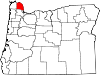
Columbia County is one of the 36 counties in the U.S. state of Oregon. As of the 2010 census, the population was 49,351. The county seat is St. Helens. It was named for the Columbia River, which forms its eastern and northern borders.
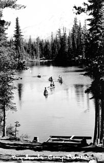
Scouting in the U.S. state of Oregon includes the Boy Scouts of America (BSA) and Girl Scouts (GSUSA) youth organizations, as well as newer organizations like the Baden-Powell Service Association.
Riverside, Oregon may refer to one of these places in the U.S. state of Oregon:
Three Sisters may refer to:
The Territory of Washington was an organized incorporated territory of the United States that existed from March 2, 1853, until November 11, 1889, when the territory was admitted to the Union as the State of Washington. It was created from the portion of the Oregon Territory north of the lower Columbia River and north of the 46th parallel east of the Columbia. At its largest extent, it also included the entirety of modern Idaho and parts of Montana and Wyoming, before attaining its final boundaries in 1863.

Rogue Community College (RCC) is a public community college with campuses in both Jackson County and Josephine County, falling roughly in the geographic region known as the Rogue Valley in Southern Oregon.

Mist is an unincorporated community in Columbia County, Oregon, United States. Formerly called Riverside, the place was renamed in 1888 for the atmospheric conditions of the Nehalem Valley. The first land claims in the area had been made circa 1870. The original Riverside post office was closed in 1975.
Columbia blue is a light blue tertiary color named after Columbia University. The color itself derives from the official hue of the Philolexian Society, the university's oldest student organization. Although Columbia blue is often identified with Pantone 292, the Philolexian Society first used it in 1852, before the standardization of colors. Pantone 290, a slightly lighter shade of blue, has also been specified by some Columbia University offices, and is the current official color listed by the Columbia University visual communications office.

Central Oregon is a geographic region in the U.S. state of Oregon and is traditionally considered to be made up of Deschutes, Jefferson, and Crook counties. Other definitions include larger areas, often encompassing areas to the north towards the Columbia River, eastward towards Burns, or south towards Klamath Falls. These three counties have a combined population of 200,431 as of the 2010 census, with Deschutes the largest of the three counties, having approximately four times the population of the other two counties combined. As of 2015, the most populous city in the region is Bend, with an estimated 87,014 residents. As defined by the three county definition, Central Oregon covers 7,833 square miles (20,290 km2) of land. Central Oregon has had 3 record tourism years beginning in 2012. Over 2.2 million people visited Central Oregon in 2012 and again in 2013.
The Oregon Department of Fish and Wildlife (ODFW) is an agency of the government of the U.S. state of Oregon responsible for programs protecting Oregon fish and wildlife resources and their habitats. The agency operates hatcheries, issues hunting and angling licenses, advises on habitat protection, and sponsors public education programs. Its history dates to the 1878 establishment of the office of Columbia River Fish Warden. Since 1931, enforcement of Oregon's Fish and Game laws has been the responsibility of the Oregon State Police rather than separate wardens.
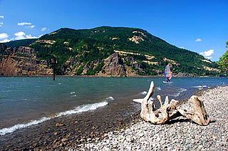
Viento State Park is a state park in north central Hood River County, Oregon, near the city of Hood River. The park, named for the former Viento railroad station located there, is administered by the Oregon Parks and Recreation Department. The park is on the south bank of the Columbia River in the Columbia River Gorge. Interstate 84 and the Union Pacific Railroad pass through the park. It offers a seasonal, full-service campground, access to gorge hiking trails beyond park boundaries, a day-use area and river access for windsurfing and kiteboarding.

The Nevada–California–Oregon Railway was a 3 ft narrow gauge railroad originally planned to connect Reno, Nevada, to the Columbia River. However, only 238 mi (383 km) of track were laid so service never extended beyond Lakeview, Oregon. Because of the company’s reputation for mismanagement, it was often called the "Narrow, Crooked & Ornery" railroad.
Riverside is an unincorporated community in Malheur County, Oregon, United States. It lies at an elevation of 3,343 feet (1,019 m) and is part of the Ontario, Oregon–Idaho Micropolitan Statistical Area. It is northeast of Crane and south of Juntura along Juntura–Riverside Road and the South Fork Malheur River near its confluence with the main stem.
Riverside is an unincorporated community in Linn County, Oregon. It lies at an elevation of 223 feet.
Riverwood is an unincorporated community in Multnomah County, Oregon. It lies at an elevation of about 436 feet.

Riverside is an unincorporated historic locale in Yamhill County, Oregon, United States. It lies at an elevation of 213 feet.

Riverside is an unincorporated, historic community in Clackamas County, Oregon, United States. It lies at an elevation of 292 feet.

Launched in 1850, Lot Whitcomb, later known as Annie Abernathy, was the first steam-powered craft built on the Willamette River in the U.S. state of Oregon. She was one of the first steam-driven vessels to run on the inland waters of Oregon, and contributed to the rapid economic development of the region.
Needy, also known as Hardscrabble, is an unincorporated community in Clackamas County, Oregon, United States. James H. Brents gave the community its names, which may be such because of its poverty. Needy's post office was established on February 16, 1885 and John M. Bacon was its postmaster. It closed on September 19, 1903. It is now served by the Canby post office.