
Guelph is a city in Southwestern Ontario, Canada. Known as "The Royal City", Guelph is roughly 28 km (17 mi) east of Kitchener and 100 km (62 mi) west of Downtown Toronto, at the intersection of Highway 6, Highway 7 and Wellington County Road 124. It is the seat of Wellington County, but is politically independent of it. The city is built on the traditional territory of the Mississaugas of the Credit First Nation.

Erin is a town in Wellington County, approximately 80 kilometres (50 mi) northwest of Toronto, Ontario, Canada. Erin is bordered by the Town of Caledon, Ontario to the east, the Town of Halton Hills to the south, the Township of Guelph/Eramosa to the west and the Township of East Garafraxa to the north.

Wellington County is a county located in Southwestern Ontario, Canada and is part of the Greater Golden Horseshoe. The County, made up of two towns and five townships, is predominantly rural in nature. However many of the residents in the southern part of the County commute to urban areas such as Guelph, Kitchener, Waterloo, Brampton, Mississauga, Toronto and Hamilton for employment. The northern part of the county is made up of mainly rural farming communities, except for a few larger towns such as Mount Forest and Arthur. According to the 2016 Census, the population of the County was 90,932.

Puslinch is a township in south-central Ontario, Canada, in Wellington County, surrounding the south end of Guelph. The main source of production is agricultural, spring water bottling and mining. Aggregate mining has been dominant throughout the county. About half of the township is forested, and a conservation area lies to the southwest. Near the western edge of the township, just outside Cambridge, Ontario, is Puslinch Lake, the largest kettle lake in North America. It is part of the Guelph census metropolitan area.
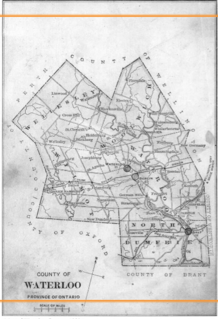
Waterloo County, created in 1853 and dissolved in 1973, was the forerunner of the Regional Municipality of Waterloo in Ontario, Canada. Situated on a subset of land within the Haldimand Tract, the traditional territory of the Attawandaron, Anishinaabe and Haudenosaunee peoples, Waterloo County consisted of five townships: Woolwich, Wellesley, Wilmot, Waterloo, and North Dumfries. The major population centres were Waterloo, Kitchener, Preston, Hespeler, Blair, and Doon in Waterloo township; Galt in North Dumfries; Elmira in Woolwich; and New Hamburg in Wilmot. All are now part of the Regional Municipality.

Fergus is the largest community in Centre Wellington, a township within Wellington County in Ontario, Canada. It lies on the Grand River about 18 km NNW of Guelph. The population of this community at the time of the 2016 Census was 20,767, but the community is growing as new homes are being built for sale.
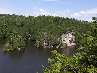
Guelph/Eramosa is a township located in Wellington County, in midwestern Ontario, Canada. It partly encircles the city of Guelph, surrounding it in a continuous arc from approximately northeast to south-southwest of the city. It is part of the Guelph census metropolitan area.

Alma is an unincorporated rural community in Mapleton Township, Wellington County, Ontario, Canada.

Wellington North is a township in the Canadian province of Ontario, located within Wellington County.

The Township of Perth East is a municipality in Perth County, Ontario, Canada and situated north of Stratford. It was created in 1998 when the Ontario government amalgamated the village of Milverton with the surrounding former townships of Ellice, Mornington, North Easthope and South Easthope.

Brucedale is an unincorporated rural community in Guelph/Eramosa Township, Wellington County, Ontario, Canada.
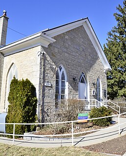
Centre Inn is an unincorporated rural community in Guelph/Eramosa Township, Wellington County, Ontario, Canada.

Living Springs is an unincorporated rural community in Centre Wellington Township, Wellington County, Ontario, Canada. The settlement was part of West Garafraxa Township until 1999.

Spier is an unincorporated rural community in Centre Wellington Township, Wellington County, Ontario, Canada. The settlement was part of West Garafraxa Township until 1999.

Kenilworth is an unincorporated rural community in Wellington North Township, Wellington County, Ontario, Canada. Kenilworth was located in Arthur Township until 1999.

Olivet is an unincorporated rural community in Wellington North Township, Wellington County, Ontario, Canada.

Petherton is an unincorporated rural community in Wellington North Township, Wellington County, Ontario, Canada. Petherton was located in Arthur Township until 1999.

Creek Bank is an unincorporated rural community in Centre Wellington Township, Wellington County, Ontario, Canada.
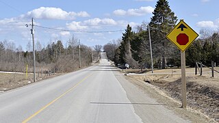
Riverbank is an unincorporated rural community in Mapleton Township, Wellington County, Ontario, Canada. Prior to 1999, Riverbank was located in Maryborough Township.
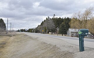
Cumnock is an unincorporated rural community in Centre Wellington Township, Wellington County, Ontario, Canada. Cumnock was part of Nichol Township until 1999.


