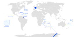
Rivières du Sud

Last updated • 4 min readFrom Wikipedia, The Free Encyclopedia
French colonial possessions (in red) at the time of Rivieres du Sud administration (circa 1872-1884) WestAfricaCirca1875 1880.jpg
French colonial possessions (in red) at the time of Rivières du Sud administration (circa 1872-1884)

Rivières du Sud (English: Southern Rivers) was a French colonial division in West Africa, roughly corresponding to modern coastal sections of Guinea. While the designation was used from the 18th to 20th century, the administrative division only existed from 1882-1891. [1]

Contents

Early usage

Since the 18th century, Portuguese, British and French traders had established small stations on the coast which was called Rivières du Sud by the French. The Portuguese had trading stations at Rio Pongo and Rio Nunez, mostly for the purchase of enslaved Africans captured inland and brought to the coast. Subsequently a number of English and American traders also settled in the region. With the establishment of Sierra Leone by British Abolitionists, this area attracted their attention and that of the Christian Missionary Society, which sought to promote Christianity and trading opportunities By 1820, British suppression of the slave trade and Portuguese imperial decline saw these posts abandoned, with British and French traders moving in. The French admiral Bouët-Willaumez made a number of treaties with coastal communities in the area (usually under the threat of force), and ensured Marseilles based trade houses exclusive access to the palm oil trade by the 1840s. Used for making soap, the palm oil trade was with Diola merchants who established markets in the interior, and transported it to the coastal stations.

Administrative expansion

The French colonial governor of Senegal Louis Faidherbe in the 1850s formalised the colonial structure which was christened Rivières du Sud. In 1854 Guinea ports were placed under control of Naval administration and split from new colonial administration in Saint-Louis, Senegal under the name Gorée and Dependencies. Previously, they had fallen under the naval 'supreme commander in Gabon' of the Establissements francais de la Cote de l'Or et du Gabon.

By 1859, Faidherbe's campaigns of conquest on the riverine coast south of Gorée saw the region annexed to the colonial administration, under the arrondissement of Gorée. The Rivières du Sud now referred to the entire region from Sine-Salmon to the border of British Sierra Leone.

In 1865 the fort at Boké was built in the Rio Nunez area, expanding from the main French-controlled town of Conakry. Shortly after this, Bayol was taken as a 'protectorate' as well. The Rio Pongo area, nominally held by Germany, was traded to France for their 'rights' to Porto-Seguro and Petit Popo on the Togolese coast. [2] The British formally recognised French control of the area, and the administrative division collecting these possessions was created under the name Rivières du Sud in 1882.

Pause

The background to these legalistic and administrative manoeuvres was the Berlin conference of 1884 and the "loaded pause" of French imperial expansion. Domestically, this stemmed from the disastrous French defeat in Tonkin and the collapse of the colonial policy of the Ferry ministry. [3] European horse-trading followed the Berlin conference, in which foreign powers divided the African continent and attempted to consolidate their own possessions. Rivières du Sud was a formal division which, apart from the coast, had little relation to actual governance until the next decade.

Evolution of French administrative division

In 1891, Rivières du Sud was placed under the colonial lieutenant governor at Dakar, who had authority over the French coastal regions east to Porto-Novo (modern Benin).

Governor general Gallieni, having faced fierce resistance to French expansion on the upper Senegal and Niger basin from the Toucouleur Empire, Samori, and then Mahmadu Lamine's forces, turned the colonial gaze to the Rivières du Sud in the late 1880s, marking a new phase in French expansion.

Between 1889 and 1894, Rivières du Sud, Côte d'Ivoire and Dahomey were each successively separated into 'independent' colonies, with Rivières du Sud being renamed the 'Colony of French Guinea'. In 1895 these colonies came under the authority of the governor general of French West Africa, and in 1904, this was formalised into the Afrique Occidentale Française. French Guinea, along with Senegal, Dahomey, Cote-d'Ivoire and Upper Senegal and Niger each were ruled by a lieutenant governor, under the Governor General in Dakar.

Futa Jallon opposition

The Rivières du Sud colony never extended far from the coast, as the French were unable to conquer the people of the Futa Jallon highlands, running from the south of modern Senegal though the interior of modern Guinea.

The Imamate of Futa Jallon was located mainly in present-day Guinea as well as parts of Guinea Bissau, Senegal, and Sierra Leone. A powerful force, it stymied French expansion until 1896 when the French colonial troops defeated the last Almami, Bokar Biro Barry, dismantled the state and integrated it into their colony of French Guinea.

See also

Related Research Articles

French Guinea French colony in West Africa (1891-1958); now the country of Guinea

French Guinea was a French colonial possession in West Africa. Its borders, while changed over time, were in 1958 those of the current independent nation of Guinea.

French West Africa French colonial federation

French West Africa was a federation of eight French colonial territories in Africa: Mauritania, Senegal, French Sudan, French Guinea, Ivory Coast, Upper Volta, Dahomey and Niger. The federation existed from 1895 until 1958. Its capital was Saint-Louis, Senegal until 1902, and then Dakar until the federation's collapse in 1960.

Louis Faidherbe

Louis Léon César Faidherbe was a French general and colonial administrator. He created the Senegalese Tirailleurs when he was governor of Senegal.

Guinea (region) Region of West Africa

Guinea is a traditional name for the region of the African coast of West Africa which lies along the Gulf of Guinea. It is a naturally moist tropical forest or savanna that stretches along the coast and borders the Sahel belt in the north.

Fouta Djallon

Fouta Djallon is a highland region in the center of Guinea, roughly corresponding with Middle Guinea, in West Africa.

Upper Guinea is a geographical term used in several contexts:

  1. Upper Guinea is one of the four geographic regions of the Republic of Guinea, being east of Futa Jalon, north of Forest Guinea, and bordering Mali. The population of this region is mainly Malinke.
  2. In a larger sense, it refers to a large plain covering eastern Guinea, Sierra Leone, Liberia and extending into north western Côte d'Ivoire. Mostly forming the upper watershed of the River Niger, it is sparsely populated and is home to the Haut Niger National Park.
  3. Upper Guinea can also refer to the interior part of the wider Guinea region, bordering the Sahel. The interior regions are largely defined by the watersheds of rivers that arise from Fouta Djallon, including the Niger, Senegal, Faleme and others. The term was widely applied during the sixteenth to nineteenth centuries to describe a coastal region and its related hinterland with which Europeans traded.
  4. In biogeography, Upper Guinea refers the region of tropical rainforest extending from southwestern Guinea through Sierra Leone, Liberia, southeastern Guinea, Côte d'Ivoire, and southwestern Ghana. The Dahomey Gap, a drier region of Ghana, Togo, and Benin where the Guinean forest-savanna mosaic extends to the Gulf of Guinea, separates Upper Guinea from the tropical rainforests of Lower Guinea further east. The Upper Guinea forests are also recognized as an endemic bird area.
Boké Urban Sub-prefecture and city in Boké Region, Guinea

Boké is the capital city of Boké Prefecture within the Boké Region of Lower Guinea near the border with Guinea-Bissau. It is also a sub-prefecture of Guinea. Located along the Rio Nuñez which flows to its not-too-distant mouth on the Atlantic Ocean, Boké is a port. It is known for the Fortin de Boké museum, formerly a slave fort. The town is served by Boké Baralande Airport. As of 2014 the city and surrounding sub-prefecture had a population of 61,449 people.

Imamate of Futa Toro

The Imamate of Futa Toro (1776-1861) was a West African theocratic state of the Fula-speaking people centered on the middle valley of the Senegal River. The region is known as Futa Toro.

Louis Brière de lIsle

Louis Alexandre Esprit Gaston Brière de l'Isle was a French Army general who achieved distinction firstly as Governor of Senegal (1876–81), and then as general-in-chief of the Tonkin Expeditionary Corps during the Sino-French War.

Ahmadou, was one of the last Almamis of the Fula Imamate of Futa Jallon, in the Futa Jallon region of today's Guinea.

Outline of Guinea Overview of and topical guide to Guinea

The following outline is provided as an overview of and topical guide to Guinea:

The Jakhanke also spelled Jahanka, Jahanke, Jahanque, Jahonque, Diakkanke, Diakhanga, Diakhango, Dyakanke, Diakhanké, Diakanké, or Diakhankesare are a Manding-speaking ethnic group in the Senegambia region, often classified as a subgroup of the larger Soninke. The Jakhanke have historically constituted a specialized caste of professional Muslim clerics (ulema) and educators. They are centered on one larger group in Guinea, with smaller populations in the eastern region of The Gambia, Senegal, and in Mali near the Guinean border. Although generally considered a branch of the Soninke, also known as Serahule or Serakhulle, their language is closer to Western Manding languages such as Mandinka.

The French conquest of Senegal started in 1659 with the establishment of Saint-Louis, Senegal, followed by the French capture of the island of Gorée from the Dutch in 1677, but would only become a full-scale campaign in the 19th century.

Nunez River

Nunez River or Rio Nuñez (Kakandé) is a river in Guinea with its source in the Futa Jallon highlands. It is also known as the Tinguilinta River, after a village along its upper course.

Point of Sangomar

The Point of Sangomar is a sand spit located on the Atlantic Ocean at the mouth of the Saloum Delta, which marks the end of the Petite Côte west of Senegal.

Bokar Biro Barry was the last independent ruler of the Imamate of Futa Jallon in what is now Guinea. He died in the Battle of Porédaka, when his forces were destroyed by French artillery.

Ernest Noirot

Jean-Baptiste Ernest Noirot was a French comic actor, photographer, explorer and colonial administrator in Senegal and French Guinea in West Africa. He became involved in scandal and was suspended in 1905 when two of his protégés were accused of extortion and other abuses of power, but later he was reinstated.

Jean-Marie Bayol

Jean-Marie Bayol was a French army doctor, colonial administrator and politician.

Kapitaï and Koba

Kapitaï and Koba were two areas on the coast of West Africa which were the object of German colonial initiatives in 1884 and 1885. They lay between the Pongo and Dubréka rivers, south of Senegal and Gambia in modern Guinea; in the terms commonly used in the 19th century they were considered part of Senegambia. The short-lived German colony there was known as the Dembiah colony or Colinsland.

References

  1. Jean Suret-Canele. French Colonialism in Tropical Africa 1900-1945. Trans. Pica Press (1971) pp 87-88.
  2. Suret-Canale, Jean. Guinea in the Colonial System, in Essays on African History. Translated, Hurst (1980) pp 111-147.
  3. Virgil L Matthew, Jr. Joseph Simon Gallieni in L.H. Gann and Peter Duignan, African Proconsuls. European Governors in Africa. Free Press/Collier Macmillan and Hoover Institution (1988).