Rochelle, Georgia | |
---|---|
Coordinates: 31°56′56″N83°27′14″W / 31.94889°N 83.45389°W | |
Country | United States |
State | Georgia |
County | Wilcox |
Area | |
• Total | 1.91 sq mi (4.94 km2) |
• Land | 1.91 sq mi (4.94 km2) |
• Water | 0.00 sq mi (0.00 km2) |
Elevation | 367 ft (112 m) |
Population (2020) | |
• Total | 1,167 |
• Density | 611.96/sq mi (236.29/km2) |
Time zone | UTC-5 (Eastern (EST)) |
• Summer (DST) | UTC-4 (EDT) |
ZIP code | 31079 |
Area code | 229 |
FIPS code | 13-66024 [2] |
GNIS feature ID | 0321704 [3] |
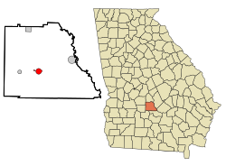
Rochelle is a city in Wilcox County, Georgia, United States. Per the 2020 census, the population was 1,167. [4]
The community was named after La Rochelle, in France. [5] The Georgia General Assembly incorporated Rochelle as a town in 1888. [6]
Rochelle is located at 31°56′56″N83°27′14″W / 31.94889°N 83.45389°W (31.948993, -83.453875). [7]
According to the United States Census Bureau, the city has a total area of 1.9 square miles (4.9 km2), all land.
Census | Pop. | Note | %± |
---|---|---|---|
1900 | 793 | — | |
1910 | 860 | 8.4% | |
1920 | 1,046 | 21.6% | |
1930 | 1,053 | 0.7% | |
1940 | 1,175 | 11.6% | |
1950 | 1,097 | −6.6% | |
1960 | 1,235 | 12.6% | |
1970 | 1,380 | 11.7% | |
1980 | 1,626 | 17.8% | |
1990 | 1,510 | −7.1% | |
2000 | 1,415 | −6.3% | |
2010 | 1,174 | −17.0% | |
2020 | 1,167 | −0.6% | |
U.S. Decennial Census [8] 1850-1870 [9] 1870-1880 [10] 1890-1910 [11] 1920-1930 [12] 1940 [13] 1950 [14] 1960 [15] 1970 [16] 1980 [17] 1990 [18] 2000 [19] 2010 [20] 2020 [21] |
Race / Ethnicity (NH = Non-Hispanic) | Pop 2010 [22] | Pop 2020 [21] | % 2010 | % 2020 |
---|---|---|---|---|
White alone (NH) | 593 | 566 | 50.51% | 48.50% |
Black or African American alone (NH) | 541 | 549 | 46.08% | 47.04% |
Native American or Alaska Native alone (NH) | 0 | 0 | 0.00% | 0.00% |
Asian alone (NH) | 9 | 13 | 0.77% | 1.11% |
Pacific Islander alone (NH) | 0 | 0 | 0.00% | 0.00% |
Other race alone (NH) | 0 | 2 | 0.00% | 0.17% |
Mixed race or Multiracial (NH) | 3 | 13 | 0.26% | 1.11% |
Hispanic or Latino (any race) | 28 | 24 | 2.39% | 2.06% |
Total | 1,174 | 1,167 | 100.00% | 100.00% |
In 2020, the city's population was 1,167, down from 1,174 in 2010.
The Wilcox County School District holds pre-school to grade twelve, and consists of one elementary school, a middle school, and a high school. [23] The district has 90 full-time teachers and over 1,439 students. [24]
The schools, located in Rochelle, are:
Wilcox County is a county located in the south-central portion of the U.S. state of Georgia. As of the 2020 census, the population was 8,766. The county seat is Abbeville.
Dooly County is a county located in the central portion of the U.S. state of Georgia. As of the 2020 census, the population was 11,208. The county seat is Vienna. The county was created by an act of the Georgia General Assembly on May 15, 1821, and named for Colonel John Dooly, a Georgia American Revolutionary War fighter. It was one of the original landlot counties created from land ceded from the Creek Nation.
Newton is a city in Baker County, Georgia, United States. As of the 2020 census, the city population was 602. The city is the county seat of Baker County.
Midville is a city in Burke County, Georgia, United States. The population was 269 at the 2010 census, and 385 in 2020. It is part of the Augusta, Georgia metropolitan area.
Arlington is a city in Calhoun and Early counties, Georgia, United States. Per the 2020 census, the population was 1,209.
Edison is a city in Calhoun County, Georgia, United States. Per the 2020 census, the population was 1,230. The Edison Commercial Historic District is listed on the National Register of Historic Places.
Dooling is a town in Dooly County, Georgia, United States. The population was 68 at the 2020 census.
Cairo is a city in Grady County, Georgia, United States. As of the 2020 census, the city had a population of 10,179. The city is the county seat of Grady County.
White Plains is a city in Greene County, Georgia, United States. The population was 284 at the 2010 census.
Wrightsville is a city in and the county seat of Johnson County, Georgia, United States. The population was 2,195 at the 2010 census, down from 2,223 at the 2000 census. By 2020, its population grew to 3,449. The city limits include Johnson State Prison on the northeast side of town. Wrightsville is part of the Dublin Micropolitan Statistical Area.
Oglethorpe is a city in Macon County, Georgia, United States. The population was 995 at the 2020 census, down from 1,328 in 2010. The city is the county seat of Macon County. It was named for Georgia's founder, James Oglethorpe.
Richland is a city in Stewart County, Georgia, United States. Per the 2020 census, the population was 1,370.
Lumber City is a city located in Telfair County, Georgia, United States. As of the 2020 census, the city had a total population of 967.
Boston is a city in Thomas County, Georgia, United States. As of the 2020 census, the city had a population of 1,207.
Danville is a town in Twiggs and Wilkinson counties in the U.S. state of Georgia. The population was 238 at the 2010 census, down from 373 in 2000.
Alamo is a town in Wheeler County, Georgia, United States. As of the 2020 census, the town had a population of 771. The town is the county seat of Wheeler County.
Pineview is a town in Wilcox County, Georgia, United States. Per the 2020 census, the population was 454.
Pitts is a city in Wilcox County, Georgia, United States. Per the 2020 census, the population was 252.
Seville is an unincorporated community and census-designated place (CDP) in Wilcox County, Georgia, United States. Per the 2020 census, the population was 197. It lies approximately 0.5 miles (0.80 km) away from the Crisp County line, and about 4 miles (6.4 km) away from Pitts.
Abbeville is a city in Wilcox County, Georgia, United States. Per the 2020 census, the population was 2,685. The city is the county seat of Wilcox County.