Related Research Articles

Greenland is located between the Arctic Ocean and the North Atlantic Ocean, northeast of Canada and northwest of Iceland. The territory comprises the island of Greenland—the largest island in the world—and more than a hundred other smaller islands. Greenland has a 1.2-kilometer-long (0.75 mi) border with Canada on Hans Island. A sparse population is confined to small settlements along certain sectors of the coast. Greenland possesses the world's second-largest ice sheet.

The Arctic Archipelago, also known as the Canadian Arctic Archipelago, is an archipelago lying to the north of the Canadian continental mainland, excluding Greenland and Iceland.

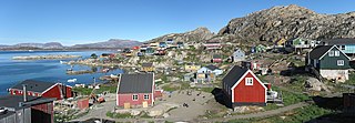
Upernavik is a small town in the Avannaata municipality in northwestern Greenland, located on a small island of the same name. With 1,064 inhabitants as of 2024,it is the twelfth-largest town in Greenland. It contains the Upernavik Museum.

Baffin Bay, located between Baffin Island and the west coast of Greenland, is defined by the International Hydrographic Organization as a marginal sea of the Arctic Ocean. It is sometimes considered a sea of the North Atlantic Ocean. It is connected to the Atlantic via Davis Strait and the Labrador Sea. The narrower Nares Strait connects Baffin Bay with the Arctic Ocean. The bay is not navigable most of the year because of the ice cover and high density of floating ice and icebergs in the open areas. However, a polynya of about 80,000 km2 (31,000 sq mi), known as the North Water, opens in summer on the north near Smith Sound. Most of the aquatic life of the bay is concentrated near that region.

UTC−03:00 is an identifier for a time offset from UTC of −03:00.
Tasiusaq is an island settlement in the Avannaata municipality in northwestern Greenland. It had 252 inhabitants in 2020. In Kalaallisut, the name means "looks like a lake".
Innaarsuit is an island settlement in Avannaata municipality in northwestern Greenland, located on an island of the same name. the settlement had 180 inhabitants in 2020.
Naajaat is a settlement in Avannaata municipality in northwestern Greenland. Former spellings include Naujât, Naujat, and Naajat. Located on a small island of the same name, the settlement has 49 inhabitants as of 2020.
Kangersuatsiaq, formerly Prøven, is an island settlement in the Avannaata municipality in northwestern Greenland. It had 130 inhabitants in 2020.

Bloomingdale Park is a 138-acre (56 ha) park on the South Shore of Staten Island. It is located in the Prince's Bay neighborhood, and is bounded on the north by Ramona Avenue, on the west by Bloomingdale Road, on the east by Lenevar Avenue, and on the south by Drumgoole Road West and the Korean War Veterans Parkway. It is nearly bisected by Maguire Avenue, but the avenue's two spurs into the park from the north and south do not meet in the middle.
Aappilattoq is a settlement in the Avannaata municipality in northwestern Greenland, located on an island of the same name in the southern part of Upernavik Archipelago. Founded in 1805, the settlement had 149 inhabitants in 2020.

The Ilimaussaq intrusive complex is a large alkalic layered intrusion located on the southwest coast of Greenland. It is Mesoproterozoic in age, about 1.16 Ga. It is the type locality of agpaitic nepheline syenite and hosts a variety of unusual rock types.
Upernavik Archipelago is a vast coastal archipelago in the Avannaata municipality in northwestern Greenland, off the shores of northeastern Baffin Bay. The archipelago extends from the northwestern coast of Sigguup Nunaa peninsula in the south at approximately 71°50′N56°00′W to the southern end of Melville Bay in the north at approximately 74°50′N57°30′W.
Sugar Loaf Bay is a bay in the Upernavik Archipelago in the Avannaata municipality in northwestern Greenland. It is an indentation of northeastern Baffin Bay. The name of the bay derives from the name of an island of the same name in the bay, Sugar Loaf Island.
Tasiusaq Bay is a bay in the Upernavik Archipelago in the Avannaata municipality in northwestern Greenland. It is an indentation of northeastern Baffin Bay. The name of the bay derives from the name of the settlement of the same name in the bay.
Kangerlussuaq Icefjord is a fjord in Avannaata municipality in northwestern Greenland.
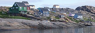
Saattoq is a former settlement in Avannaata municipality in northwestern Greenland. It was located in the north-central part of Upernavik Archipelago, in Tasiusaq Bay, straddling Saattorsuaq Island, and the nearby Saattoq skerry.
Appaalissiorfiup Ikerasaa is a strait in Avannaata municipality in northwestern Greenland.

Cape Shackleton is a cape in Avannaata municipality in northwestern Greenland. The cape is the western promontory on Apparsuit Island, delimiting the northern end of Tasiusaq Bay, an indentation of Baffin Bay in the Upernavik Archipelago.
Ikerasak Strait is a strait in the Avannaata municipality in northwestern Greenland.
References
- ↑ "Saattoq island, Qaasuitsup, Greenland". gl.geoview.info. Retrieved 2022-08-17.
- ↑ "Mindat.org". www.mindat.org. Retrieved 2022-08-18.
73°31′00″N56°07′07″W / 73.51676°N 56.11849°W
| | This Greenland location article is a stub. You can help Wikipedia by expanding it. |