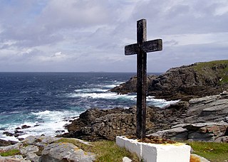
The Gulf of St. Lawrence is the outlet of the North American Great Lakes via the St. Lawrence River into the Atlantic Ocean. The gulf is a semi-enclosed sea, covering an area of about 226,000 square kilometres (87,000 sq mi) and containing about 34,500 cubic kilometres (8,300 cu mi) of water, at an average depth of 152 metres (500 ft).

The Arctic Archipelago, also known as the Canadian Arctic Archipelago, is an archipelago lying to the north of the Canadian continental mainland, excluding Greenland and Iceland.

This is a list of the extreme points of Ireland – the points that are farthest north, south, east or west in Ireland. It includes the Republic of Ireland and Northern Ireland.
The Gravina Islands are a group of islands a part of the Alexander Archipelago in southeast Alaska. The islands are bounded by the Clarence Strait on the west and the Revillagigedo Channel on the east.

Grenadines is an administrative parish of Saint Vincent and the Grenadines, comprising the islands of the Grenadines other than those belonging to Grenada. The capital is Port Elizabeth.

Poza de la Vega is a municipality located in the province of Palencia, Castile and León, Spain. According to the 2004 census (INE), the municipality has a population of 267 inhabitants.

Tubilla del Lago is a municipality located in the province of Burgos, Castile and León, Spain. According to the 2004 census (INE), the municipality had a population of 170 inhabitants.
Levasseur Inlet is a body of water in Nunavut's Qikiqtaaluk Region. It lies on the eastern side of Admiralty Inlet on Baffin Island's Borden Peninsula.
The Southwest Bylot plain is an uninhabited plain in Qikiqtaaluk, Nunavut, Canada. It is located in southwestern Bylot Island directly north of Eclipse Sound. Pond Inlet is the closest community. Southwest Bylot is notable for housing the largest known breeding colony of the greater snow goose.
Bates Peak, about 600 metres (2,000 ft) high, is the westernmost peak on Rothschild Island, rising west of Fournier Ridge in the Desko Mountains. It was named by the Advisory Committee on Antarctic Names for Commander Lawrence O. Bates, U.S. Coast Guard, Executive Officer on USCGC Edisto during U.S. Navy Operation Deep Freeze, 1969.

The borders of the oceans are the limits of Earth's oceanic waters. The definition and number of oceans can vary depending on the adopted criteria. The principal divisions of the five oceans are the Pacific Ocean, Atlantic Ocean, Indian Ocean, Southern (Antarctic) Ocean, and Arctic Ocean. Smaller regions of the oceans are called seas, gulfs, bays, straits, and other terms. Geologically, an ocean is an area of oceanic crust covered by water.
Atilissuaq Island is an island of Greenland. It is located in Baffin Bay in the Upernavik Archipelago. The area is 22.1 square kilometers.
Defant Glacier is a glacier 2 nautical miles (4 km) wide at its mouth, which flows east-southeast to the west side of Violante Inlet, on the east coast of Palmer Land. It was discovered and photographed from the air in December 1940 by the United States Antarctic Service; during 1947 the glacier was photographed from the air by members of the Ronne Antarctic Research Expedition, who in conjunction with the Falkland Islands Dependencies Survey (FIDS) charted it from the ground. It was named by the FIDS for Albert Defant, an Austrian meteorologist and oceanographer who was Professor of Oceanography at the "Friedrich-Wilhelms-Universität" and also Director of the "Institut and Museum für Meereskunde" in Berlin, Germany, from 1926 to 1945.

German submarine U-153 was a Type IXC U-boat of Nazi Germany's Kriegsmarine built for service during World War II. The keel for this boat was laid down on 12 September 1940 at the DeSchiMAG AG Weser yard in Bremen, Germany as yard number 995. She was launched on 5 April 1941 and commissioned on 19 July under the command of Korvettenkapitän Wilfried Reichmann.

German submarine U-541 was a Type IXC U-boat of Nazi Germany's Kriegsmarine during World War II.
This page is based on this
Wikipedia article Text is available under the
CC BY-SA 4.0 license; additional terms may apply.
Images, videos and audio are available under their respective licenses.


