
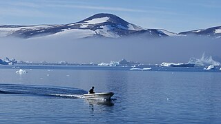
Wilcox Head is a cape in Avannaata municipality in northwestern Greenland.
Wilcox Head is a cape in Avannaata municipality in northwestern Greenland.

The cape is the western promontory on Kiatassuaq Island, [1] delimiting the southern end of Melville Bay, with the other end defined as Cape York, 297.5 km (184.9 mi) to the northwest, in northern Baffin Bay. An alternative endpoint for the bay is Nuussuup Nuua, the western promontory on Nuussuaq Peninsula. [2]
Coordinates: 74°29′26.6″N57°30′51.9″W / 74.490722°N 57.514417°W

Baffin Bay, located between Baffin Island and the west coast of Greenland, is defined by the International Hydrographic Organization as a marginal sea of the Arctic Ocean. It is sometimes considered a sea of North Atlantic Ocean. It is connected to the Atlantic via Davis Strait and the Labrador Sea. The narrower Nares Strait connects Baffin Bay with the Arctic Ocean. The bay is not navigable most of the year because of the ice cover and high density of floating ice and icebergs in the open areas. However, a polynya of about 80,000 km2 (31,000 sq mi), known as the North Water, opens in summer on the north near Smith Sound. Most of the aquatic life of the bay is concentrated near that region.

Davis Strait is a northern arm of the Atlantic Ocean that lies north of the Labrador Sea. It lies between mid-western Greenland and Baffin Island in Nunavut, Canada. To the north is Baffin Bay. The strait was named for the English explorer John Davis (1550–1605), who explored the area while seeking a Northwest Passage. By the 1650s it was used for whale hunting.

This is a list of the extreme points of North America: the points that are highest and lowest, and farther north, south, east or west than any other location on the continent. Some of these points are debatable, given the varying definitions of North America.

Cape York is a cape on the northwestern coast of Greenland, in northern Baffin Bay.
Tasiusaq is an island settlement in the Avannaata municipality in northwestern Greenland. It had 252 inhabitants in 2020. In Kalaallisut, the name means "looks like a lake".
Innaarsuit is an island settlement in Avannaata municipality in northwestern Greenland. Located on an island of the same name, the settlement had 180 inhabitants in 2020.
Naajaat is a settlement in Avannaata municipality in northwestern Greenland. Former spellings include Naujât, Naujat, and Naajat. Located on a small island of the same name, the settlement has 49 inhabitants as of 2020.
Kangersuatsiaq, formerly Prøven, is an island settlement in the Avannaata municipality in northwestern Greenland. It had 130 inhabitants in 2020.

Melville Bay, is a large bay off the coast of northwestern Greenland. Located to the north of the Upernavik Archipelago, it opens to the south-west into Baffin Bay. Its Kalaallisut name, Qimusseriarsuaq, means "the great dog sledding place".
Aappilattoq is a settlement in the Avannaata municipality in northwestern Greenland, located on an island of the same name in the southern part of Upernavik Archipelago. Founded in 1805, the settlement had 149 inhabitants in 2020.
Nuussuaq Peninsula is a mainland peninsula in northwestern Greenland, located at the northern end of Upernavik Archipelago, approximately 70 km (43 mi) to the south of Melville Bay. It is much smaller than its namesake in western Greenland.
Kiatassuaq Island is an uninhabited island in the northern Upernavik Archipelago in Avannaata municipality in northwestern Greenland. It marks the southern border of Melville Bay.
Inussulik Bay is a bay in the Upernavik Archipelago in Avannaata municipality in northwestern Greenland.
Sugar Loaf Bay is a bay in the Upernavik Archipelago in the Avannaata municipality in northwestern Greenland. It is an indentation of northeastern Baffin Bay. The name of the bay derives from the name of an island of the same name in the bay, Sugar Loaf Island.
Illulissuaq Peninsula is a mainland peninsula in northwestern Greenland, located in the northern part of Upernavik Archipelago
Tasiusaq Bay is a bay in the Upernavik Archipelago in the Avannaata municipality in northwestern Greenland. It is an indentation of northeastern Baffin Bay. The name of the bay derives from the name of the settlement of the same name in the bay.
Tuttulikassak is a nunatak in Avannaata municipality in northwestern Greenland.
Apparsuit Island is an uninhabited island in Avannaata municipality in northwestern Greenland. Cape Shackleton, the western promontory of the island, marks the northernmost extent of Tasiusaq Bay, an indentation of Baffin Bay.

Cape Shackleton is a cape in Avannaata municipality in northwestern Greenland. The cape is the western promontory on Apparsuit Island, delimiting the northern end of Tasiusaq Bay, an indentation of Baffin Bay in the Upernavik Archipelago.
Nuussuup Nuua is a cape in Avannaata municipality in northwestern Greenland.