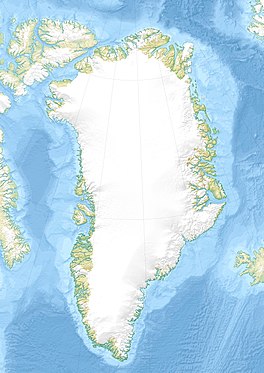
Greenland is located between the Arctic Ocean and the North Atlantic Ocean, northeast of Canada and northwest of Iceland. The territory comprises the island of Greenland—the largest island in the world—and more than a hundred other smaller islands. Greenland has a 1.2-kilometer-long (0.75 mi) border with Canada on Hans Island. A sparse population is confined to small settlements along certain sectors of the coast. Greenland possesses the world's second-largest ice sheet.

Glacier ice accumulation occurs through accumulation of snow and other frozen precipitation, as well as through other means including rime ice, avalanching from hanging glaciers on cliffs and mountainsides above, and re-freezing of glacier meltwater as superimposed ice. Accumulation is one element in the glacier mass balance formula, with ablation counteracting. With successive years in which accumulation exceeds ablation, then a glacier will experience positive mass balance, and its terminus will advance.

Glacier morphology, or the form a glacier takes, is influenced by temperature, precipitation, topography, and other factors. The goal of glacial morphology is to gain a better understanding of glaciated landscapes and the way they are shaped. Types of glaciers can range from massive ice sheets, such as the Greenland ice sheet, to small cirque glaciers found perched on mountain tops. Glaciers can be grouped into two main categories:

Glacier Girl is a Lockheed P-38F Lightning, World War II fighter plane, 41-7630, c/n 222-5757, restored to flying condition after being buried beneath the Greenland ice sheet for over 50 years.

Petermann Glacier is a large glacier located in North-West Greenland to the east of Nares Strait. It connects the Greenland ice sheet to the Arctic Ocean at 81°10' north latitude, near Hans Island.

Ilulissat Icefjord is a fjord in western Greenland. Located 250 km north of the Arctic Circle, the Ilulissat Icefjord runs west 40 km (25 mi) from the Greenland ice sheet to Disko Bay just south of the town of Ilulissat. Ilulissat Icefjord was declared a UNESCO World Heritage Site in 2004 because of its natural beauty and the importance of the fast-moving Jakobshavn Glacier in developing the current scientific understanding of anthropogenic climate change.

Illullip Sermia is a tidewater glacier in Avannaata municipality on the northwestern shore of Greenland. It drains the Greenland ice sheet southwestwards into Inussulik Bay, an inlet of Baffin Bay. The glacier front is located between the Sanningassorsuaq Peninsula in the north, and the base of Illulissuaq Peninsula in the south. The glacier front is located at 74°22′40″N56°04′50″W.
Nunatakassaup Sermia is a tidewater glacier in Avannaata municipality on the northwestern shore of Greenland. It drains the Greenland ice sheet westwards into Melville Bay. The glacier front is located between the Nunatakassak nunatak in the north, and the Wandel Land nunatak in the south.
Tuttulikassak is a nunatak in Avannaata municipality in northwestern Greenland.
Kangerlussuaq Icefjord is a fjord in Avannaata municipality in northwestern Greenland.
Nunatakassaup Sermia is a tidewater glacier in Avannaata municipality on the northwestern shore of Greenland. It drains the Greenland ice sheet southwestwards into Tasiusaq Bay. The glacier front is located to the southeast of the Nunatarsuaq nunatak, and to the north of the Qassersuaq Peninsula. Alanngorsuup Sermia, a sibling glacier to the south, drains the icesheet into the same point at the inner end of Tasiusaq Bay.
Alanngorsuup Sermia is a tidewater glacier in Avannaata municipality on the northwestern shore of Greenland. It drains the Greenland ice sheet northwestwards into Tasiusaq Bay. The glacier front is located to the south of the Nunatarsuaq nunatak, and to the north of the Qassersuaq Peninsula. Nunatakassaup Sermia, a sibling glacier to the north, drains the icesheet into the same point at the inner end of Tasiusaq Bay.
Kjer Glacier is a tidewater glacier in the northwestern shore of Greenland. Administratively it belongs to Avannaata municipality.

The Watkins Range is Greenland's highest mountain range. It is located in King Christian IX Land, Sermersooq municipality.
The Harvard Islands are an island group east of Qaanaaq in the Avannaata Municipality, northwestern Greenland.

The Princess Caroline-Mathilde Alps are a mountain range system in the Holm Land Peninsula, King Frederick VIII Land, northeastern Greenland. Administratively this range is part of the Northeast Greenland National Park zone.

The Roosevelt Range or Roosevelt Mountains is a mountain range in Northern Greenland. Administratively this range is part of the Northeast Greenland National Park. Its highest peak is the highest point in Peary Land.

Dodge Glacier, is a glacier in northwestern Greenland. Administratively it belongs to the Avannaata municipality.