
Qassersuaq Peninsula (Upernavik Archipelago)
Qassersuaq Peninsula (old spelling: Qagsserssuaq) is a mainland peninsula in northwestern Greenland, located in the south-central part of Upernavik Archipelago. [1]
Qassersuaq Peninsula (old spelling: Qagsserssuaq) is a mainland peninsula in northwestern Greenland, located in the south-central part of Upernavik Archipelago. [1]
The peninsula is of triangular shape, with the base adjacent to the Greenland ice sheet (Greenlandic : Sermersuaq), south of the Alanngorsuup Sermia glacier. The distance from the Qaassorsuaq promontory in the west at 73°05′10″N55°42′55″W / 73.08611°N 55.71528°W , to the innermost unglaciated part of the mainland is 24.3 km (15.1 mi). In the northwest, the inner waterways of southern Tasiusaq Bay weakly indent the peninsula with the Nuniaat Bay. In the south, the Qassersuit Saqqaa strait separates the peninsula from a chain of larger islands of the archipelago, bounding Upernavik Icefjord from the northeast: Maniitsoq Island, Puugutaa Island, Sisuarissut Island, and Qaneq Island. [1]
The peninsula is very mountainous, culminating in several glaciated summits. The highest, unnamed peak in the center of the peninsula reaches 1,160 m (3,810 ft). Other named summits include Qassersuit at 1,080 m (3,540 ft) in the center, Issumaarsuaq at 870 m (2,850 ft) in the north, and Nuniaat Qaqqarsua at 1,023 m (3,356 ft) in the west. [1]

Nuussuaq, formerly Kraulshavn, is a settlement in Avannaata municipality in northwestern Greenland. It is the only mainland settlement in the Upernavik Archipelago, located near the western tip of the Nuussuaq Peninsula, on the northern coast of Sugar Loaf Bay, an indentation of Baffin Bay.
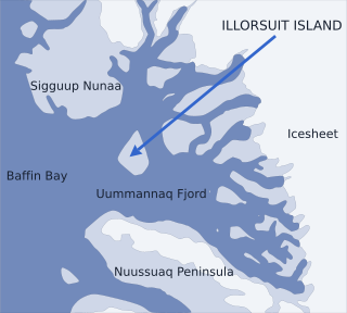
Nunavik Peninsula is a large peninsula in northwestern Greenland. It separates two cultural and geographical regions of northwestern Greenland: Uummannaq Fjord region in the southeast, and Upernavik Archipelago in the north.
Upernavik Archipelago is a vast coastal archipelago in the Avannaata municipality in northwestern Greenland, off the shores of northeastern Baffin Bay. The archipelago extends from the northwestern coast of Sigguup Nunaa peninsula in the south at approximately 71°50′N56°00′W to the southern end of Melville Bay in the north at approximately 74°50′N57°30′W.
Nuussuaq Peninsula is a mainland peninsula in northwestern Greenland, located at the northern end of Upernavik Archipelago, approximately 70 km (43 mi) to the south of Melville Bay. It is much smaller than its namesake in western Greenland.

Qullikorsuit Island is an uninhabited island in Avannaata municipality in northwestern Greenland. It is located in the northern part of Upernavik Archipelago.
Kiatassuaq Island is an uninhabited island in the northern Upernavik Archipelago in Avannaata municipality in northwestern Greenland. It marks the southern border of Melville Bay.
Ammarqua Strait is a strait in the southern part of the Upernavik Archipelago in Avannaata municipality in northwestern Greenland.
Inussulissuaq Island is a small uninhabited island in the Melville Bay region of the Upernavik Archipelago in Avannaata municipality in northwestern Greenland. The name of the island means "a large cairn" in the Greenlandic language.
Inussulik Bay is a bay in the Upernavik Archipelago in Avannaata municipality in northwestern Greenland.
Sanningassorsuaq Peninsula is a mainland peninsula in northwestern Greenland, located at the northern end of Upernavik Archipelago.
Ikerasaa Strait is a strait in the Upernavik Archipelago in Avannaata municipality in northwestern Greenland. The strait separates Kiatassuaq Island in the north from the mainland Sanningassorsuaq Peninsula in the south. The name of the strait is the local dialect version of ikerasak, a generic word for 'strait' in the Greenlandic language.
Alison Bay is a bay in Avannaata municipality in northwestern Greenland. The bay is a tributary bay of Melville Bay, and is located in the northern part of Upernavik Archipelago, between Kiatassuaq Island in the southwest and the mainland of Greenland in the northeast.
Amitsorsuaq Island is a small, uninhabited island in Avannaata municipality in northwestern Greenland.
Torsukattak Strait is a strait in Avannaata municipality in northwestern Greenland.
Sugar Loaf Bay is a bay in the Upernavik Archipelago in the Avannaata municipality in northwestern Greenland. It is an indentation of northeastern Baffin Bay. The name of the bay derives from the name of an island of the same name in the bay, Sugar Loaf Island.
Wandel Land is a 15.7 km (52,000 ft) nunatak in Avannaata municipality in northwestern Greenland. It is one of several nunataks in the Melville Bay region of Greenland, where the Greenland ice sheet drains into the bay alongside its entire length apart from an occasional nunatak.
Anoritooq is a nunatak in Avannaata municipality in northwestern Greenland.
Illulissuaq Peninsula is a mainland peninsula in northwestern Greenland, located in the northern part of Upernavik Archipelago
Tasiusaq Bay is a bay in the Upernavik Archipelago in the Avannaata municipality in northwestern Greenland. It is an indentation of northeastern Baffin Bay. The name of the bay derives from the name of the settlement of the same name in the bay.
Nunatarsuaq is a nunatak in Avannaata municipality in northwestern Greenland.