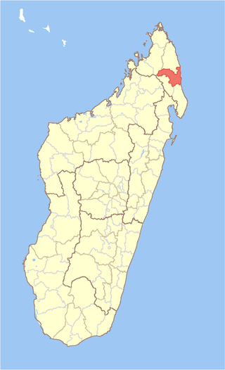
Sava is a region in northern Madagascar. Its capital is Sambava. Until 2009 Sava belonged to Antsiranana Province. The region is situated at the northern part of the east coast of Madagascar. It is bordered by the region Diana to the north, Sofia to the west, and Analanjirofo to the south. As of 2018, its population was 1,123,013 and the total area is 25,518 km2 (9,853 sq mi). The region contains wild areas such as Marojejy National Park.
Antsirabato Airport is an airport in Antalaha, Madagascar.

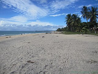
Antalaha is an urban municipality in northern Madagascar. It belongs to the district of Antalaha, which is a part of Sava Region. The population of Antalaha was 67.888 in 2018.

Sambava[samˈbav] is a city and commune at the east coast of northern Madagascar. It is the capital of Sambava District and Sava Region. The population of the commune was 84,039 in as of the 2018 commune census.
Sarahandrano is a commune in northern Madagascar. It belongs to the district of Antalaha, which is a part of Sava Region. According to 2001 census the population of Sarahandrano was 12,758.

Marofinaritra is a rural municipality and village in northeast Madagascar. It belongs to the district of Antalaha, which is a part of Sava Region.
Antsambalahy is a commune in northern Madagascar. It belongs to the district of Antalaha, which is a part of Sava Region. According to 2001 census the population of Antsambalahy was 11,284.
Antsahanoro is a commune in northern Madagascar. It belongs to the district of Antalaha, which is a part of Sava Region. According to 2001 census the population of Antsahanoro was 16,253.
Ampohibe is a commune in northern Madagascar. It belongs to the district of Antalaha, which is a part of Sava Region. The municipality has a populations of 14,433 inhabitants (2019).
Ambinanifaho is a municipality in northern Madagascar. It belongs to the district of Antalaha, which is a part of Sava Region. According to 2001 census the population of Ambinanifaho was 6,573.
Antananambo or Antanambao is a commune in northern Madagascar. It belongs to the district of Antalaha, which is a part of Sava Region. According to 2001 census the population of Antananambo was 18,232.

Ambohimalaza is a municipality in northern Madagascar. It belongs to the district of Sambava, which is a part of Sava Region. The population of the commune was estimated to be approximately 8,000 in 2001 commune census.
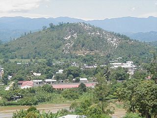
Andapa District is a district in northern Madagascar. It is a part of Sava Region and borders the districts of Ambilobe and Sambava to the north, Antalaha to the east, Maroantsetra to the south, and Befandriana Nord and Bealanana to the west. The area is 4,051.48 km2 (1,564 sq mi) and the population was estimated to be 189,882 in 2013.
Antalaha District is a district in northeastern Madagascar. The district contains the Masoala Peninsula, and is limited by Antongil Bay in south-west and the Indian Ocean on east. It is a part of Sava Region and borders the districts of Sambava into the north, Andapa to the north-west and Maroantsetra to the west. The area is 6,795 km2 (2,624 sq mi) and the population was estimated to be 222,203 in 2009 and 282,921 in 2018. At the time of the last Madagascar census in 1993 149,684 inhabitants lived in this district.
Sambava District is a district in northern Madagascar. It is a part of Sava Region and borders the districts of Antalaha to the south, Andapa to the south-west, Ambilobe to the north-west and Iharana to the north. The area is 4,681.76 km2 (1,808 sq mi) and the population was estimated to be 304,366 in 2013.
Didier Léandre Tsiajotso is a Malagasy politician. A member of the National Assembly of Madagascar, he was elected as a member of the Tiako I Madagasikara party; he represents the constituency of Antalaha.

Route nationale 5a is a secondary highway in Madagascar of 406 km, running from Ambilobe to Antalaha. It crosses the regions of Diana and Sava.
Ampanavoana is a rural municipality in northern Madagascar. It belongs to the district of Antalaha, which is a part of Sava Region. The municipality has a populations of 13,009 inhabitants (2019).

Andampy is a rural municipality in northern Madagascar. It belongs to the district of Antalaha, which is a part of Sava Region. The municipality has a populations of 6,843 inhabitants (2019).
Manakambahiny Ankavia is a rural municipality in northern Madagascar. It belongs to the district of Antalaha, which is a part of Sava Region. The municipality has a populations of 7,830 inhabitants (2019).

