Maromokotra | |
|---|---|
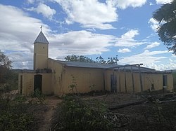 A protestant church in Antanananabo, a village of the municipality of Maromokotra | |
 Maromokotra Location in Madagascar | |
| Coordinates: 12°57′S49°34′E / 12.950°S 49.567°E | |
| Country | |
| Region | Sava |
| District | Vohemar |
| Elevation | 172 m (564 ft) |
| Population (2001) [2] | |
• Total | 4,000 |
| Time zone | UTC3 (EAT) |
| Postal code | 209 |
Maromokotra is a rural municipality in northern Madagascar. It is situated at the unpaved Route nationale 5a halfway between Ambilobe (80km) [3] and Daraina, near the Saharenana River. It belongs to the district of Vohemar, which is a part of the Sava Region. The population of the municipality was estimated to be approximately 4,000 in the 2001 commune census. [2]
Only primary schooling is available. The majority (94%) of the population of the commune are farmers. The most important crop is rice, while other important products are banana, maize and seeds of catechu. Services provide employment for 1% of the population, and fishing employs the remaining 5% of the population. [2]
