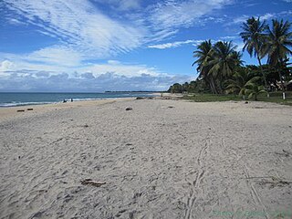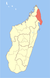
Sava is a region in northern Madagascar. Its capital is Sambava. Until 2009 Sava belonged to Antsiranana Province. The region is situated at the northern part of the east coast of Madagascar. It is bordered by the region Diana to the north, Sofia to the west, and Analanjirofo to the south. As of 2018, its population was 1,123,013 and the total area is 25,518 km2 (9,853 sq mi). The region contains wild areas such as Marojejy National Park.

Sambava[samˈbav] is a city and commune at the east coast of northern Madagascar. It is the capital of Sambava District and Sava Region. The population of the commune was 84,039 in as of the 2018 commune census.
Marofinaritra is a commune and village in northeast Madagascar. It belongs to the district of Antalaha, which is a part of Sava Region.

Nosiarina is a town and commune in northern Madagascar. It belongs to the district of Sambava, which is a part of Sava Region. It is situated at the Bemarivo River and the Route Nationale 5a between Sambava and Vohemar.
Morafeno is a town and commune in northern Madagascar. It belongs to the district of Sambava, which is a part of Sava Region. It is located at the Fanambana River.
Marojala is a town and commune in northern Madagascar. It belongs to the district of Sambava, which is a part of Sava Region. At the time of the 2001 commune census, the population was estimated to be approximately 13,000.
Bevonotra is a town and commune in northern Madagascar. It belongs to the district of Sambava, which is a part of Sava Region. The population of the commune was estimated to be approximately 16,000 in 2001 commune census.
Bemanevika is a town and commune in northern Madagascar. It belongs to the district of Sambava, which is a part of Sava Region. The population of the commune was estimated to be approximately 13,000 in 2001 commune census.
Antindra is a town and commune in northern Madagascar. It belongs to the district of Sambava, which is a part of Sava Region. The population of the commune was estimated to be approximately 16,000 in 2001 commune census.
Anjialava is a town and commune in northern Madagascar. It belongs to the district of Sambava, which is a part of Sava Region. The population of the commune was estimated to be approximately 9,000 in 2001 commune census.
Anjangoveratra is a town and commune in northern Madagascar. It belongs to the district of Sambava, which is a part of Sava Region. The population of the commune was estimated to be approximately 16,000 in 2001 commune census.
Andratamarina is a town and commune in northern Madagascar. It belongs to the district of Sambava, which is a part of Sava Region. The population of the commune was estimated to be approximately 8,000 in 2001 commune census.
Andrahanjo is a town and commune in northern Madagascar. It belongs to the district of Sambava, which is a part of Sava Region. The population of the commune was estimated to be approximately 8,000 in 2001 commune census.
Analamaho is a town and commune in northern Madagascar. It belongs to the district of Sambava, which is a part of Sava Region. The population of the commune was estimated to be approximately 6,000 in 2001 commune census.
Ambohimitsinjo is a town and commune in northern Madagascar. It belongs to the district of Sambava, which is a part of Sava Region. The population of the commune was estimated to be approximately 5,000 in 2001 commune census.
Ambohimalaza is a town and commune in northern Madagascar. It belongs to the district of Sambava, which is a part of Sava Region. The population of the commune was estimated to be approximately 8,000 in 2001 commune census.
Ambodiampana is a town and commune in northern Madagascar. It belongs to the district of Sambava, which is a part of Sava Region. The population of the commune was estimated to be approximately 13,000 in 2001 commune census.
Tanambao Daoud or Tanambao is a rural municipality in northern Madagascar. It belongs to the district of Sambava, which is a part of Sava Region. The population of the commune was estimated to be approximately 10,000 in 2001 commune census.

Antsirabe Nord or Antsirabe Avaratra is a rural municipality in northern Madagascar. It belongs to the district of Vohemar, which is a part of Sava Region. The population of the commune was estimated to be approximately 25,000 in 2001 commune census.

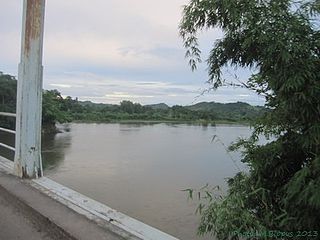
The Lokoho River is located in northern Madagascar. It drains to the north-east coast, into the Indian Ocean. It drains the southern half of the Marojejy Massif. Its mouth is situated 25 km in the south of Sambava, near Farahalana.


