Villahermosa is a town and municipality in the Tolima department of Colombia. The population of the municipality was 12,574 as of the 1993 census. The municipality is also one of the most important coffee producers of Tolima's north.

Abel Iturralde is one of the twenty provinces of the Bolivian La Paz Department. It is situated in its northern part. Its name honors Abel Iturralde Palacios, a Bolivian politician. Madidi National Park is partially in this province.

Temotu is the easternmost province of Solomon Islands. The province was formerly known as Santa Cruz Islands Province. It consists, essentially, of two chains of islands which run parallel to each other from the northwest to the southeast. Its area is 895 square kilometres.

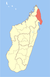
Vohemar is a coastal city and a municipality in northern Madagascar. It belongs to the district of Iharana, which is a part of Sava Region. It had a population of 22047 in 2018.
Goncha Siso Enese is one of the woredas in the Amhara Region of Ethiopia.Part of the Misraq Gojjam Zone. It has 2 town and 41 rural kebeles. Goncha Siso Enese is bordered on the south by Enarj Enawga, on the west by Hulet Ej Enese, on the north by the Abay River which separates it from the Debub Gondar Zone, and on the east by Enbise Sar Midir. The major town in Goncha Siso Enese is Ginde Weyin.
Yayo is one of the districts in the Oromia Region of Ethiopia. Part of the Illubabor Zone, Yayo is bordered on the south by the Southern Nations, Nationalities and Peoples Region, on the west by Matu, on the north by Supena Sodo, on the east by Chora, and on the southeast by the Jimma Zone. Towns in Yayo include Elemo and Yayo. Doreni and Hurumu districts were part of Yayo district.
Bako Tibe is one of the Aanaas, or districts, in the Oromia region of Ethiopia. Part of the West Shewa Zone, Bako Tibe is bordered on the south and west by the East Welega Zone, on the north by Horo Gudru Welega Zone, and on the east by Cheliya. The administrative center of this woreda is Bako; other towns in Bako Tibe include Tibe and Shoboka.
Tulo is one of the Aanaas in Oromia Regional State of Ethiopia. Part of the West Hararghe Zone, Tulo is bordered on to the north by Doba, to the south by Masela, to the east by the East haraghe Zone, and to the west by Nannawa Chiro. Towns in Tulo include Debeso and Hirna.
Lennox-King Glacier is a large valley glacier, about 40 nautical miles (70 km) long that flows east into the Ross Ice Shelf.

Sambava is a city and commune at the east coast of northern Madagascar. It is the capital of Sambava District and Sava Region. The population of the commune was 84,039 in as of the 2018 commune census.
Ambalabe is a town and commune in northern Madagascar. It belongs to the district of Antalaha, which is a part of Sava Region. According to 2001 commune census the population of Ambalabe was 16,250.
Antananambo or Antanambao is a commune in northern Madagascar. It belongs to the district of Antalaha, which is a part of Sava Region. According to 2001 census the population of Antananambo was 18,232.

Farahalana is a municipality in northern Madagascar. It belongs to the district of Sambava, which is a part of Sava Region and lies near the mouth of the Lokoho River at the Indian Ocean. The population of the commune was estimated to be approximately 23,000 in 2001 commune census.

Antalaha District is a district in northeastern Madagascar. The district contains the Masoala Peninsula, and is limited by Antongil Bay in south-west and the Indian Ocean on east. It is a part of Sava Region and borders the districts of Sambava into the north, Andapa to the north-west and Maroantsetra to the west. The area is 6,795 km2 (2,624 sq mi) and the population was estimated to be 222,203 in 2009 and 282,921 in 2018. At the time of the last Madagascar census in 1993 149,684 inhabitants lived in this district.
Marotandrano is a town and commune in Madagascar. It belongs to the district of Mandritsara, which is a part of Sofia Region. The population of the commune was estimated to be approximately 11,000 in 2001 commune census.
Beravina is a town and commune in western Madagascar. It belongs to the district of Morafenobe, which is a part of Melaky Region. The population of the commune was estimated to be approximately 3,000 in 2001 commune census.
Berenty is a town and commune in Madagascar. It belongs to the district of Ankazoabo, which is a part of Atsimo-Andrefana Region. The population of the commune was estimated to be approximately 1,000 in 2001 commune census.
Belavabary is a town and commune in Madagascar. It belongs to the district of Moramanga, which is a part of Alaotra-Mangoro Region. The population of the commune was estimated to be approximately 10,000 in 2001 commune census.
Ivahona is a town and commune in Madagascar. It belongs to the district of Betroka, which is a part of Anosy Region. The population of the commune was estimated to be approximately 7,000 in 2001 commune census.

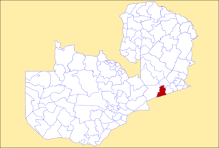
Petauke District is a district of Zambia, located in Eastern Province. The capital lies at Petauke. As of the 2022 Zambian Census, the district had a population of 259,385 people. It consists of two constituencies, namely Petauke Central and Kaumbwe.


