Ambalamanasy II

Last updated
Ambalamanasy II
Madagascar location map.svg
Red pog.svg
Ambalamanasy II
Location in Madagascar
Coordinates: 14°31′S49°35′E / 14.517°S 49.583°E / -14.517; 49.583
CountryFlag of Madagascar.svg  Madagascar
Region Sava
District Andapa
Elevation [1] 521 m (1,709 ft)
Population (2001) [2]
  Total 24,211
Time zone EAT (UTC3)

Ambalamanasy II is a commune (Malagasy : kaominina) in northern Madagascar. It belongs to the district of Andapa, which is a part of Sava Region. According to 2001 census the population of Ambalamanasy II was 24,211. [2]

Malagasy is an Austronesian language and the national language of Madagascar. Most people in Madagascar speak it as a first language as do some people of Malagasy descent elsewhere.

Madagascar island nation off the coast of Southeast Africa, in the Indian Ocean

Madagascar, officially the Republic of Madagascar, and previously known as the Malagasy Republic, is an island country in the Indian Ocean, approximately 400 kilometres off the coast of East Africa. The nation comprises the island of Madagascar and numerous smaller peripheral islands. Following the prehistoric breakup of the supercontinent Gondwana, Madagascar split from the Indian subcontinent around 88 million years ago, allowing native plants and animals to evolve in relative isolation. Consequently, Madagascar is a biodiversity hotspot; over 90% of its wildlife is found nowhere else on Earth. The island's diverse ecosystems and unique wildlife are threatened by the encroachment of the rapidly growing human population and other environmental threats.

Districts of Madagascar

Districts are second-level administrative divisions of Madagascar below the regions. There are 114 districts in Madagascar. Districts are in their turn divided into communes; while some of the districts in urban areas and offshore islands each consist of only one commune, most of the districts are divided typically into 5–20 communes.

Primary and junior level secondary education are available in town. The majority 98% of the population are farmers. The most important crops are rice and vanilla, while other important agricultural products are coffee and sugarcane. Services provide employment for 2% of the population. [2]

Rice cereal grain and seed of Oryza sativa

Rice is the seed of the grass species Oryza sativa or Oryza glaberrima. As a cereal grain, it is the most widely consumed staple food for a large part of the world's human population, especially in Asia. It is the agricultural commodity with the third-highest worldwide production, after sugarcane and maize.

Vanilla A flavoring extracted from orchids of the genus Vanilla

Vanilla is a flavoring derived from orchids of the genus Vanilla, primarily from the Mexican species, flat-leaved vanilla (V. planifolia). The word vanilla, derived from vainilla, the diminutive of the Spanish word vaina, is translated simply as "little pod". Pre-Columbian Mesoamerican people cultivated the vine of the vanilla orchid, called tlīlxochitl by the Aztecs. Spanish conquistador Hernán Cortés is credited with introducing both vanilla and chocolate to Europe in the 1520s.

Coffee Brewed beverage

Coffee is a brewed drink prepared from roasted coffee beans, the seeds of berries from certain Coffea species. The genus Coffea is native to tropical Africa and Madagascar, the Comoros, Mauritius, and Réunion in the Indian Ocean. Coffee plants are now cultivated in over 70 countries, primarily in the equatorial regions of the Americas, Southeast Asia, Indian subcontinent, and Africa. The two most commonly grown are C. arabica and C. robusta. Once ripe, coffee berries are picked, processed, and dried. Dried coffee seeds are roasted to varying degrees, depending on the desired flavor. Roasted beans are ground and then brewed with near-boiling water to produce the beverage known as coffee.

References and notes

  1. Estimated based on DEM data from Shuttle Radar Topography Mission
  2. 1 2 3 "ILO census data". Cornell University. 2002. Retrieved 2008-02-15.

Coordinates: 14°31′S49°35′E / 14.517°S 49.583°E / -14.517; 49.583

Geographic coordinate system Coordinate system

A geographic coordinate system is a coordinate system that enables every location on Earth to be specified by a set of numbers, letters or symbols. The coordinates are often chosen such that one of the numbers represents a vertical position and two or three of the numbers represent a horizontal position; alternatively, a geographic position may be expressed in a combined three-dimensional Cartesian vector. A common choice of coordinates is latitude, longitude and elevation. To specify a location on a plane requires a map projection.


Related Research Articles

Andrafiabe Place in Diana, Madagascar

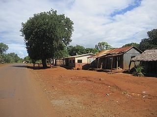
Andrafiabe is a town and commune in Madagascar. It belongs to the district of Antsiranana II, which is a part of Diana Region. According to 2001 commune census the population of Andrafiabe was 2,080.

Doany Place in Sava, Madagascar

Doany is a commune in northern Madagascar. It belongs to the district of Andapa, which is a part of Sava Region. According to 2001 census the population of Doany was 19,928.

Bealampona Place in Sava, Madagascar

Bealampona is a commune in northern Madagascar. It belongs to the district of Andapa, which is a part of Sava Region. According to 2001 census the population of Bealampona was 11,976.

Milanoa Place in Sava, Madagascar

Milanoa is a town and commune in northern Madagascar. It belongs to the district of Vohemar, which is a part of Sava Region. The population of the commune was estimated to be approximately 17,000 in 2001 commune census.

Antsamaka Place in Sofia, Madagascar

Antsamaka is a town and commune in Madagascar. It belongs to the district of Bealanana, which is a part of Sofia Region. The population of the commune was estimated to be approximately 8,000 in 2001 commune census.

Andreba Place in Sofia, Madagascar

Andreba is a town and commune in Madagascar. It belongs to the district of Antsohihy, which is a part of Sofia Region. The population of the commune was estimated to be approximately 13,000 in 2001 commune census. It on the shore of Lake Alaotra.

Tsarahasina Place in Sofia, Madagascar

Tsarahasina is a town and commune in Madagascar. It belongs to the district of Boriziny, which is a part of Sofia Region. The population of the commune was estimated to be approximately 14,000 in 2001 commune census.

Ambalakida Place in Boeny, Madagascar

Ambalakida is a town and commune in Madagascar. It belongs to the district of Mahajanga II, which is a part of Boeny Region. The population of the commune was estimated to be approximately 5,000 in 2001 commune census.

Ambatoharanana, Mananara Nord Place in Analanjirofo, Madagascar

Ambatoharanana is a town and commune in Madagascar. It belongs to the district of Mananara Nord, which is a part of Analanjirofo Region. The population of the commune was estimated to be approximately 9,000 in 2001 commune census.

Soanierana Ivongo Place in Analanjirofo, Madagascar

Soanierana Ivongo is a town and commune in Madagascar. It belongs to the district of Soanierana Ivongo, which is a part of Analanjirofo Region. The population of the commune was estimated to be approximately 22,000 in 2001 commune census.

Ambinanitelo Place in Analanjirofo, Madagascar

Ambinanitelo is a town and commune in Madagascar. It belongs to the district of Maroantsetra, which is a part of Analanjirofo Region. The population of the commune was estimated to be approximately 30,000 in 2001 commune census.

Mandrofify Place in Atsimo-Andrefana, Madagascar

Mandrofify or Manorofify is a town and commune in Madagascar. It belongs to the district of Toliara II, which is a part of Atsimo-Andrefana Region. The town is situated at the Onilahy River. The population of the commune was estimated to be approximately 8,000 in 2001 commune census.

Milenaka Place in Atsimo-Andrefana, Madagascar

Milenaka is a town and commune in Madagascar. It belongs to the district of Toliara II, which is a part of Atsimo-Andrefana Region. The population of the commune was estimated to be approximately 15,000 in 2001 commune census.

Soalara Place in Atsimo-Andrefana, Madagascar

Soalara is a town and commune in Madagascar. It belongs to the district of Toliara II, which is a part of Atsimo-Andrefana Region. The population of the commune was estimated to be approximately 10,000 in 2001 commune census.

Tsianisiha Place in Atsimo-Andrefana, Madagascar

Tsianisiha is a town and commune in Madagascar. It belongs to the district of Toliara II, which is a part of Atsimo-Andrefana Region. The population of the commune was estimated to be approximately 18,000 in 2001 commune census.

Mandrosohasina Place in Vakinankaratra, Madagascar

Mandrosohasina is a town and commune in Madagascar. It belongs to the district of Antsirabe II, which is a part of Vakinankaratra Region. The population of the commune was estimated to be approximately 20,000 in 2001 commune census.

Fandrandava Place in Haute Matsiatra, Madagascar

Fandrandava is a town and commune in Madagascar. It belongs to the district of Fianarantsoa II, which is a part of Haute Matsiatra Region. The population of the commune was estimated to be approximately 9,000 in 2001 commune census.

Mahasoabe, Fianarantsoa II Place in Haute Matsiatra, Madagascar

Mahasoabe is a town and commune in Madagascar. It belongs to the district of Fianarantsoa II, which is a part of Haute Matsiatra Region. The population of the commune was estimated to be approximately 34,000 in 2001 commune census.

Androrangovola Place in Vatovavy-Fitovinany, Madagascar

Androrangovola is a town and commune in Madagascar. It belongs to the district of Nosy Varika, which is a part of Vatovavy-Fitovinany Region. The population of the commune was estimated to be approximately 16,000 in 2001 commune census.

Ambatomarina Place in Amoroni Mania, Madagascar

Ambatomarina is a town and commune in Madagascar. It belongs to the district of Manandriana, which is a part of Amoron'i Mania Region. The population of the commune was estimated to be approximately 14,000 in 2001 commune census.