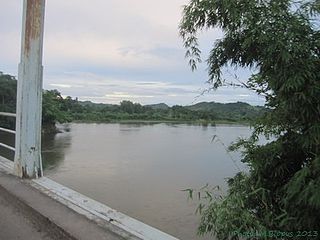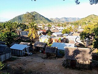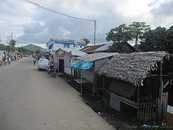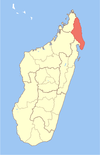
Nosiarina is a rural municipality in northern Madagascar. It belongs to the district of Sambava, which is a part of Sava Region. It is situated at the Bemarivo River and the Route Nationale 5a between Sambava and Vohemar.

Ambodiampana is a town and commune in northern Madagascar. It belongs to the district of Sambava, which is a part of Sava Region. The population of the commune was estimated to be approximately 13,000 in 2001 commune census.
Ambalasatrana is a town and commune in northern Madagascar. It belongs to the district of Vohemar, which is a part of Sava Region. The population of the commune was estimated to be approximately 5,000 in 2001 commune census.
Ambinanin'andravory is a town and commune in northern Madagascar. It belongs to the district of Vohemar, which is a part of Sava Region. The population of the commune was estimated to be approximately 9,000 in 2001 commune census.
Amboriala is a town and commune in northern Madagascar. It belongs to the district of Vohemar, which is a part of Sava Region. The population of the commune was estimated to be approximately 7,000 in 2001 commune census.
Ampisikina or Ampisikinana is a town and commune in northern Madagascar. It belongs to the district of Vohemar, which is a part of Sava Region. The population of the commune was estimated to be approximately 4,000 in 2001 commune census.
Ampondra is a town and commune in northern Madagascar. It belongs to the district of Vohemar, which is a part of Sava Region. The population of the commune was estimated to be approximately 12,000 in 2001 commune census.
Andrafainkona is a town and commune in northern Madagascar. It belongs to the district of Vohemar, which is a part of Sava Region. The population of the commune was estimated to be approximately 5,000 in 2001 commune census.
Andravory is a town and commune in northern Madagascar. It belongs to the district of Vohemar, which is a part of Sava Region. The population of the commune was estimated to be approximately 5,000 in 2001 commune census.

Antsirabe Nord or Antsirabe Avaratra is a rural municipality in northern Madagascar. It belongs to the district of Vohemar, which is a part of Sava Region. The population of the commune was estimated to be approximately 25,000 in 2001 commune census.
Bobakindro is a town and commune in northern Madagascar. It belongs to the district of Vohemar, which is a part of Sava Region. The population of the commune was estimated to be approximately 8,000 in 2001 commune census.

Daraina is a town and commune in northern Madagascar. It belongs to the district of Vohemar, which is a part of Sava Region. The city is located at the unpaved part of the Route Nationale 5a between Vohemar and Ambilobe.

Fanambana is a town and commune in northern Madagascar. It belongs to the district of Vohemar, which is a part of Sava Region.
Milanoa is a town and commune in northern Madagascar. It belongs to the district of Vohemar, which is a part of Sava Region. The population of the commune was estimated to be approximately 17,000 in 2001 commune census.
Nosibe is a town and commune in northern Madagascar. It belongs to the district of Vohemar, which is a part of Sava Region. The population of the commune was estimated to be approximately 9,000 in 2001 commune census.

Tsarabaria is a rural municipality in northern Madagascar. It belongs to the district of Vohemar, which is a part of Sava Region. The population of the commune was estimated to be approximately 20,000 in 2001 commune census.
Belambo is a town and commune in northern Madagascar. It belongs to Vohemar District, which is a part of Sava Region. The population of the commune was estimated to be approximately 6,000 in 2001 commune census.
Antsahavaribe is a town and commune in northern Madagascar. It belongs to the district of Vohemar, which is a part of Sava Region. The population of the commune was estimated to be approximately 9,000 in the 2001 census.
Matsondana is a town and commune in Madagascar. It belongs to the district of Befandriana-Nord, which is a part of Sofia Region. The population of the commune was estimated to be approximately 40,000 in 2001 commune census.

Beforona is a town and commune in Madagascar. It belongs to the district of Moramanga, which is a part of Alaotra-Mangoro Region. The population of the commune was estimated to be approximately 20,380 in 2018.


