Ampisikina or Ampisikinana is a town and commune (Malagasy: kaominina) in northern Madagascar. It belongs to the district of Vohemar, which is a part of Sava Region. The population of the commune was estimated to be approximately 4,000 in 2001 commune census.[2]
Only primary schooling is available. The majority 81.5% of the population of the commune are farmers, while an additional 3% receives their livelihood from raising livestock. The most important crop is rice, while other important products are maize and cassava. Industry and services provide employment for 12% and 0.5% of the population, respectively. Additionally fishing employs 3% of the population.[2]
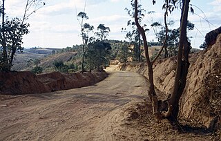
Nosibe is a town and commune in northern Madagascar. It belongs to the district of Vohemar, which is a part of Sava Region. The population of the commune was estimated to be approximately 9,000 in 2001 commune census.
Ambarijeby or Ambarijeby Sud is a town and commune in Madagascar. It belongs to the district of Analalava, which is a part of Sofia Region. The population of the commune was estimated to be approximately 5,000 in 2001 commune census.
Anahidrano is a town and commune in Madagascar. It belongs to the district of Antsohihy, which is a part of Sofia Region. The population of the commune was estimated to be approximately 15,000 in 2001 commune census.
Antsakabary is a rural municipality in Madagascar. It belongs to the district of Befandriana-Nord, which is a part of Sofia Region. The population of the commune was estimated to be approximately 22,000 in 2001 commune census.
Ampasimatera is a town and commune in Madagascar. It belongs to the district of Mampikony, which is a part of Sofia Region. The population of the commune was estimated to be approximately 21,000 in 2001 commune census.
Ambodisakoana is a town and commune in Madagascar. It belongs to the district of Boriziny, which is a part of Sofia Region. The population of the commune was estimated to be approximately 13,000 in 2001 commune census.
Leanja is a town and commune in Madagascar. It belongs to the district of Boriziny, which is a part of Sofia Region. The population of the commune was estimated to be approximately 16,000 in 2001 commune census.
Bekobay is a town and commune in Madagascar. It belongs to the district of Mahajanga II, which is a part of Boeny Region. The population of the commune was estimated to be approximately 5,000 in 2001 commune census.
Antongomena Bevary is a town and commune in Madagascar. It belongs to the district of Mitsinjo, which is a part of Boeny Region. The population of the commune was estimated to be approximately 13,000 in 2001 commune census.
Andriba is a municipality in Madagascar. It belongs to the district of Maevatanana, which is a part of Betsiboka Region. The population of the commune was estimated to be approximately 32,000 in 2001 commune census.
Antanimenabaka is a town and commune in Madagascar. It belongs to the district of Andilamena, which is a part of Alaotra-Mangoro Region. The population of the commune was estimated to be approximately 15,000 in 2001 commune census.
Andilanatoby is a rural municipality in Madagascar. It is situated at 55 km south-east of Ambatondrazaka and also belongs to the district with the same name: Ambatondrazaka, which is a part of Alaotra-Mangoro Region. The population of the commune was estimated to be approximately 22,000 in 2001 commune census.
Fotsialanana is a town and commune in Madagascar. It belongs to the district of Soanierana Ivongo, which is a part of Analanjirofo Region. The population of the commune was estimated to be approximately 11,000 in 2001 commune census.
Mandabe is a town and commune in Madagascar. It belongs to the district of Mahabo, which is a part of Menabe Region. The population of the commune was estimated to be approximately 27,000 in the 2001 commune census.
Beantake is a town and commune in southwest Madagascar. It belongs to the district of Betioky Sud, which is a part of Atsimo-Andrefana Region. The population of the commune was estimated to be approximately 18,000 in 2001 commune census.
Marofoty is a town and commune in Madagascar. It belongs to the district of Toliara II, which is a part of Atsimo-Andrefana Region. The population of the commune was estimated to be approximately 17,000 in the 2001 commune census.
Andrainjato is a town and commune in Madagascar. It belongs to the district of Ambalavao, which is a part of Haute Matsiatra Region. The population of the commune was estimated to be approximately 6,000 in the 2001 commune census.
Ankaramena is a town and commune in Madagascar. It belongs to the district of Ambalavao, which is a part of Haute Matsiatra Region. The population of the commune was estimated to be approximately 7,000 in 2001 commune census.
Nasandratrony is a rural municipality in Madagascar.
Ambohimalaza is a town and commune in Madagascar. It belongs to the district of Ambovombe, which is a part of Androy Region. The population of the commune was estimated to be approximately 8,000 in 2001 commune census.
This page is based on this Wikipedia article Text is available under the CC BY-SA 4.0 license; additional terms may apply. Images, videos and audio are available under their respective licenses.