Matsohely is a commune in northern Madagascar. It belongs to the district of Andapa, which is a part of Sava Region. According to a 2001 census, the population of Matsohely was 7,565.
Marovato is a commune in northern Madagascar. It belongs to the district of Andapa, which is a part of Sava Region. According to 2001 census the population of Marovato was 5,747.
Belaoka Marovato is a commune in northern Madagascar. It belongs to the district of Andapa, which is a part of Sava Region. According to 2001 census the population of Belaoka Marovato was 8,463.
Ankiaka Be Nord or Ankiakabe is a commune in northern Madagascar. It belongs to the district of Andapa, which is a part of Sava Region. According to 2001 census the population of Ankiaka Be Nord was 8,253.
Andranomena is a commune in northern Madagascar. It belongs to the district of Andapa, which is a part of Sava Region. According to 2001 census the population of Andranomena was 4,038.
Lanjarivo or Langarivo is a commune in northern Madagascar. It belongs to the district of Antalaha, which is a part of Sava Region. According to 2001 census the population of Lanjarivo was 11,326.

Antindra is a municipality in northern Madagascar. It belongs to the district of Sambava, which is a part of Sava Region. The population of the commune was estimated to be approximately 16,000 in 2001 commune census.
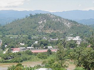
Andapa District is a district in northern Madagascar. It is a part of Sava Region and borders the districts of Ambilobe and Sambava to the north, Antalaha to the east, Maroantsetra to the south, and Befandriana Nord and Bealanana to the west. The area is 4,051.48 km2 (1,564 sq mi) and the population was estimated to be 227,941 in 2020.
Ambonomby or Ambovonomby is a town and commune in Madagascar. It belongs to the district of Bealanana, which is a part of Sofia Region. The population of the commune was estimated to be approximately 10,000 in 2001 commune census.
Ambalaromba is a town and commune in Madagascar. It belongs to the district of Bealanana, which is a part of Sofia Region. The population of the commune was estimated to be approximately 9,000 in 2001 commune census.
Analila is a town and commune in Madagascar. It belongs to the district of Bealanana, which is a part of Sofia Region. The population of the commune was estimated to be approximately 16,000 in 2001 commune census.
Ambatoriha or Ambatoria is a town and commune in Madagascar. It belongs to the district of Bealanana, which is a part of Sofia Region. The population of the commune was estimated to be approximately 9,000 in 2001 commune census.
Ambimadiro is a town and commune in Madagascar. It belongs to the district of Antsohihy, which is a part of Sofia Region. The population of the commune was estimated to be approximately 10,000 in 2001 commune census.
Matsondana is a town and commune in Madagascar. It belongs to the district of Befandriana-Nord, which is a part of Sofia Region. The population of the commune was estimated to be approximately 40,000 in 2001 commune census.
Soanenga is a town and commune in western Madagascar. It belongs to the district of Besalampy, which is a part of Melaky Region. The population of the commune was estimated to be approximately 9,000 in 2001 commune census.
Ambahoabe is a town and commune in Madagascar. It belongs to the district of Soanierana Ivongo, which is a part of Analanjirofo region. The population of the commune was estimated to be approximately 13,000 in 2001 commune census.
Maniry is a town and commune in southwestern Madagascar. It belongs to the district of Ampanihy, which is a part of Atsimo-Andrefana Region. The population of the commune was estimated to be approximately 7,000 in 2001 commune census.
Analavoka is a town and commune in Madagascar. It belongs to the district of Ihosy, which is a part of Ihorombe Region. The population of the commune was estimated to be approximately 5,000 in 2001 commune census.
Ivongo is a town and commune in Madagascar. It belongs to the district of Ivohibe, which is a part of Ihorombe Region. The population of the commune was estimated to be approximately 5,000 in 2001 commune census.
Andalatanosy is a town and commune in Madagascar. It belongs to the district of Ambovombe, which is a part of Androy Region. The population of the commune was estimated to be approximately 23,000 in 2001 commune census.

