The population of the commune was estimated to be approximately 10,000 in 2001 commune census.[2]
Primary and junior level secondary education are available in town. The majority 98% of the population of the commune are farmers. The most important crop is rice, while other important products are banana, maize, cassava and sweet potato. Services provide employment for 2% of the population.[2]
There are also artisanal gold mining activities on the rivers nearby.
Protected areas
The protected area of Loky Manambato is situated at 15km near Daraina. It hosts the only side where the Golden-crowned sifaka (Propithecus tattersalli) can be found.
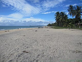
Sava is a region in northern Madagascar. Its capital is Sambava. Until 2009 Sava belonged to Antsiranana Province. The region is situated at the northern part of the east coast of Madagascar. It is bordered by the region Diana to the north, Sofia to the west, and Analanjirofo to the south. As of 2018, its population was 1,123,013 and the total area is 25,518 km2 (9,853 sq mi). The region contains wild areas such as Marojejy National Park.
Ambalasatrana is a town and commune in northern Madagascar. It belongs to the district of Vohemar, which is a part of Sava Region. The population of the commune was estimated to be approximately 5,000 in 2001 commune census.
Ambinanin'andravory is a town and commune in northern Madagascar. It belongs to the district of Vohemar, which is a part of Sava Region. The population of the commune was estimated to be approximately 9,000 in 2001 commune census.
Amboriala is a town and commune in northern Madagascar. It belongs to the district of Vohemar, which is a part of Sava Region. The population of the commune was estimated to be approximately 7,000 in 2001 commune census.
Ampanefena is a town and commune in northern Madagascar. It belongs to the district of Vohemar, which is a part of Sava Region. In 2008 its population was estimated to 23.000.
Ampisikina or Ampisikinana is a town and commune in northern Madagascar. It belongs to the district of Vohemar, which is a part of Sava Region. The population of the commune was estimated to be approximately 4,000 in 2001 commune census.
Ampondra is a town and commune in northern Madagascar. It belongs to the district of Vohemar, which is a part of Sava Region. The population of the commune was estimated to be approximately 12,000 in 2001 commune census.
Andrafainkona is a town and commune in northern Madagascar. It belongs to the district of Vohemar, which is a part of Sava Region. The population of the commune was estimated to be approximately 5,000 in 2001 commune census.
Andravory is a town and commune in northern Madagascar. It belongs to the district of Vohemar, which is a part of Sava Region. The population of the commune was estimated to be approximately 5,000 in 2001 commune census.
Antsirabe Nord or Antsirabe Avaratra is a rural municipality in northern Madagascar. It belongs to the district of Vohemar, which is a part of Sava Region. The population of the commune was estimated to be approximately 25,000 in 2001 commune census.
Bobakindro is a town and commune in northern Madagascar. It belongs to the district of Vohemar, which is a part of Sava Region. The population of the commune was estimated to be approximately 8,000 in 2001 commune census.
Fanambana is a town and commune in northern Madagascar. It belongs to the district of Vohemar, which is a part of Sava Region.
Milanoa is a town and commune in northern Madagascar. It belongs to the district of Vohemar, which is a part of Sava Region. The population of the commune was estimated to be approximately 17,000 in 2001 commune census.
Nosibe is a town and commune in northern Madagascar. It belongs to the district of Vohemar, which is a part of Sava Region. The population of the commune was estimated to be approximately 9,000 in 2001 commune census.
Tsarabaria is a rural municipality in northern Madagascar. It belongs to the district of Vohemar, which is a part of Sava Region. The population of the commune was estimated to be approximately 20,000 in 2001 commune census.
Maromokotra is a rural municipality in northern Madagascar. It is situated at the unpaved Route nationale 5a halfway between Ambilobe (80km) and Daraina, near the Saharenana River. It belongs to the district of Vohemar, which is a part of the Sava Region. The population of the municipality was estimated to be approximately 4,000 in the 2001 commune census.
Belambo is a town and commune in northern Madagascar. It belongs to Vohemar District, which is a part of Sava Region. The population of the commune was estimated to be approximately 6,000 in 2001 commune census.
Antsahavaribe is a town and commune in northern Madagascar. It belongs to the district of Vohemar, which is a part of Sava Region. The population of the commune was estimated to be approximately 9,000 in the 2001 census.
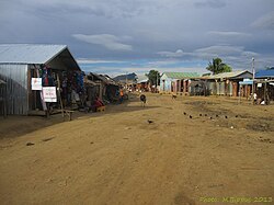
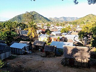
Vohemar District is a district in northern Madagascar. It is a part of Sava Region and borders the districts of Sambava to the south, Ambilobe to the west and Antsiranana II to the north. The area is 8,268.55 km2 (3,193 sq mi) and the population was estimated to be 264,236 in 2020. Its capitol is Vohemar.
Antanambaobe is a rural municipality in Madagascar. It belongs to the district of Mananara Nord, which is a part of Analanjirofo Region. The population of the commune was estimated to be approximately 14,000 in 2001.
This page is based on this Wikipedia article Text is available under the CC BY-SA 4.0 license; additional terms may apply. Images, videos and audio are available under their respective licenses.