Belambo is a town and commune (Malagasy: kaominina) in northern Madagascar. It belongs to Vohemar District, which is a part of Sava Region. The population of the commune was estimated to be approximately 6,000 in 2001 commune census.[2]
Primary and junior level secondary education are available in town. The majority 99.9% of the population of the commune are farmers. The most important crop is vanilla, while other important products are coffee, beans and rice. Services provide employment for 0.1% of the population.[2]
Antindra is a municipality in northern Madagascar. It belongs to the district of Sambava, which is a part of Sava Region. The population of the commune was estimated to be approximately 16,000 in 2001 commune census.
Andrahanjo is a town and commune in northern Madagascar. It belongs to the district of Sambava, which is a part of Sava Region. The population of the commune was estimated to be approximately 8,000 in 2001 commune census.
Analamaho is a town and commune in northern Madagascar. It belongs to the district of Sambava, which is a part of Sava Region. The population of the commune was estimated to be approximately 6,000 in 2001 commune census.
Ambodivoara is a town and commune in northern Madagascar. It belongs to the district of Sambava, which is a part of Sava Region. The population of the commune was estimated to be approximately 10,000 in 2001 commune census.
Antsahambaharo or Antsambaharo is a town and commune in northern Madagascar. It belongs to the district of Sambava, which is a part of Sava Region. The population of the commune was estimated to be approximately 11,000 in 2001 commune census.
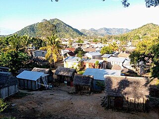
Amboangibe or Amboahangibe is a town and commune in northern Madagascar. It belongs to the district of Sambava, which is a part of Sava Region. The population of the commune was estimated to be approximately 11.956 in 2018.
Ampondra is a town and commune in northern Madagascar. It belongs to the district of Vohemar, which is a part of Sava Region. The population of the commune was estimated to be approximately 12,000 in 2001 commune census.
Tsarabaria is a rural municipality in northern Madagascar. It belongs to the district of Vohemar, which is a part of Sava Region. The population of the commune was estimated to be approximately 20,000 in 2001 commune census.
Antananadava or Antanandava is a town and commune in Madagascar. It belongs to the district of Mandritsara, which is a part of Sofia Region. The population of the commune was estimated to be approximately 11,000 in 2001 commune census.
Ambodiampana is a town and commune in Madagascar. It belongs to the district of Soanierana Ivongo, which is a part of Analanjirofo Region. The population of the commune was estimated to be approximately 11,000 in 2001 commune census.
Maniry is a town and commune in southwestern Madagascar. It belongs to the district of Ampanihy, which is a part of Atsimo-Andrefana Region. The population of the commune was estimated to be approximately 7,000 in 2001 commune census.
Mahazoarivo is a town and commune in Madagascar. It belongs to the district of Fianarantsoa II, which is a part of Haute Matsiatra Region. The population of the commune was estimated to be approximately 12,000 in 2001 commune census.
Antanimora Sud is a town and commune in Madagascar. It belongs to the district of Ambovombe-Androy, which is a part of Androy Region.
Lanivo is a town and commune in Madagascar in the district of Vohipeno, which is a part of Vatovavy-Fitovinany Region. The population of the commune was estimated to be approximately 9,000 in the 2001 commune census.
Nato is a town and commune in Madagascar. It belongs to the district of Vohipeno, which is a part of Vatovavy-Fitovinany Region. The population of the commune was estimated to be approximately 9,000 in 2001 commune census.
Vohimasy is a town and commune in Madagascar. It belongs to the district of Farafangana, which is a part of Atsimo-Atsinanana Region. The population of the commune was estimated to be approximately 5,000 in 2001 commune census.
Ambatofitorahana is a town and commune in Madagascar. It belongs to the district of Ambositra, which is a part of Amoron'i Mania Region. The population of the commune was estimated to be approximately 7,000 in 2001 commune census.
Anjoma Betoho is a town and commune in Madagascar. It belongs to the district of Manjakandriana, which is a part of Analamanga Region. The population of the commune was estimated to be approximately 3,000 in 2001 commune census.
Ankazondandy is a town and commune in Madagascar. It belongs to the district of Manjakandriana, which is a part of Analamanga Region. The population of the commune was estimated to be approximately 16,000 in 2001 commune census.
Ranovao is a town and commune in Madagascar. It belongs to the district of Manjakandriana, which is a part of Analamanga Region. The population of the commune was estimated to be approximately 4,000 in 2001 commune census.
This page is based on this Wikipedia article Text is available under the CC BY-SA 4.0 license; additional terms may apply. Images, videos and audio are available under their respective licenses.