Ankiaka Be Nord or Ankiakabe is a commune (Malagasy: kaominina) in northern Madagascar. It belongs to the district of Andapa, which is a part of Sava Region. According to 2001 census the population of Ankiaka Be Nord was 8,253.[2]
Only primary schooling is available in town. The majority 98% of the population are farmers. The most important crop is rice, while other important products are coffee, beans and vanilla. Industry and services provide employment for 0.05% and 1.94% of the population, respectively. Additionally fishing employs 0.01% of the population.[2]
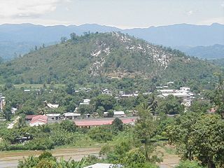
Anivorano Nord or Anivorano Avaratra is a municipality in Madagascar. It belongs to the district of Antsiranana II, which is a part of Diana Region.
Marovato is a commune in northern Madagascar. It belongs to the district of Andapa, which is a part of Sava Region. According to 2001 census the population of Marovato was 5,747.
Belaoka Marovato is a commune in northern Madagascar. It belongs to the district of Andapa, which is a part of Sava Region. According to 2001 census the population of Belaoka Marovato was 8,463.
Andranomena is a commune in northern Madagascar. It belongs to the district of Andapa, which is a part of Sava Region. According to 2001 census the population of Andranomena was 4,038.
Ambodiangezoka is a commune in northern Madagascar. It belongs to the district of Andapa, which is a part of Sava Region. According to 2001 census the population of Ambodiangezoka was 26,673.
Antsirabe Nord or Antsirabe Avaratra is a rural municipality in northern Madagascar. It belongs to the district of Vohemar, which is a part of Sava Region. The population of the commune was estimated to be approximately 25,000 in 2001 commune census.
Daraina is a town and commune in northern Madagascar. It belongs to the district of Vohemar, which is a part of Sava Region. The city is located at the unpaved part of the Route Nationale 5a between Vohemar and Ambilobe.
Andapa District is a district in northern Madagascar. It is a part of Sava Region and borders the districts of Ambilobe and Sambava to the north, Antalaha to the east, Maroantsetra to the south, and Befandriana Nord and Bealanana to the west. The area is 4,051.48 km2 (1,564 sq mi) and the population was estimated to be 227,941 in 2020.
Ambatosia is a town and commune in Madagascar. It belongs to the district of Bealanana, which is a part of Sofia Region. The population of the commune was estimated to be approximately 19,000 in 2001 commune census.
Ambalaromba is a town and commune in Madagascar. It belongs to the district of Bealanana, which is a part of Sofia Region. The population of the commune was estimated to be approximately 9,000 in 2001 commune census.
Ambodimotso-Atsimo is a town and commune in Madagascar. It belongs to the district of Befandriana-Nord, which is a part of Sofia Region. The population of the commune was estimated to be approximately 22,000 in 2001 commune census.
Maroamalona is a town and commune in Madagascar. It belongs to the district of Befandriana-Nord, which is a part of Sofia Region. The population of the commune was estimated to be approximately 11,000 in 2001 commune census.
Matsondana is a town and commune in Madagascar. It belongs to the district of Befandriana-Nord, which is a part of Sofia Region. The population of the commune was estimated to be approximately 40,000 in 2001 commune census.
Ambodivoanio is a town and commune in Madagascar. It belongs to the district of Mananara Nord, which is a part of Analanjirofo Region. The population of the commune was estimated to be approximately 9,000 in 2001 commune census.
Antanambaobe is a rural municipality in Madagascar. It belongs to the district of Mananara Nord, which is a part of Analanjirofo Region. The population of the commune was estimated to be approximately 14,000 in 2001.
Manambolosy is a town and commune in Madagascar. It belongs to the district of Mananara Nord, which is a part of Analanjirofo Region. The population of the commune was estimated to be approximately 11,000 in 2001 commune census.
Ampasimazava is a town and commune in Madagascar. It belongs to the district of Vavatenina, which is a part of Analanjirofo Region. The population of the commune was estimated to be approximately 10,000 in 2001 commune census.
Amboronabo is a town and commune in Madagascar. It belongs to the district of Sakaraha, which is a part of Atsimo-Andrefana Region. The population of the commune was estimated to be approximately 9,000 in 2001 commune census.
Ambahikily is a municipality in Madagascar. It belongs to the district of Morombe, which is a part of Atsimo-Andrefana Region. The population of this municipality is 58,027 inhabitants. It is situated on the National road 55 and in the Mangoky River delta.
Andalatanosy is a town and commune in Madagascar. It belongs to the district of Ambovombe, which is a part of Androy Region. The population of the commune was estimated to be approximately 23,000 in 2001 commune census.
This page is based on this Wikipedia article Text is available under the CC BY-SA 4.0 license; additional terms may apply. Images, videos and audio are available under their respective licenses.