Saint-Basile St. Basil, St. Basile | |
---|---|
Coordinates: 47°21′36″N68°15′18″W / 47.36°N 68.255°W | |
Country | Canada |
Province | New Brunswick |
County | Madawaska |
Erected | 1850 |
Area | |
• Land | 129.96 km2 (50.18 sq mi) |
Population (2021) [1] | |
• Total | 736 |
• Density | 4.6/km2 (12/sq mi) |
• Change 2016-2021 | 24.3% |
• Dwellings | 342 |
Time zone | UTC-4 (AST) |
• Summer (DST) | UTC-3 (ADT) |
Figures do not include portions within the city of Edmundston and the St. Basile 10 Indian reserve |
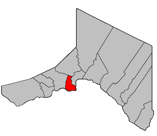
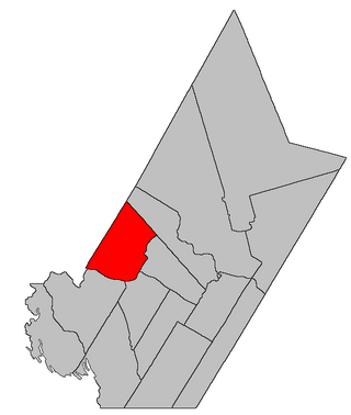
Saint-Basile is a geographic parish in Madawaska County, New Brunswick, Canada. [4]
For governance purposes it is divided between the city of Edmundston, [5] the St. Basile 10 Indian Reserve, and the Northwest rural district; [6] the city and rural district are members of the Northwest Regional Service Commission. [7]
Before the 2023 governance reform, the area now in the rural district formed the local service district of the parish of Saint-Basile. [8]
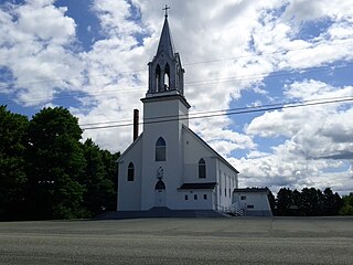
The parish was named for the Roman Catholic church. [9]
Saint-Basile was erected as Saint Basil in 1850 from Madawaska Parish. [10]
In 1852 the parish's boundaries were extended northward to include territory awarded in the boundary settlement with the Province of Canada. [11]
In 1874 the core of modern Edmundston was removed from Saint-Basile and added to Madawaska Parish. [12]
In 1877 the newly erected Sainte-Anne Parish included part of Saint-Basile. [13]
In 1896 the boundary along Green River was altered. [14]
In 1920 part of Saint-Basile was erected as Rivière-Verte Parish. [15]
In 1973 the name was officially changed to Saint-Basile. [16]
Saint-Basile Parish is bounded: [2] [17] [18] [19]
Communities at least partly within the parish. [17] [18] [19] bold indicates an incorporated municipality or Indian reserve; italics indicate a name no longer in official use
|
|
Bodies of water [lower-alpha 3] at least partly in the parish. [17] [18] [19]
|
|
Islands at least partly in the parish. [17] [18] [19]
Parish population total does not include Indian reserve or portion in Edmundston
2021 | 2016 | 2011 | |
---|---|---|---|
Population | 736 (+24.3% from 2016) | 592 (-17.4% from 2011) | 717 (-10.3% from 2006) |
Land area | 129.96 km2 (50.18 sq mi) | 129.61 km2 (50.04 sq mi) | 129.74 km2 (50.09 sq mi) |
Population density | 5.7/km2 (15/sq mi) | 4.6/km2 (12/sq mi) | 5.5/km2 (14/sq mi) |
Median age | 51.2 (M: 51.6, F: 51.2) | 47.5 (M: 48.0, F: 47.1) | 44.7 (M: 46.1, F: 42.9) |
Private dwellings | 325 (total) | 270 (total) | 313 (total) |
Median household income | $58,048 | $46,535 |
|
|
| |||||||||||||||||||||||||||
[27] [28] |
Canada Census Mother Tongue - Saint-Basile Parish, New Brunswick [27] | ||||||||||||||||||
---|---|---|---|---|---|---|---|---|---|---|---|---|---|---|---|---|---|---|
Census | Total | French | English | French & English | Other | |||||||||||||
Year | Responses | Count | Trend | Pop % | Count | Trend | Pop % | Count | Trend | Pop % | Count | Trend | Pop % | |||||
2011 | 715 | 695 | 11.5% | 97.20% | 20 | 33.3% | 2.80% | 0 | 0.0% | 0.00% | 0 | 0.0% | 0.00% | |||||
2006 | 800 | 785 | 18.9% | 98.13% | 15 | 0.0% | 1.87% | 0 | 100.0% | 0.00% | 0 | 0.0% | 0.00% | |||||
2001 | 710 | 660 | 1.5% | 92.96% | 15 | 50.0% | 2.11% | 35 | 250.0% | 4.93% | 0 | 0.0% | 0.00% | |||||
1996 | 670 | 650 | n/a | 97.01% | 10 | n/a | 1.49% | 10 | n/a | 1.49% | 0 | n/a | 0.00% |
Southampton is a geographic parish in York County, New Brunswick, Canada.
Paquetville is a geographic parish in Gloucester County, New Brunswick, Canada.
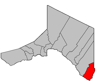
Saint-François is a geographic parish in Madawaska County, New Brunswick, Canada.
Lac Baker is a geographic parish in Madawaska County, New Brunswick, Canada.
Clair is a geographic parish in Madawaska County, New Brunswick, Canada.
Baker Brook is a geographic parish in Madawaska County, New Brunswick, Canada.
Saint-Hilaire is a geographic parish in Madawaska County, New Brunswick, Canada.
Madawaska is a geographic parish in Madawaska County, New Brunswick, Canada.
Saint-Jacques is a geographic parish in Madawaska County, New Brunswick, Canada. The parish consists of two discontiguous portions separated by Saint-Joseph Parish.
Saint-Joseph is a geographic parish in Madawaska County, New Brunswick, Canada.
Rivière-Verte is a geographic parish in Madawaska County, New Brunswick, Canada.
Sainte-Anne is a geographic parish in Madawaska County, New Brunswick, Canada.
Notre-Dame-de-Lourdes is a geographic parish in Madawaska County, New Brunswick, Canada.
Saint-Léonard is a geographic parish in Madawaska County, New Brunswick, Canada.
Saint-André is a geographic parish in Madawaska County, New Brunswick, Canada.
Drummond is a geographic parish in Victoria County, New Brunswick, Canada.
Saint-Marie, is a geographic parish in Kent County, New Brunswick, Canada.
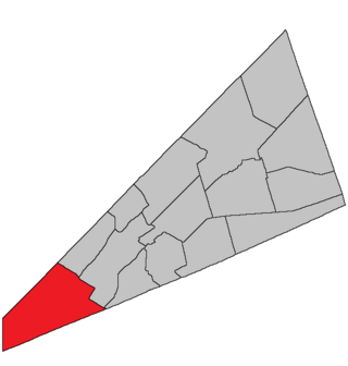
Hampton is a geographic parish in Kings County, New Brunswick, Canada.
Westfield is a geographic parish in Kings County, New Brunswick, Canada.
Kingston is a geographic parish in Kings County, New Brunswick, Canada.