San Juan de Miraflores

Last updated
Saint John of Miraflores
San Juan de Miraflores (Spanish)
Bandera de San Juan de Miraflores.png
Escudo SJM.png
Lica-sanjuandemiraflores.PNG
Location of San Juan de Miraflores in Lima
Coordinates: 12°9′5″S76°58′12″W / 12.15139°S 76.97000°W / -12.15139; -76.97000
Country Flag of Peru.svg  Peru
Province Lima
CreatedJanuary 12, 1965
Capital Ciudad de Dios
Subdivisions 6 zones
Government
   Mayor Delia Castro
(2023-2026)
Area
  Total23.98 km2 (9.26 sq mi)
Elevation
141 m (463 ft)
Population
 (2023) [1]
  Total430,772
Time zone UTC-5 (PET)
UBIGEO 150133
Website munisjm.gob.pe

The district of San Juan de Miraflores is one of the forty-three districts that make up the province of Lima, located in the department of the same name, in Peru. Is one of the new towns, that have been formed by the massive numbers of people moving from other towns of Metropolitan Lima (such as Miraflores, Surquillo, La Victoria, among others) and from the countryside. During the early 1960s, was mostly a desert area.

Contents

San Juan de Miraflores is divided into zones ("A", "B", "C", "D", "E", and "K"). In the early 80's, people from Cuzco, Ayacucho, Pasco, and many of the other departments that were under the attack of terrorists chose San Juan and Villa El Salvador as their new home. As new residents were coming into SJM, two new zones were created: Pamplona Alta and Pamplona Baja. This name was taken in honor of some of the Spanish missionaries (who were from Pamplona, Spain) who offered their help to the residents. One of Pamplona Alta's mains streets, "Pista Nueva" or "New Street", is an example of how new the area is. When it was first settled, many people lived without electricity, water or plumbing, often building their houses from reed mats into the steep hills, with treacherous paths leading to the houses at the top. As residents could afford building materials, they would begin to reinforce these reed mats with plywood, bricks, or whatever else they could find.

Today, the houses are a hodgepodge of building materials, most in a state of continual construction as residents can afford each additional brick. Most have access to electricity, but many still lack running water or plumbing. In just the last couple of years the mayor of Lima has launched an extremely successful program to build concrete staircases, or "escapers", into the hillsides, replacing the treacherous paths and dramatically improving the living conditions of residents. These staircases are distinctively painted yellow, with bright blue signs, and neighborhood residents are hired by the city to build them.

In addition to these new zones, 2 more were created. By the year 1981, America and Umamarca were created. Usually, these new zones are well known because of its highly interest of being better every day, since most of the owners are the people, who worked most of their lives (and still do) in Ciudad de Dios' Market. These areas were urbanized quickly.

By 1983 and 1984, two new more zones had been created - Maria Auxiliadora and Amauta ("teacher" in English), located between zones "A" and "B". One of the main streets of Maria Auxiliadora is Pedro Miotta, which was well known as the former Panamericana Sur freeway.

Geography

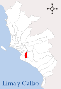
The district is located at the South of Lima. It has a total land area of 23.98 km2. Its administrative center is located 141 meters above sea level.

Boundaries

Demographics

According to the 2005 census by the INEI, the district has 335,237 inhabitants, a population density of 13,979.9 persons/km2 and 71,384 households.

Urban Structure

The history and urban growth in San Juan de Miraflores has occurred gradually, which has been marked in six areas. This, according to Ordinance No. 1018-MML, published on July 11, 2007 by the Metropolitan Municipality of Lima.

Zone No. 1 or Pamplona Alta Zone, includes all the sectors whose limits go from Defensores de Lima Avenue to the north of the district, whose limits are the adjacent hills. There are the urban spaces of San Luis, 28 de Julio, El Brillantes, Malvinas, Alfonso Ugarte, Miguel Grau, Leoncio Prado, Nazareno, San Francisco de la Cruz, Buenos Milagros, Los Laureles, Virgen del Buen Paso, Ollantay, Rinconada, Nueva Rinconada, among others. This last urban settlement was described in a thesis developed in 2000.13 Likewise, the northern area of Pamplona Alta was historically recognized as a place of hills. Recently, this recognition is being given at a legal level.

Zone No. 2 or Pamplona Baja Zone, on this land the urbanizations of Ciudad de Dios, Pamplona Baja, San Juanito, Arenal San Juan, La Gloria, 13 de Enero and Andrés Avelino Cáceres are established. It is in the central part of the district, in a strip that runs parallel between Los Héroes and Defensores de Lima avenues. It borders the districts of Santiago de Surco and Villa María del Triunfo. The district capital, according to law No. 15382, is located in this area. Its full name is Urbanización Popular Ciudad de Dios, which is organized internally into zone A and K. The housing modules were delivered (through sale) in 1958.

Zone No. 3 or Urban Zone, this name is a little confusing, since, before the existence of the San Juan A urbanization, there were the urbanizations of Ciudad de Dios, Pamplona (Baja) and others in the process of construction. It includes the San Juan urbanizations (organized into zone A, B, C, D, E1 and E2).

Zone No. 4 or María Auxiliadora Zone, is located in the southern part of the district, with sandy and salty terrain, starting on Miguel Iglesias Avenue to the left. It borders in the upper part with the district of Villa María del Triunfo. It has 16 urban establishments, including Martín de San Juan. The María Auxiliadora General Hospital is located in this area.

Zone No. 5 or Pampas Zone of San Juan, located in the southern part of the district, covers an approximate area of 350 hectares of rugged terrain and wastelands of sandy and salty consistency. It borders the districts of Villa El Salvador and Villa María del Triunfo. There is the industrial zone. It has 46 urban settlements. Among these urban settlements we have Fortaleza, Trebo Azul, Felipe Alva y Alva, La Ciudad de los Ninos and the Huayna Capac Zonal Park. In this area is the well-known Children's City of the Immaculate Conception, founded in 1955 by the Capuchin Franciscan brother Francisco Minasso of Riva Ligure, known as the "Iluminated Father", who collected abandoned children from the street.14

Zone No. 6 or Pan-American South Zone, is located in the western part of the district and covers the right strip that runs parallel to the Pan-American South Highway, for an approximate extension of 6 kilometers, from the Amauta Bridge to kilometer 18 of the Pan-American Highway. . It borders the districts of Santiago de Surco and Chorrillos. It has 50 urban settlements. Among these we have Umamarca, Las Américas, Los Eucaliptos, Las Dunas.

There is talk of Zone No. 7, corresponding to the Monterrico Sur Urbanizations and other areas bordering the district of Santiago de Surco. Remember that the district of San Juan de Miraflores since its legal-political existence, the west bordered the avenue now known as Caminos del Inca avenue. This is usually one of the reasons for seeking a solution to the border dispute between the authorities of these districts.

See also

Related Research Articles

<span class="mw-page-title-main">Lima</span> Capital and largest city of Peru

Lima, founded in 1535 as the Ciudad de los Reyes, is the capital and largest city of Peru. It is located in the valleys of the Chillón, Rímac and Lurín Rivers, in the desert zone of the central coastal part of the country, overlooking the Pacific Ocean. The city is considered the political, cultural, financial and commercial center of Peru. Due to its geostrategic importance, the Globalization and World Cities Research Network has categorized it as a "beta" tier city. Jurisdictionally, the metropolis extends mainly within the province of Lima and in a smaller portion, to the west, within the Constitutional Province of Callao, where the seaport and the Jorge Chávez Airport are located. Both provinces have regional autonomy since 2002.

<span class="mw-page-title-main">Pueblos jóvenes</span> Shanty town of Peru

Pueblos jóvenes is the term used for the shanty towns that surround Lima and other cities of Peru. Many of these towns have developed into districts of Lima such as Comas, Los Olivos and Villa El Salvador.

<span class="mw-page-title-main">Toa Alta, Puerto Rico</span> Town and municipality in Puerto Rico

Toa Alta is a town and municipality of Puerto Rico located in the northern coast of the island, north of Naranjito; south of Dorado and Toa Baja; east of Vega Alta and Corozal; and west of Bayamón. Toa Alta is spread over eight barrios and Toa Alta Pueblo. It is part of the San Juan-Caguas-Guaynabo metropolitan statistical area. There are nine barrios in Toa Alta and altogether in 2020 had a population of 66,852. Río de la Plata, is a large river that runs through Toa Alta. Toa Alta celebrates its patron saint festival in May.

<span class="mw-page-title-main">Santiago de Surco</span> District in Lima, Peru

Santiago de Surco, commonly known simply as Surco, is a district of Lima, Peru. It is bordered on the north with the district of Ate Vitarte and La Molina; on the east with San Juan de Miraflores, on the west with San Borja, Surquillo, Miraflores and Barranco, and on the south with Chorrillos.

<span class="mw-page-title-main">Lima and Callao Metro</span> Rapid transit system in Lima, Peru

The Lima and Callao Metro is a rapid transit system that serves the cities of Lima and Callao, which make up the Lima metropolitan area. The existing metro lines currently link the district of Villa El Salvador in the south of Lima with San Juan de Lurigancho in the northeast of the city, as well as a 5km segment in the east of the metro area. Furthermore, there are four additional lines planned for the network.

<span class="mw-page-title-main">Villa El Salvador</span> District in Lima, Peru

The Savior Town District is an urban, largely residential coastal district on the outskirts of Lima, Peru. It borders the district of Chorrillos on the east; the Pacific Ocean on the southwest; Lurín on the southeast; Villa María del Triunfo on the east and San Juan de Miraflores on the north.

<span class="mw-page-title-main">Lima metropolitan area</span> Place in Peru

The Lima Metropolitan Area is an area formed by the conurbation of the Peruvian provinces of Lima and Callao. It is the largest of the metropolitan areas of Peru, the seventh largest in the Americas, the fourth largest in Latin America, and among the thirty largest in the world. The conurbation process started to be evident in the 1980s.

<span class="mw-page-title-main">La Molina District</span> District in Lima, Peru

The district of La Molina is one of the forty-three districts that make up the province of Lima, located in the department of the same name, in Peru. Officially established as a district on February 6, 1962. The current mayor of La Molina is Esteban Diego Uceda Guerra-García.

<span class="mw-page-title-main">San Borja District</span> District in Lima, Peru

San Borja is a district of the Lima Province in Peru, and one of the upscale districts that comprise the city of Lima. Originally part of the district of Surquillo and San Isidro, it became officially established as a separate district on June 1, 1983. The new district took its name from a former hacienda (estate) which dominated the area. The district's postal code is 41. The current mayor (alcalde) is Marco Antonio Álvarez Vargas.

<span class="mw-page-title-main">Miraflores District, Lima</span> District in Peru

Miraflores is a district of the Lima Province in Peru. It is a residential and upscale shopping district south of downtown Lima. It is also one of the wealthiest districts that make up the city of Lima. It has several hotels, restaurants, bars, nightclubs, and department stores. Miraflores is one of the main tourist destinations in Lima.

<span class="mw-page-title-main">Ate District</span> District in Lima, Peru

The Ate district, also called Ate-Vitarte, is one of the forty-three districts that make up the Lima Province, located in Peru.

<span class="mw-page-title-main">Villa María del Triunfo</span> District in Lima, Peru

Mary of the Triumph Town District is a district of the Lima Province in Peru. It is located in the Cono Sur area of the city of Lima. It was officially established as a district on December 28, 1961. The current mayor (alcalde) of Villa María del Triunfo is Eloy Chávez Hernández.

A Peruvian postal code is a five-digit string that comprises part of a postal address in Peru. Prior to 2011, only the major cities of Lima and Callao used postal codes. However, in February 2011 a nationwide system was implemented which employs a five-digit numeric format. Similar to the postal codes of Mexico, Brazil, Australia, the United States, and elsewhere, postal codes in Peru are strictly numerical, using only numbers.

<span class="mw-page-title-main">Suba, Bogotá</span> Locality of Bogotá in Bogotá D.C., Colombia

Suba is the 11th locality of Bogotá, capital of Colombia. It is located in the northwest of the city, bordering to the north the municipality of Chía in Cundinamarca, to the west the municipality of Cota, to the east the locality Usaquén and to the south the localities Engativá and Barrios Unidos. This district is inhabited by residents of all social classes.

<span class="mw-page-title-main">Ciudad Bolívar, Bogotá</span> Locality of Bogotá in Bogotá D.C., Colombia

Ciudad Bolívar is the 19th locality in the Capital District of the Colombian capital city Bogotá. Ciudad Bolívar is located in the south of the city at the southern border of the Bogotá savanna. This district is mostly inhabited by under privileged residents.

<span class="mw-page-title-main">Battle of San Juan and Chorrillos</span> 1881 battle of the War of the Pacific

The Battle of San Juan, also known as the Battle of San Juan and Chorrillos, was the first of two battles in the Lima Campaign during the War of the Pacific, and was fought on 13 January 1881. This battle is really a group of smaller, yet fierce confrontations at the defensive strongholds of Villa, Chorrillos, Santiago de Surco, San Juan de Miraflores, Santa Teresa and Morro Solar. The Chilean army led by Gen. Manuel Baquedano inflicted a harsh defeat on the Peruvian army commanded by the Supreme Chief Nicolás de Piérola. The Chilean triumph eliminated the first defensive line guarding Lima, and almost obliterated the Peruvian army defending it.

<span class="mw-page-title-main">Cono Sur (Lima)</span> Sector in Lima, Peru

The Cono Sur or Lima Sur is one of the five areas that make up the Lima Metropolitan Area. It is located in the southern part of the metropolis hence its name. This socioeconomic levels of this district are varied. Most of the population however belongs to the lower and middle classes. But it is the area closest to the districts of the modern zone and residential areas like Miraflores, La Molina, Santiago de Surco, etc. Many of the residents belonging to these districts are immigrants from various regions of the country. As they settled there, some developed successful communities such as Villa El Salvador, while others still live in poor housing known as Pueblos jóvenes. The area is popular for its beaches, farms and factories in that population greatly increases during the summer months.

<span class="mw-page-title-main">Zaidín (Granada)</span>

El Zaidín is a district located in the South of the city of Granada. It is also known by the name of Zaidín-Vergeles. It is the most populated neighborhood. In the north lie the neighborhoods of Cervantes and Mirasierra, to the west lies Figares neighborhood, to the south lies Armilla and to the east lies La Zubia.

<span class="mw-page-title-main">Squatting in Peru</span> Occupation of unused land or derelict buildings in Peru

Squatting in Peru is the occupation of unused or derelict buildings or land without the permission of the owner. From the 1940s onwards, land invasions created shanty towns which were first called barriadas and later pueblos jóvenes. They were initially repressed, then the government decided upon toleration and by 1998 it was estimated 2.5 million inhabitants were living in this way in the capital Lima. There are also slum tenements in the centre known as solares or tugurios, and a "Wall of Shame" has been built to separate rich and poor areas of the city. During the COVID-19 pandemic, an increase in the occupation of UNESCO World Heritage Sites such as Caral and the Nazca Lines was reported.

References

  1. "Estadística Poblacional - Ministerio de Salud del Perú".