Sarahsville, Ohio | |
---|---|
Coordinates: 39°48′27″N81°28′10″W / 39.80750°N 81.46944°W | |
Country | United States |
State | Ohio |
County | Noble |
Area | |
• Total | 0.17 sq mi (0.44 km2) |
• Land | 0.17 sq mi (0.44 km2) |
• Water | 0.00 sq mi (0.00 km2) |
Elevation | 948 ft (289 m) |
Population (2020) | |
• Total | 147 |
• Density | 869.82/sq mi (336.32/km2) |
Time zone | UTC-5 (Eastern (EST)) |
• Summer (DST) | UTC-4 (EDT) |
ZIP code | 43779 |
Area code | 740 |
FIPS code | 39-70520 [3] |
GNIS feature ID | 2399183 [2] |
Sarahsville is a village in Noble County, Ohio, United States. The population was 147 at the 2020 census.
A post office called Sarahsville has been in operation since 1840. [4] The village was named after Sarah Devold, the wife of an early settler. [5]
According to the United States Census Bureau, the village has a total area of 0.15 square miles (0.39 km2), all land. [6]
Census | Pop. | Note | %± |
---|---|---|---|
1870 | 256 | — | |
1880 | 249 | −2.7% | |
1890 | 306 | 22.9% | |
1900 | 279 | −8.8% | |
1910 | 281 | 0.7% | |
1920 | 186 | −33.8% | |
1930 | 198 | 6.5% | |
1940 | 193 | −2.5% | |
1950 | 170 | −11.9% | |
1960 | 164 | −3.5% | |
1970 | 181 | 10.4% | |
1980 | 226 | 24.9% | |
1990 | 162 | −28.3% | |
2000 | 198 | 22.2% | |
2010 | 166 | −16.2% | |
2020 | 147 | −11.4% | |
U.S. Decennial Census [7] |
As of the census [8] of 2010, there were 166 people, 56 households, and 48 families living in the village. The population density was 1,106.7 inhabitants per square mile (427.3/km2). There were 63 housing units at an average density of 420.0 per square mile (162.2/km2). The racial makeup of the village was 98.8% White and 1.2% African American.
There were 56 households, of which 48.2% had children under the age of 18 living with them, 69.6% were married couples living together, 7.1% had a female householder with no husband present, 8.9% had a male householder with no wife present, and 14.3% were non-families. 10.7% of all households were made up of individuals, and 5.4% had someone living alone who was 65 years of age or older. The average household size was 2.96 and the average family size was 3.04.
The median age in the village was 32.5 years. 27.7% of residents were under the age of 18; 10.1% were between the ages of 18 and 24; 32.4% were from 25 to 44; 24% were from 45 to 64; and 5.4% were 65 years of age or older. The gender makeup of the village was 50.0% male and 50.0% female.
As of the census [3] of 2000, there were 198 people, 63 households, and 57 families living in the village. The population density was 1,177.4 people per square mile (454.6 people/km2). There were 72 housing units at an average density of 428.1 per square mile (165.3/km2). The racial makeup of the village was 98.99% White, 0.51% African American, and 0.51% from two or more races. Hispanic or Latino of any race were 3.54% of the population.
There were 63 households, out of which 41.3% had children under the age of 18 living with them, 79.4% were married couples living together, 6.3% had a female householder with no husband present, and 9.5% were non-families. 7.9% of all households were made up of individuals, and 6.3% had someone living alone who was 65 years of age or older. The average household size was 3.14 and the average family size was 3.19.
In the village, the population was spread out, with 29.8% under the age of 18, 12.1% from 18 to 24, 31.3% from 25 to 44, 19.2% from 45 to 64, and 7.6% who were 65 years of age or older. The median age was 30 years. For every 100 females there were 110.6 males. For every 100 females age 18 and over, there were 113.8 males.
The median income for a household in the village was $37,500, and the median income for a family was $35,313. Males had a median income of $36,875 versus $21,875 for females. The per capita income for the village was $12,114. About 7.5% of families and 14.4% of the population were below the poverty line, including 14.0% of those under the age of eighteen and 8.7% of those 65 or over.
Oakfield is a town in Aroostook County, Maine, United States. The population was 661 at the 2020 census. The village of Oakfield, listed as a census-designated place, is in the northwestern corner of the town.
Lyons is a village in Ionia County in the U.S. state of Michigan. The population was 789 at the 2010 census. Most of the village is within Lyons Township. A small portion extends west into Ionia Township.
Kingston is a village in Tuscola County in the U.S. state of Michigan. The population was 440 at the 2010 census. The village is located at the southern edge of Kingston Township and is partially within Koylton Township.
Junction City is a village in Madison County, Missouri, United States. The population was 327 at the 2010 census.
Mackenzie is an unincorporated community in St. Louis County, Missouri, United States. The population was 134 at the 2010 census.
Pasadena Park is a village in St. Louis County, Missouri, United States. The population was 470 at the 2010 census. It is part of the Normandy School District, and is distinct from the city of Pasadena Hills.
Velda Village Hills is a city in northeastern St. Louis County, Missouri, United States. The population was 1,055 at the 2010 census.
Westwood is a village in west St. Louis County, Missouri, United States. The population was 316 at the 2020 census.
McCord Bend is a village in Stone County, Missouri, United States. The population was 212 at the 2020 census. It is part of the Branson, Missouri Micropolitan Statistical Area.
Cedar Creek is a village in Cass County, Nebraska, United States. The population was 465 at the 2020 census.
Baldwin Park is a village in Cass County, Missouri, United States. The population was 92 at the 2010 census. It is part of the Kansas City metropolitan area.
Fort Shawnee is census-designated place (CDP) in Allen County, Ohio, United States. The population was 6,263 at the 2020 census. It is included in the Lima, Ohio Metropolitan Statistical Area. Fort Shawnee is adjacent to the city of Lima and the village of Cridersville in Auglaize County. In 2012, village residents voted to disincorporate the village. According to the United States Census Bureau, the village had a total area of 7.25 square miles (18.78 km2), of which 7.21 square miles (18.67 km2) is land and 0.04 square miles (0.10 km2) is water.
New Weston is a village in Darke County, Ohio, United States. The population was 124 at the 2020 census.
Woodlawn is a village in Hamilton County, Ohio, United States. The population was 3,916 at the 2020 census.
Waite Hill is a village in Lake County, Ohio, United States and a rural suburb of Cleveland. The population was 543 at the 2020 census.
Graysville is a village in Monroe County, Ohio, United States. The population was 70 at the 2020 census.
Melrose is a village in Paulding County, Ohio, United States. The population was 233 at the 2020 census.
Port Jefferson is a village in Salem Township, Shelby County, Ohio, United States. The population was 308 at the 2020 census.
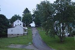
Elgin is a village in Van Wert County, Ohio, United States. The population was 49 at the 2020 census. It is included within the Van Wert, Ohio Micropolitan Statistical Area.
Verona is a village in Montgomery and Preble counties in the U.S. state of Ohio. The population was 403 at the 2020 census. It is part of the Dayton Metropolitan Statistical Area.