Sarles, North Dakota

Last updated

Sarles, North Dakota
Sarles, North Dakota 7-19-2009.jpg
Building in Sarles
ND Cavalier County Sarles.svg
Location of Sarles, North Dakota
Coordinates: 48°56′41″N98°59′49″W / 48.94472°N 98.99694°W / 48.94472; -98.99694
CountryUnited States
State North Dakota
Counties Cavalier, Towner
Founded1905
Area
[1]
  Total0.26 sq mi (0.68 km2)
  Land0.26 sq mi (0.68 km2)
  Water0.00 sq mi (0.00 km2)
Elevation
[2]
1,585 ft (483 m)
Population
 (2020) [3]
  Total16
  Estimate 
(2022) [4]
15
  Density61.30/sq mi (23.65/km2)
Time zone UTC-6 (Central (CST))
  Summer (DST) UTC-5 (CDT)
ZIP code
58372
Area code 701
FIPS code 38-70780
GNIS feature ID1036254 [2]

Sarles is a city in Cavalier and Towner counties in the State of North Dakota. [5] The population was 16 at the 2020 census. [3] Sarles was founded in 1905 at the end of the Great Northern railway extension north of Munich, called the "Sarles Branch". The town is named for North Dakota Governor Elmore Y. Sarles. [6]

Contents

Geography

According to the United States Census Bureau, the city has a total area of 0.22 square miles (0.57 km2), all land. [7]

Demographics

Historical population
CensusPop.Note
1910 346
1920 3480.6%
1930 38310.1%
1940 302−21.1%
1950 285−5.6%
1960 225−21.1%
1970 148−34.2%
1980 111−25.0%
1990 86−22.5%
2000 25−70.9%
2010 2812.0%
2020 16−42.9%
2022 (est.)15 [4] −6.2%
U.S. Decennial Census [8]
2020 Census [3]

2010 census

As of the census of 2010, there were 28 people, 13 households, and 5 families residing in the city. The population density was 127.3 inhabitants per square mile (49.2/km2). There were 27 housing units at an average density of 122.7 per square mile (47.4/km2). The racial makeup of the city was 96.4% White and 3.6% Native American.

There were 13 households, of which 30.8% had children under the age of 18 living with them, 30.8% were married couples living together, 7.7% had a male householder with no wife present, and 61.5% were non-families. 53.8% of all households were made up of individuals, and 30.8% had someone living alone who was 65 years of age or older. The average household size was 2.15 and the average family size was 3.80.

The median age in the city was 35.5 years. 35.7% of residents were under the age of 18; 0.0% were between the ages of 18 and 24; 32.1% were from 25 to 44; 14.3% were from 45 to 64; and 17.9% were 65 years of age or older. The gender makeup of the city was 53.6% male and 46.4% female.

2000 census

As of the census of 2000, there were 25 people, 16 households, and 5 families residing in the city. The population density was 97.5 inhabitants per square mile (37.6/km2). There were 44 housing units at an average density of 171.5 per square mile (66.2/km2). The racial makeup of the city was 84.00% White and 16.00% Native American.

There were 16 households, out of which 12.5% had children under the age of 18 living with them, 25.0% were married couples living together, 6.3% had a female householder with no husband present, and 68.8% were non-families. 68.8% of all households were made up of individuals, and 43.8% had someone living alone who was 65 years of age or older. The average household size was 1.56 and the average family size was 2.40.

In the city, the population was spread out, with 8.0% under the age of 18, 4.0% from 18 to 24, 24.0% from 25 to 44, 28.0% from 45 to 64, and 36.0% who were 65 years of age or older. The median age was 56 years. For every 100 females, there were 127.3 males. For every 100 females age 18 and over, there were 130.0 males.

The median income for a household in the city was $31,875, and the median income for a family was $36,875. Males had a median income of $31,250 versus $0 for females. The per capita income for the city was $21,479. There were no families and 8.3% of the population living below the poverty line, including no under eighteens and none of those over 64.

Related Research Articles

<span class="mw-page-title-main">Brinsmade, North Dakota</span> City in North Dakota, United States

For people with the surname, see Brinsmade (surname).

<span class="mw-page-title-main">Gardena, North Dakota</span> City in North Dakota, United States

Gardena is a city in Bottineau County, North Dakota, United States. The population was 24 at the 2020 census. Gardena was founded in 1905.

<span class="mw-page-title-main">Westhope, North Dakota</span> City in North Dakota, United States

Westhope is a city in Bottineau County, North Dakota, United States. The population was 374 at the 2020 census. Westhope was founded in 1903 along a Great Northern Railway branch line that began in Rugby. The name was based on the slogan "Hope of the West," created by Great Northern officials to promote prosperity for the new town.

<span class="mw-page-title-main">Willow City, North Dakota</span> City in North Dakota, United States

Willow City is a city in Bottineau County, North Dakota, United States. The population was 149 at the 2020 census. Willow City was founded in 1887.

<span class="mw-page-title-main">Scranton, North Dakota</span> City in North Dakota, United States

Scranton is a small town in Bowman County, North Dakota, United States. The population was 258 at the 2020 census.

<span class="mw-page-title-main">Lincoln, North Dakota</span> City in North Dakota, United States

Lincoln is a city in Burleigh County, North Dakota, United States. It is a suburb of adjacent Bismarck, and also a core city of the Bismarck-Mandan Metropolitan Statistical Area. The population was 4,257 at the 2020 census, making it the 14th most populous city in North Dakota. Lincoln was founded in 1977.

<span class="mw-page-title-main">Briarwood, North Dakota</span> City in North Dakota, United States

Briarwood is a city in Cass County, North Dakota, United States. The population was 57 at the 2020 census. Briarwood was founded in 1973. It is a suburb directly adjacent to the city of Fargo.

<span class="mw-page-title-main">Calio, North Dakota</span> City in North Dakota, United States

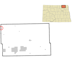
Calio is a city in Cavalier County, North Dakota, United States. The population was 8 at the 2020 census. Calio was founded in 1905.

<span class="mw-page-title-main">Loma, North Dakota</span> City in North Dakota, United States

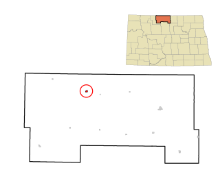
Loma is a city in Cavalier County, North Dakota, United States. The population was 10 at the 2020 census. Loma was founded in 1905.

<span class="mw-page-title-main">Hannaford, North Dakota</span> City in North Dakota, United States

Hannaford is a city in Griggs County, North Dakota, United States. The population was 126 at the 2020 census. Hannaford was founded in 1883.

<span class="mw-page-title-main">Fairmount, North Dakota</span> City in Richland County, North Dakota, United States

Fairmount is a city in Richland County, North Dakota, United States. The population was 343 at the 2020 census. Fairmount was founded in 1884. It is part of the Wahpeton, ND–MN Micropolitan Statistical Area.

<span class="mw-page-title-main">Forest River, North Dakota</span> City in North Dakota, United States

Forest River is a city in Walsh County, North Dakota, United States. The population was 109 at the 2020 census. Forest River was founded on July 13, 1887.

<span class="mw-page-title-main">Hoople, North Dakota</span> City in North Dakota, United States

Hoople is a city in Walsh County, North Dakota, United States. The population was 247 at the 2020 census. Hoople, named for early settler Alan Hoople, was founded in 1889. Hoople's nickname is "Tatertown."

<span class="mw-page-title-main">Kenmare, North Dakota</span> City in North Dakota, United States

Kenmare is a city in Ward County, North Dakota, United States. The population was 961 at the 2020 census. Kenmare is part of the Minot Micropolitan Statistical Area.

<span class="mw-page-title-main">White, South Dakota</span> City in South Dakota, United States

White is a city in Brookings County, South Dakota, United States. The population was 537 at the 2020 census.

<span class="mw-page-title-main">Bristol, South Dakota</span> City in South Dakota, United States

Bristol is a city located in western Day County, South Dakota, United States. It lies in Section 25 of Bristol Township, on the main line of what is now the BNSF Railway alongside U.S. Route 12. The population was 288 at the 2020 census.`

<span class="mw-page-title-main">Corsica, South Dakota</span> City in South Dakota, United States

Corsica is a city in Douglas County, South Dakota, United States. The population was 561 at the 2020 census.

<span class="mw-page-title-main">Kadoka, South Dakota</span> City in South Dakota, United States

Kadoka is a city in, and the county seat of, Jackson County, South Dakota, United States. The population was 543 at the 2020 census. The town occupies about 2.3 square miles.

<span class="mw-page-title-main">Crooks, South Dakota</span> City in South Dakota, United States

Crooks is a city in Minnehaha County, South Dakota, United States and is a suburb of Sioux Falls. The population was 1,362 at the 2020 census. Crooks was named New Hope until 1904. The town's present name honors W. A. Crooks, a local politician.

<span class="mw-page-title-main">Ashton, South Dakota</span> City in South Dakota, United States

Ashton is a city in eastern Spink County, South Dakota, United States. The population was 108 at the 2020 census.

References

  1. "ArcGIS REST Services Directory". United States Census Bureau. Retrieved September 20, 2022.
  2. 1 2 U.S. Geological Survey Geographic Names Information System: Sarles, North Dakota
  3. 1 2 3 "Explore Census Data". United States Census Bureau . Retrieved December 14, 2023.
  4. 1 2 "City and Town Population Totals: 2020-2022". United States Census Bureau. December 14, 2023. Retrieved December 14, 2023.
  5. 2007 Taxable Valuation Survey Archived February 13, 2012, at the Wayback Machine , North Dakota League of Cities
  6. "The Town Of Sarles", The Bismarck Daily Tribune, June 7, 1905.
  7. "US Gazetteer files 2010". United States Census Bureau. Archived from the original on July 2, 2012. Retrieved June 14, 2012.
  8. United States Census Bureau. "Census of Population and Housing" . Retrieved August 30, 2013.