Bisbee, North Dakota

Last updated

Bisbee, North Dakota
Bisbee, North Dakota 7-18-2009.jpg
Business district of Bisbee
ND Towner County Bisbee.svg
Location of Bisbee, North Dakota
Coordinates: 48°37′33″N99°22′47″W / 48.62583°N 99.37972°W / 48.62583; -99.37972
CountryUnited States
State North Dakota
County Towner
Founded1888
Area
[1]
  Total0.30 sq mi (0.78 km2)
  Land0.30 sq mi (0.78 km2)
  Water0.00 sq mi (0.00 km2)
Elevation
[2]
1,595 ft (486 m)
Population
 (2020)
  Total110
  Density365.45/sq mi (141.31/km2)
Time zone UTC-6 (CST)
  Summer (DST) UTC-5 (CDT)
ZIP code
58317
Area code 701
FIPS code 38-07180
GNIS feature ID1035933 [2]

Bisbee is a city in Towner County, North Dakota, United States. The population was 110 at the 2020 census. [3] Bisbee was founded in 1888.

Contents

History

The town was named after Colonel Andrew Bisbee, a native of Peru, Maine. Bisbee, a veteran of the Civil War who came to Towner County in 1885. In 1890 he was chosen by the county commissioners of Towner County to solicit drought relief and was elected to a term in the North Dakota Senate. Col. Bisbee donated a portion of the townsite of Bisbee, as well donating land for the railroads to pass through the village. [4] [5] [6]

Geography

According to the United States Census Bureau, the city has a total area of 0.26 square miles (0.67 km2), all land. [7]

Climate

This climatic region is typified by large seasonal temperature differences, with warm to hot (and often humid) summers and cold (sometimes severely cold) winters. According to the Köppen Climate Classification system, Bisbee has a humid continental climate, abbreviated "Dfb" on climate maps. [8]

Culture

Bisbee was featured in the September 10, 2001 edition of Newsweek, discussing the slow, painful decline of the town since (at that time) even the mayor, Bob Weltin, was preparing to forsake what was left of the town and seek a better life elsewhere. Things Bisbee had lost over the years, according to the Newsweek article, included movies at Pettsinger's Theater, root-beer floats at Brannon's Drug and Soda Fountain, and groceries at Dick's Red Owl. At the time of the article, there wasn't a doctor, lawyer, plumber or priest in Bisbee anymore. Population had dropped more than 30 percent in a decade. At the time of the article, there were only 227 "hearty souls" hanging on for dear life in Bisbee. [9]

Demographics

Historical population
CensusPop.Note
1910 444
1920 50012.6%
1930 5316.2%
1940 393−26.0%
1950 365−7.1%
1960 3886.3%
1970 305−21.4%
1980 257−15.7%
1990 227−11.7%
2000 167−26.4%
2010 126−24.6%
2020 110−12.7%
2021 (est.)106 [10] −3.6%
U.S. Decennial Census [11]
2020 Census [3]

2010 census

As of the census of 2010, there were 126 people, 63 households, and 31 families residing in the city. The population density was 484.6 inhabitants per square mile (187.1/km2). There were 97 housing units at an average density of 373.1 per square mile (144.1/km2). The racial makeup of the city was 96.0% White and 4.0% Native American. Hispanic or Latino of any race were 0.8% of the population.

There were 63 households, of which 19.0% had children under the age of 18 living with them, 38.1% were married couples living together, 4.8% had a female householder with no husband present, 6.3% had a male householder with no wife present, and 50.8% were non-families. 46.0% of all households were made up of individuals, and 22.2% had someone living alone who was 65 years of age or older. The average household size was 2.00 and the average family size was 2.84.

The median age in the city was 49 years. 17.5% of residents were under the age of 18; 5.6% were between the ages of 18 and 24; 20.6% were from 25 to 44; 33.2% were from 45 to 64; and 23% were 65 years of age or older. The gender makeup of the city was 53.2% male and 46.8% female.

2000 census

As of the census of 2000, there were 167 people, 82 households, and 39 families residing in the city. The population density was 624.2 inhabitants per square mile (241.0/km2). There were 102 housing units at an average density of 381.3 per square mile (147.2/km2). The racial makeup of the city was 97.01% White, 0.60% African American, 1.20% Native American, and 1.20% from two or more races.

There were 82 households, out of which 22.0% had children under the age of 18 living with them, 41.5% were married couples living together, 6.1% had a female householder with no husband present, and 52.4% were non-families. 48.8% of all households were made up of individuals, and 26.8% had someone living alone who was 65 years of age or older. The average household size was 2.04 and the average family size was 3.05.

In the city, the population was spread out, with 22.2% under the age of 18, 6.0% from 18 to 24, 21.6% from 25 to 44, 26.3% from 45 to 64, and 24.0% who were 65 years of age or older. The median age was 45 years. For every 100 females, there were 94.2 males. For every 100 females age 18 and over, there were 88.4 males.

The median income for a household in the city was $30,000, and the median income for a family was $37,188. Males had a median income of $21,875 versus $12,292 for females. The per capita income for the city was $17,610. About 15.4% of families and 13.7% of the population were below the poverty line, including 21.4% of those under the age of eighteen and 10.0% of those 65 or over.

Education

Its school district is North Star Schools in Cando. [12]

It was a part of the Bisbee School District until 1980, when it became part of the Bisbee-Egeland School District. In 2008 that district closed and consolidated into Cando schools. [13]

Related Research Articles

<span class="mw-page-title-main">Towner County, North Dakota</span> County in North Dakota, United States

Towner County is a county in the U.S. state of North Dakota. As of the 2020 census, the population is 2,162. Its county seat is Cando. It is south of the Canada–US border with Manitoba.

<span class="mw-page-title-main">Hettinger, North Dakota</span> City in North Dakota, United States

Hettinger is a city in, and the county seat of, Adams County, North Dakota, United States. The population was 1,074 at the 2020 census.

<span class="mw-page-title-main">Minnewaukan, North Dakota</span> City in North Dakota, United States

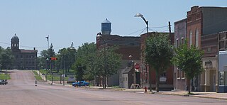
Minnewaukan is a city in Benson County, North Dakota, United States. It serves as the county seat and is fourth largest city in the county, after Fort Totten, Leeds, and Maddock. The population was 199 at the 2020 census. Minnewaukan was founded in 1884.

<span class="mw-page-title-main">Wolford, North Dakota</span> City in North Dakota, United States

Wolford is a city in Pierce County, North Dakota, United States. The population was 43 at the 2020 census. Wolford was founded in 1905.

<span class="mw-page-title-main">Egeland, North Dakota</span> City in North Dakota, United States

Egeland is a city in Towner County, North Dakota, United States. The population was 32 at the 2020 census. Egeland was founded in 1905.

<span class="mw-page-title-main">Tyndall, South Dakota</span> City in South Dakota, United States

Tyndall is a city in and the county seat of Bon Homme County, South Dakota, United States. The population was 1,057 at the 2020 census.

<span class="mw-page-title-main">Mound City, South Dakota</span> Town in South Dakota, United States

Mound City is a town in and the county seat of Campbell County, South Dakota, United States. The population was 69 at the 2020 census.

<span class="mw-page-title-main">Wagner, South Dakota</span> City in South Dakota, United States

Wagner is a city in Charles Mix County, South Dakota, United States. The population was 1,490 at the 2020 census. The city is served by Wagner Municipal Airport as well as YST Transit buses.

<span class="mw-page-title-main">Garden City, South Dakota</span> Town in South Dakota, United States

Garden City is a town in Clark County, South Dakota, United States. The population was 33 at the 2020 census.

<span class="mw-page-title-main">Webster, South Dakota</span> City in South Dakota, United States

Webster is a city in and the county seat of Day County, South Dakota, United States. The population was 1,728 at the 2020 census.

<span class="mw-page-title-main">Clear Lake, South Dakota</span> City in South Dakota, United States

Clear Lake is a city in and the county seat of Deuel County, South Dakota, United States. The population was 1,218 at the 2020 census.

<span class="mw-page-title-main">Milbank, South Dakota</span> City in South Dakota, United States

Milbank is a city in Grant County, South Dakota, United States, located along the South Fork of the Whetstone River. The population was 3,544 at the 2020 census. It is the county seat of Grant County. Milbank is the birthplace of American Legion Baseball. The program was created in Milbank in 1925 and is now enjoyed by high school aged youth on more than five thousand teams in all fifty states.

<span class="mw-page-title-main">Kadoka, South Dakota</span> City in South Dakota, United States

Kadoka is a city in, and the county seat of, Jackson County, South Dakota, United States. The population was 543 at the 2020 census. The town occupies about 2.3 square miles.

<span class="mw-page-title-main">Leola, South Dakota</span> City in South Dakota, United States

Leola is a small city in, and the county seat of, McPherson County, South Dakota, United States. It was founded on May 1, 1884, and named for Leola Haynes, daughter of one of the town's founders. The population was 434 as of the 2020 census.

<span class="mw-page-title-main">Crooks, South Dakota</span> City in South Dakota, United States

Crooks is a city in Minnehaha County, South Dakota, United States and is a suburb of Sioux Falls. The population was 1,362 at the 2020 census. Crooks was named New Hope until 1904. The town's present name honors W. A. Crooks, a local politician.

<span class="mw-page-title-main">Hartford, South Dakota</span> City in South Dakota, United States

Hartford is a suburban American city in Minnehaha County, South Dakota, a few miles northwest of Sioux Falls. Its population was 3,354 at the 2020 census.

<span class="mw-page-title-main">Woonsocket, South Dakota</span> City in South Dakota, United States

Woonsocket is a city in Sanborn County, South Dakota. The population was 631 at the 2020 census. It is the county seat of Sanborn County.

<span class="mw-page-title-main">Redfield, South Dakota</span> City in South Dakota, United States

Redfield is a city in and the county seat of Spink County, South Dakota, United States. The population was 2,214 at the 2020 census. The city was named for J. B. Redfield, a railroad official.

<span class="mw-page-title-main">Parker, South Dakota</span> City in South Dakota, U.S.

Parker is a city in Turner County, South Dakota, United States. The population was 1,194 at the 2020 census. It is the county seat of Turner County. Parker is bordered on its eastern side by South Dakota State Highway 19. Its northern side is bordered by South Dakota State Highway 44. Parker is located approximately 8 miles (13 km) northwest of Chancellor, 42 miles (68 km) east of Parkston and 41 miles (66 km) south of Madison.

<span class="mw-page-title-main">Elk Point, South Dakota</span> City in South Dakota, United States

Elk Point is a city in and county seat of Union County, South Dakota, United States. The population was 2,149 as of the 2020 census.

References

  1. "ArcGIS REST Services Directory". United States Census Bureau. Retrieved September 20, 2022.
  2. 1 2 U.S. Geological Survey Geographic Names Information System: Bisbee, North Dakota
  3. 1 2 "Explore Census Data". United States Census Bureau . Retrieved July 12, 2022.
  4. The Towner County Tribune; January 16, 1886 Second Year, No 66, Cando, ND.
  5. The Cando Herald, December 20, 1894, Cando, ND
  6. E. S. Oderkirk, Field Worker in Towner County
  7. "US Gazetteer files 2010". United States Census Bureau. Archived from the original on January 25, 2012. Retrieved June 14, 2012.
  8. Climate Summary for Bisbee, North Dakota
  9. Johnson, Dirk (September 10, 2001). "Death of a Small Town". Newsweek. 138 (11): 30–31. Retrieved March 31, 2022.
  10. "City and Town Population Totals: 2020-2021". United States Census Bureau. July 12, 2022. Retrieved July 12, 2022.
  11. United States Census Bureau. "Census of Population and Housing" . Retrieved September 7, 2013.
  12. "2020 CENSUS - SCHOOL DISTRICT REFERENCE MAP: Towner County, ND" (PDF). United States Census Bureau . Retrieved August 25, 2021.
  13. "Bisbee-Egeland school's final day ends in acceptance". Bismarck Tribune . May 23, 2008. Retrieved August 25, 2021.