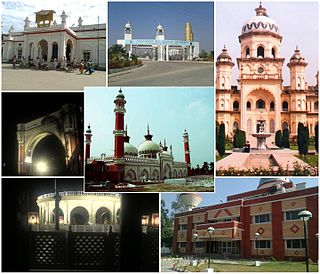
Rampur ( ) is a city, and the municipality headquarter of Rampur District in the Indian state of Uttar Pradesh. It was formerly known for its various industries, like sugar refining and cotton milling. Its library has more than 12,000 rare manuscripts and a fine collection of Mughal miniature paintings. It is located 322 kilometres north-west of the state capital Lucknow.

Rampur district is one of the districts of Uttar Pradesh state of India, and Rampur town is the district headquarters. Rampur district is a part of Moradabad division. The district occupies an area of 2,367 km2 (914 sq mi).
Nagina is a town and a municipal board in Bijnor district in the Indian state of Uttar Pradesh.
Kemri is a town and nagar panchayat in Rampur district in the Indian state of Uttar Pradesh.
Bhandardaha is a census town in Domjur CD Block of Howrah Sadar subdivision in Howrah district in the state of West Bengal, India. It is close to Makardaha and also a part of Kolkata Urban Agglomeration.

Bhowali is a town and a municipal board in Nainital District in the state of Uttarakhand, India. It is situated at a distance of 11 km (6.8 mi) from the city of Nainital, the district headquarters; at an average elevation of 1,654 m (5,427 ft) from sea level. It is the seat of Bhowali tehsil, one of the eight subdivisions of Nainital district.
Gauri Bazar is a town and a nagar panchayat in Deoria district in the state of Uttar Pradesh, India.
Kelakhera is a Municipality Town in Tehsil Bajpur of Udham Singh Nagar district in the Indian state of Uttarakhand.
Makardah is a census town in Domjur CD Block of Howrah Sadar subdivision in Howrah district in the Indian state of West Bengal. It is a part of Kolkata Urban Agglomeration.

Milak is a city and a municipal board in Rampur district in the Indian state of Uttar Pradesh.In field of legal education there is one Law college at village Guladia Bhatt Milak–Bilaspur road in name of Rampur College of Law Milak imparting legal education among students in whole Rampur district. Also there are several inter college and 3 degree colleges nearby: Rambahadur Degree college, Shri Hansraj Degree College, Shri Hira Mahavidyalaya.
Parsadepur, also spelled Parshadepur, is a town and a nagar panchayat in Rae Bareli district in the Indian state of Uttar Pradesh. It is located on the north bank of the Sai river, at the crossroads between the road from Salon to Jais and the smaller road from Raebareli to Ateha. Historically noted for its large weaving industry, Parsadepur served as the headquarters of a pargana since the late 18th century. As of 2011, its population is 11,853 people, in 1,738 households.

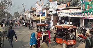
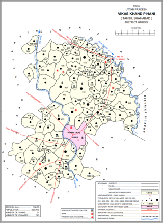
Pihani is a town and nagar palika parishad in Hardoi district of Uttar Pradesh, India. Historically, the city was a centre of sword production, leading to at least one British writer calling it "the Damascus of Oudh". Today, important industries in Pihani include jaggery and woven carpets. As of 2011, the town's population is 36,014, in 5,626 households. Pihani also serves as the headquarters of a community development block in Shahabad tehsil.
Rampur Baghelan is a town and a nagar panchayat in Satna district in the Indian state of Madhya Pradesh.
Rampur Bhawanipur is a census town in Barabanki district in the Indian state of Uttar Pradesh.

Salap is a census town in Domjur CD Block of Howrah Sadar subdivision in Howrah district in the Indian state of West Bengal. It is a part of Kolkata Urban Agglomeration.
Tanda is a city and a municipal board in Rampur district in the Indian state of Uttar Pradesh.
Suar is a city and a municipal board in Rampur district in the Indian state of Uttar Pradesh.
Shahabad is a City in Kalaburagi district in the Indian state of Karnataka. Shahabad Taluka is famous for Shahabad Stone (limestone). Shahabad is located at a very prime location in terms of rail (train) connectivity having direct trains to several metro cities. Road NH150 Gulbarga to Gooty will connect to NH7 Hyderabad to Bangalore. SH125 & SH149.

Shahabad is a town nearby Hardoi city and a municipal board in Hardoi district in the Indian state of Uttar Pradesh. At one point of time, it was counted among the few biggest cities of Oudh, but declined rapidly in the later years and reduced to a town. It is the site of the tomb of Diler Khan, a governor in the time of Shah Jahan and Aurangzeb.
Mirganj is a town and a nagar panchayat in Bareilly district in the Indian state of Uttar Pradesh.


