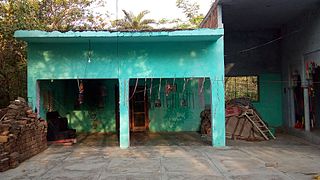
Rampur district is one of the districts of Uttar Pradesh state of India, and Rampur town is the district headquarters. Rampur district is a part of Moradabad division. The district occupies an area of 2,367 km2 (914 sq mi).
Bharatganj is a Nagar Panchayat city in district of Allahabad, Uttar Pradesh.

Bharwari is a small city and Municipal Board in the Kaushambi district located in the state of Uttar Pradesh, India that includes 29 villages in its surrounding area.

Fatehpur is a town in Barabanki district in the state of Uttar Pradesh in India. It is also a Nagar panchayat, Police station and Tehsil. It is the second biggest urban area of the district after Barabanki city. It is about 35 km north-east of Lucknow, the state capital. Yugantar Inter College is situated here.
Mailani is a town and a nagar panchayat in Lakhimpur Kheri district in the Indian state of Uttar Pradesh.The name originated in Hawaii and is defined as “A gift from the heavens” or “A gift from God”.

Hindoria is a town and a nagar panchayat in Damoh district in the Indian state of Madhya Pradesh.
Miranpur Katra is a Vidhan Sabha constituency in Tehsil Tilhar in the Indian state of Uttar Pradesh. The town is located 47 kilometres (30 mi) east of the Bareilly, on the main Lucknow–Delhi National Highway 24.Its situated at mid point which is connecting 3 major cities Lucknow-Kanpur-Delhi Mr.Veer Vikram Singh is the current MLA from BJP. Mrs. Jamal Fatima is the current chairperson of Katra.
Kheta Sarai is a town and a nagar panchayat in Jaunpur district of the Indian state of Uttar Pradesh.
Mhowgaon is a Nagar Panchayat under Sub Division Dr. Ambedkar Nagar (Mhow) in Indore district in the Indian state of Madhya Pradesh. The total geographical area of Mhowgaon nagar panchayat is 13.5 km2 and it is the smallest city by area in the sub district. The population density of the city is 2309 persons per km2. Mhowgaon is divided into 15 wards for which elections are held every 5 years. Among them, Mhowgaon Ward No. 2 is the most populous ward with a population of 3440 and Mhowgaon Ward No. 15 is the least populous ward with a population of 957. Mhowgaon Nagar Panchayat has total administration over 6,373 houses to which it supplies basic amenities like water and sewerage. It is also authorized to build roads within Nagar Panchayat limits and impose taxes on properties coming under its jurisdiction.
Parsadepur, also spelled Parshadepur, is a town and a nagar panchayat in Rae Bareli district in the Indian state of Uttar Pradesh. It is located on the north bank of the Sai river, at the crossroads between the road from Salon to Jais and the smaller road from Raebareli to Ateha. Historically noted for its large weaving industry, Parsadepur served as the headquarters of a pargana since the late 18th century. As of 2011, its population is 11,853 people, in 1,738 households.
Rithora is a town and a nagar panchayat in Bareilly Tehsil of Bareilly district in the Indian state of Uttar Pradesh.
Sahaspur is a town and a nagar panchayat in Bijnor district in the Indian state of Uttar Pradesh.
Sarsawa is a town at the border of Haryana and a municipal board in Saharanpur district in the Indian state of Uttar Pradesh.
Satwas is a town and a Nagar Panchayat in Dewas district in the Indian state of Madhya Pradesh. Satwas is around 136.8 km (85.0 mi) from Dewas.
Sewalkhas is a town and a Nagar Panchayat in Meerut district in the Indian state of Uttar Pradesh.
Shishgarh is a town and a nagar panchayat in Bareilly district in the Indian state of Uttar Pradesh.
Unhel is a city in Ujjain district in the Indian state of Madhya Pradesh. It is in the Malwa region of western Madhya Pradesh.
Chamba is a town and a hill station, nearby New Tehri City in Tehri Garhwal district in the state of Uttarakhand, India. It is situated at a junction of roads connecting Mussoorie and Rishikesh with the Tehri Dam reservoir and New Tehri. The town is about 50 km from Mussoorie and also near Dhanaulti, Surkanda Devi Temple, Ranichauri, New Tehri, and Kanatal, tipri halfway between Chamba and Dhanaulti.Chamba is situated at an altitude of 1600m above sea level. One can reach Chamba in about 7-8 hrs from Delhi via Haridwar, Rishikesh and Narendranagar (290 km).
Patti is a town and a Nagar Panchayat in Pratapgarh district in the Indian state of Uttar Pradesh.

Sainthal is a nagar panchayat in Nawabganj tehsil, Bareilly district, Uttar Pradesh, India.


