Tahoe Vista is a census-designated place located on the north shore of Lake Tahoe in Placer County, California. It is part of the Sacramento–Arden-Arcade–Roseville Metropolitan Statistical Area. The population was 1,433 at the 2010 census, down from 1,668 at the 2000 census.

West Yarmouth is a census-designated place (CDP) in the town of Yarmouth in Barnstable County, Massachusetts, United States. The population was 6,012 at the 2010 census.

Lionville is a census-designated place (CDP) in Uwchlan Township, Chester County, Pennsylvania, United States. The population was 6,189 at the 2010 census. Prior to 2010 the CDP was recorded as Lionville-Marchwood. "Marchwood", however, refers only to the housing development begun in the early 1960s that is located south of the 100-113 intersection.

Lawnton is an unincorporated area and census-designated place (CDP) in Swatara Township, Dauphin County, Pennsylvania, United States. The population was 3,813 at the 2010 census. It is part of the Harrisburg–Carlisle Metropolitan Statistical Area.

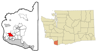
Lewisville is a census-designated place (CDP) in Clark County, Washington, United States. The population was 1,722 at the 2010 census.

Meadow Glade is a census-designated place (CDP) in Clark County, Washington, United States. The population was 2,541 at the 2010 census.

Salmon Creek is a census-designated place (CDP) in Clark County, Washington, United States. The population was 19,686 at the 2010 census, up from 16,767 at the 2000 census.

Longview Heights is a census-designated place (CDP) in Cowlitz County, Washington, United States. The population was 3,851 at the 2010 Census. The CDP is known locally as Columbia Heights.

Whidbey Island Station is a census-designated place (CDP) in Island County, Washington, United States. The population was 1,541 at the 2010 census. It is the primary location of Naval Air Station Whidbey Island. Prior to 2010 the CDP was known as Ault Field.

Prairie Ridge is a census-designated place (CDP) in Pierce County, Washington, United States. The population was 11,688 at the 2000 census.

Bay View is a census-designated place (CDP) in Skagit County, Washington, United States. The population was 696 at the 2010 census. It is included in the Mount Vernon–Anacortes, Washington Metropolitan Statistical Area.

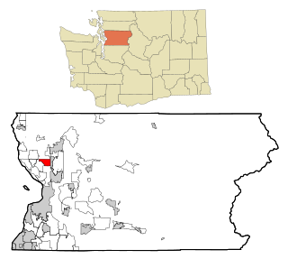
Cathan is a former census-designated place (CDP) in Snohomish County, Washington, United States. The population was 526 at the 2000 census. The CDP was discontinued at the 2010 census.

High Bridge is a census-designated place (CDP) in Snohomish County, Washington, United States. The population was 2,994 at the 2010 census. High Bridge includes the Echo Lake community and the former Echo Lake CDP, which was superseded by the larger High Bridge CDP in 2010.

Lake Ketchum is a census-designated place (CDP) in Snohomish County, Washington, United States. The population was 930 at the 2010 census.

Lochsloy is a census-designated place (CDP) in Snohomish County, Washington, United States. The population was 2,533 at the 2010 census.

Stimson Crossing is a former census-designated place (CDP) in Snohomish County, Washington, United States. The population was 773 at the 2000 census. The CDP was discontinued at the 2010 census.

Warm Beach is a census-designated place (CDP) in Snohomish County, Washington, United States. The population was 2,437 at the 2010 census.

Marietta-Alderwood is a census-designated place (CDP) in Whatcom County, Washington, United States. The population was 3,906 at the 2010 census. Parts of Marietta-Alderwood became part of Bellingham in 2019 through the process of annexation

Peaceful Valley is a census-designated place (CDP) in Whatcom County, Washington, United States, near Kendall. The population was 3,324 at the 2010 census.

Walpole is a small census-designated place (CDP) located within the much larger town of Walpole in Norfolk County, Massachusetts, United States. Walpole Town as it is called by the US Census Bureau, also includes a much larger population. The population of the Census Designated Place was 5,918 at the 2010 census.


