Sierra Pelona Mountains

Last updated
Sierra Pelona Ridge
Sierra Pelona Mountains
Sierra Pelona Mountains.JPG
View from Santa Clarita
Highest point
Peak Burnt Peak [1]
Elevation 5,791 ft (1,765 m)
Coordinates 34°36′56.5″N118°33′54.0″W / 34.615694°N 118.565000°W / 34.615694; -118.565000 Coordinates: 34°36′56.5″N118°33′54.0″W / 34.615694°N 118.565000°W / 34.615694; -118.565000
Geography
Relief map of California.png
Red triangle with thick white border.svg
Sierra Pelona Ridge
Location of Sierra Pelona Ridge in California [2]
Location Los Angeles
Parent range Transverse Ranges

The Sierra Pelona Ridge, [3] or the Sierra Pelona Mountains, is a ridge in the Transverse Ranges in Southern California. [4] Located in northwest Los Angeles County, the ridge is bordered on the north by the San Andreas fault and lies within and is surrounded by the Angeles National Forest.

Ridge A geological feature consisting of a chain of mountains or hills that form a continuous elevated crest for some distance

A ridge or a mountain ridge is a geographical feature consisting of a chain of mountains or hills that form a continuous elevated crest for some distance. The sides of the ridge slope away from narrow top on either side. The lines along the crest formed by the highest points, with the terrain dropping down on either sides, are called the ridgelines. Ridges are usually termed hills or mountains as well, depending on size.

Transverse Ranges mountain range in California

The Transverse Ranges are a group of mountain ranges of southern California, in the Pacific Coast Ranges physiographic region in North America. The Transverse Ranges begin at the southern end of the California Coast Ranges and lie within Santa Barbara, Ventura, Los Angeles, San Bernardino, Riverside and Kern counties. The Peninsular Ranges lie to the south. The name Transverse Ranges is due to their east–west orientation, making them transverse to the general northwest–southeast orientation of most of California's coastal mountains.

Southern California Place in California, United States

Southern California is a geographic and cultural region that generally comprises California's southernmost counties, and is the second most populous urban agglomeration in the United States. The region contains ten counties: Imperial, Los Angeles, Orange, Riverside, San Bernardino, San Diego, Santa Barbara, San Luis Obispo, Ventura, and Kern counties.

Contents

Geography

The Sierra Pelona Mountains lie northwest of the San Gabriel Mountains, which are divided by the wide Soledad Canyon formation. The mountains are flanked to the south by the Santa Clarita Valley and separated from the Antelope Valley to the north by the San Andreas Fault. Toward the southeast lie Vasquez Rocks, thrust up by the fault. The Tejon Pass separates the Sierra Pelonas, the San Emigdios and the Tehachapis near Gorman and Lebec.

San Gabriel Mountains mountain range in Los Angeles and San Bernardino Counties, California

The San Gabriel Mountains are a mountain range located in northern Los Angeles County and western San Bernardino County, California, United States. The mountain range is part of the Transverse Ranges and lies between the Los Angeles Basin and the Mojave Desert, with Interstate 5 to the west and Interstate 15 to the east. This range lies in, and is surrounded by, the Angeles National Forest, with the San Andreas Fault as the northern border of the range.

Soledad Canyon Canyon/valley in Southern California

Soledad Canyon is a long narrow canyon/valley located in Los Angeles County, California between the cities of Palmdale and Santa Clarita. It is a part of the Santa Clara River Valley, and extends from the top of Soledad Pass to the open plain of the Valley in Valencia. The upstream section of the Santa Clara River runs through it.

Santa Clarita Valley valley

The Santa Clarita Valley is part of the upper watershed of the Santa Clara River in Southern California. The valley was part of the 48,612-acre (19,673 ha) Rancho San Francisco Mexican land grant. Located in Los Angeles County, its main population center is the city of Santa Clarita which includes the communities of Canyon Country, Newhall, Saugus, and Valencia. Adjacent unincorporated communities include Castaic, Stevenson Ranch, Val Verde, and the new master planned community of Newhall Ranch.

Within the Sierra Pelonas lie the rural areas of Three Points, Lake Hughes, Elizabeth Lake and Green Valley, as well as Liebre Mountain, Burnt Peak, Sawmill Mountain, Grass Mountain and Mount McDill.

Three Points, California Unincorporated community in California, United States

Three Points is a scenic, sparsely populated unincorporated community at the northwestern edge of Los Angeles County, in the northern Sierra Pelona Mountains foothills and southwest of the Antelope Valley in Southern California.

Elizabeth Lake (Los Angeles County, California) lake of the United States of America

Elizabeth Lake is a natural lake that lies directly on the San Andreas Fault in the northern Sierra Pelona Mountains, in northwestern Los Angeles County, southern California.

Green Valley, Los Angeles County, California census-designated place in California, United States

Green Valley is a census-designated place in the Sierra Pelona Mountains, in Los Angeles County, California. It lies at an elevation of 2936 feet. The population was 1,027 at the 2010 census.

Climate

The climate of the mountains is a temperate Mediterranean. Summers are mostly dry but for the occasional thunderstorm, and winters comparatively cold and wet. Snowfall is infrequent due to the relatively low elevations of mountains within this ridge, with only the few tallest peaks regularly receiving snowfall during the winter.

Ecology

Mainly the ridge falls under the California montane chaparral and woodlands ecoregion, excepting the northeastern flank's gradual slope into the Antelope Valley near Palmdale. The mountains are primarily covered in short grasses, scrub oak trees, yucca, and other chaparral shrubs. The ridge is prone to wildfires in the summer and fall, especially when the Santa Ana winds blow in from the Antelope Valley.

California montane chaparral and woodlands

The California montane chaparral and woodlands is an ecoregion defined by the World Wildlife Fund, spanning 7,900 square miles (20,000 km2) of mountains in the Transverse Ranges, Peninsular Ranges, and Coast Ranges of southern and central California. The ecoregion is part of the larger California chaparral and woodlands ecoregion, and belongs to the Mediterranean forests, woodlands, and scrub biome.

Antelope Valley

Antelope Valley is located in northern Los Angeles County, California, and the southeast portion of Kern County, California, and constitutes the western tip of the Mojave Desert. It is situated between the Tehachapi and the San Gabriel Mountains. The valley was named for the pronghorns that roamed there until they were all but eliminated in the 1880s, mostly by hunting, or resettled in other areas. The principal cities in the Antelope Valley are Palmdale and Lancaster.

Palmdale, California City in California, United States

Palmdale is a city in northern Los Angeles County in the U.S. state of California. The city lies in the Antelope Valley region of Southern California. The San Gabriel Mountains separate Palmdale from the city of Los Angeles to the south.

Hydrology

Three major tributaries of the Santa Clara River and numerous minor watercourses and washes drain the ridge: Castaic Creek, San Francisquito Creek, and Bouquet Creek.

Santa Clara River (California) Least altered river in Southern California, 83 miles long

The Santa Clara River is 83 miles (134 km) long, and is one of the most dynamic river systems in Southern California. The river drains parts of four ranges in the Transverse Ranges System north and northwest of Los Angeles, then flows west onto the Oxnard Plain and into the Santa Barbara Channel of the Pacific Ocean.

Castaic Creek river in the United States of America

Castaic Creek is a 25.0-mile-long (40.2 km) stream in the Sierra Pelona Mountains, in northeastern Los Angeles County, California. It is a tributary of the Santa Clara River.

Bouquet Reservoir artificial lake in the Angeles National Forest of Los Angeles County, California

Bouquet Reservoir is an artificial lake in the Angeles National Forest of Los Angeles County, California about 15 miles (24 km) west from Palmdale.

Three sag ponds nestle within the narrow valley that divides the mountains from the Antelope Valley: Hughes Lake, Munz Lakes, and Elizabeth Lake.

Aerial view of the Sierra Pelona Mountains and San Andreas Fault Sierra Pelona Mountains2015.jpg
Aerial view of the Sierra Pelona Mountains and San Andreas Fault

Human history

Native American Habitation

The Native population of California in the Sierra Pelona and Santa Susana Mountains included the Tataviam and Serrano people. They traded with the Tongva and Chumash to the south and west, until the Spanish colonization of the Americas relocated them from their homelands.

18th & 19th Centuries

The San Francisquito Canyon, which runs north-south through the mountains, served as a major wagon route between the Antelope and San Fernando Valleys. This corridor summited at San Francisquito Pass and was part of the El Camino Viejo - an alternate land route to the El Camino Real for reaching northern Spanish and Mexican colonial Alta California - as well as the Butterfield Overland Mail route.

20th Century

The Ridge Route, a landmark two-lane highway that connected Los Angeles to the rest of California, was built along the western flank of the ridge and was completed in 1915. It was later bypassed by the Ridge Route Alternate (US 99) in 1930, itself superseded by Interstate 5 completed in 1971.

The rapid development of Southern California throughout the 20th century saw construction of the Los Angeles Aqueduct and five separate reservoirs to supply water to the region: Castaic Lake, Bouquet Reservoir, Drinkwater Reservoir, and Dry Canyon Reservoir and the St. Francis Reservoir, both now drained and destroyed.

Highest peaks

Burnt Peak is the tallest mountain in the Sierra Pelona Mountains. Burnt peak from santa clarita.JPG
Burnt Peak is the tallest mountain in the Sierra Pelona Mountains.

Adjacent landforms

Related Research Articles

California State Route 14 state highway in Los Angeles and Kern counties in California, United States

State Route 14 is a north–south state highway in the U.S. state of California that connects Los Angeles to the northern Mojave Desert. The southern portion of the highway is signed as the Antelope Valley Freeway. The route connects Interstate 5 on the border of the city of Santa Clarita to the north and the Los Angeles neighborhoods of Granada Hills and Sylmar to the south, with U.S. Route 395 (US 395) near Inyokern. Legislatively, the route extends south of I-5 to SR 1 in the Pacific Palisades area of Los Angeles; however, the portion south of the junction with I-5 has not been constructed. The southern part of the constructed route is a busy commuter freeway serving and connecting the cities of Santa Clarita, Palmdale, and Lancaster to the rest of the Greater Los Angeles area. The northern portion, from Vincent to US 395, is legislatively named the Aerospace Highway, as the highway serves Edwards Air Force Base, once one of the primary landing strips for NASA's Space Shuttle. This section is rural, following the line between the hot Mojave desert and the forming Sierra Nevada mountain range. Most of SR 14 is loosely paralleled by a main line of the Southern Pacific Railroad, used for the Antelope Valley Line of the Metrolink commuter rail system as well as a connection between Los Angeles and the Central Valley via Tehachapi Pass.

Tehachapi Mountains mountain range in Southern California

The Tehachapi Mountains are a mountain range in the Transverse Ranges system of California in the Western United States. The range extends for approximately 40 miles (64 km) in southern Kern County and northwestern Los Angeles County.

Tejon Pass mountain pass

The Tejon Pass, previously known as Portezuelo de Cortes, Portezuela de Castac, and Fort Tejon Pass, is a mountain pass between the southwest end of the Tehachapi Mountains and northeastern San Emigdio Mountains, linking Southern California north to the Central Valley. It has been traversed by major roads such as the El Camino Viejo, the Stockton – Los Angeles Road, the Ridge Route, U.S. Route 99, and now Interstate 5.

Ridge Route highway in California

The Ridge Route, officially the Castaic–Tejon Route, was a two-lane highway between Los Angeles County and Kern County, California. Opened in 1915 and paved with 20-foot-wide (6.1 m) concrete between 1917 and 1921, the road was the first paved highway directly linking the Los Angeles Basin with the San Joaquin Valley over the Tejon Pass and the rugged Sierra Pelona Mountains ridge south of Gorman. Much of the old road runs through the Angeles National Forest, and passes by many historical landmarks, including the National Forest Inn, Reservoir Summit, Kelly's Half Way Inn, Tumble Inn, and Sandberg's Summit Hotel. North of the forest, the Ridge Route passed through Deadman's Curve before ending at Grapevine.

Angeles National Forest

The Angeles National Forest (ANF) of the U.S. Forest Service is located in the San Gabriel Mountains and Sierra Pelona Mountains, primarily within Los Angeles County in southern California. The ANF manages a majority of the San Gabriel Mountains National Monument.

Pyramid Lake (Los Angeles County, California) lake in California

Pyramid Lake is a reservoir formed by Pyramid Dam on Piru Creek in the eastern San Emigdio Mountains, near Castaic, Southern California. It is a part of the West Branch California Aqueduct, which is a part of the California State Water Project. Its water is fed by the system after being pumped up from the San Joaquin Valley and through the Tehachapi Mountains.

San Francisquito Canyon

San Francisquito Canyon is a canyon created through erosion of the Sierra Pelona Mountains by the San Francisquito Creek, in Los Angeles County, Southern California.

Lake Hughes, California Unincorporated community in California, United States

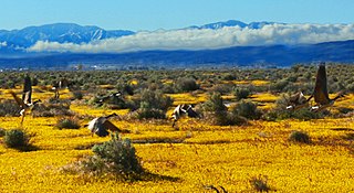
Lake Hughes is an unincorporated community in the foothills of the Sierra Pelona Mountains, northwest of Palmdale and north of the Santa Clarita Valley, in the Angeles National Forest. It is on the sag pond waters of Lake Hughes and Elizabeth Lake. The community is rural in character, with a population of 649 in 2010, but also has a strong recreational element centered on the three lakes in the vicinity. The community of Elizabeth Lake is located just east of Lake Hughes, sharing the same ZIP code.

San Emigdio Mountains mountain range in Southern California

The San Emigdio Mountains are a part of the Transverse Ranges in Southern California, extending from Interstate 5 at Lebec and Gorman on the east to Highway 33–166 on the west. They link the Tehachapis and Temblor Range and form the southern wall of the San Joaquin Valley. The range is named after Emygdius, an early Christian martyr.

Topatopa Mountains mountain range in Ventura County, California

The Topatopa Mountains are a mountain range in Ventura County, California, north of Ojai, Santa Paula, and Fillmore. They are part of the Transverse Ranges of Southern California.

Burnt Peak (California) mountain in United States of America

Burnt Peak is the highest peak of the Sierra Pelona Mountains, located in northwestern Los Angeles County, Southern California.

San Gabriel Fault

The San Gabriel Fault is a geological fault in Los Angeles County, California, running about 87 miles (140 km) southeastward from the Ridge Basin in the Sierra Pelona-San Emigdio Mountains juncture area to the western San Gabriel Mountains that forms their southwestern face near Sunland and the northeastern San Fernando Valley, and then on the south flank to the southeastern part of the San Gabriel range.

San Francisquito Creek (Santa Clara River tributary)

San Francisquito Creek, in Los Angeles County, is a tributary stream of the Santa Clara River. It drains the south facing slopes of the Sierra Pelona Mountains of the San Gabriel Mountains within the Transverse Range of California, United States.

San Francisquito Pass

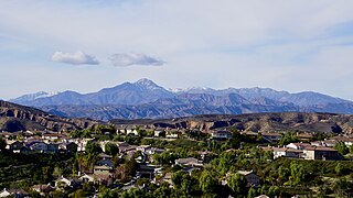
San Francisquito Pass is a mountain pass in the Sierra Pelona Mountains, located northeast of Green Valley and Santa Clarita, in northern Los Angeles County, California.

Dry Canyon Reservoir

Dry Canyon Reservoir is a small reservoir formed by an embankment dam on Dry Canyon Creek in the Sierra Pelona Mountains of northern Los Angeles County, California, just over 6 miles (9.7 km) north the city of Santa Clarita. It was designed a part of the Los Angeles Aqueduct system.

References

  1. "Burnt Peak". Peakbagger.com.
  2. "Sierra Pelona Ridge". Geographic Names Information System . United States Geological Survey . Retrieved 2015-12-16.
  3. , United States Geological Survey GNIS Detail Sierra Pelona, accessed 6/10/11
  4. , USGS GNIS Detail San Gabriel Mountains.

See also