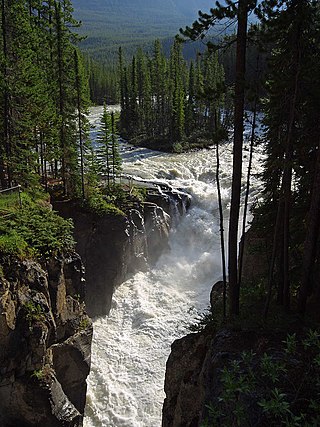
The Sunwapta River is a major tributary of the Athabasca River in Jasper National Park in Alberta, Canada.

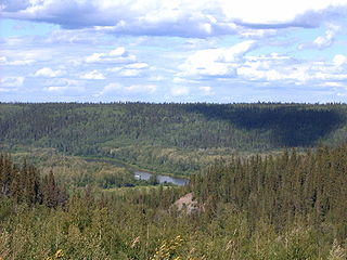
Clearwater is a river of southern Alberta, Canada. Situated entirely in the Canadian Rockies and the Rocky Mountain foothills of Alberta, it is a glacier fed upper reach tributary of the North Saskatchewan River. The upper reach of the Clearwater has become popular for equestrian travelers due to the natural setting along the river.
The Clearwater River is located in the Canadian provinces of Saskatchewan and Alberta. It rises in the northern forest region of north-western Saskatchewan and joins the Athabasca River in north-eastern Alberta. It was part of an important trade route during the fur trade era and has been designated as a Canadian Heritage River.
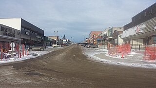
Rocky Mountain House is a town in west-central Alberta, Canada. It is approximately 77 km (48 mi) west of Red Deer at the confluence of the Clearwater and North Saskatchewan Rivers, and at the crossroads of Highway 22 and Highway 11. The surrounding Clearwater County's administration office is located in Rocky Mountain House.

Clearwater County is a municipal district in west central Alberta, Canada in Division No. 9. Its northwest boundary is the Brazeau River. The municipal office is located in the Town of Rocky Mountain House. The county has a land area of 18,691.65 km2 and comprises close to 99% of Census Division No. 9's land area of 18,921.38 km2. Although the territory excluded is rather small in geographical area, it comprises the major population centre of Rocky Mountain House, which has one-third of Division No. 9's population, in addition to the communities of Caroline, Burnstick Lake and three Indian reserves. The county's 2016 census population was 11,947.

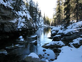
The Ghost River Wilderness Area is a provincially designated wilderness area in the Canadian Rockies of Alberta protecting the headwaters of the Ghost River. It was established in 1967 and it, as one of the three wilderness areas of Alberta, has the strictest form of government protection available in Canada. All development is forbidden, and only travel by foot is permitted. Hunting and fishing are not allowed. The other two wilderness areas are White Goat Wilderness Area and Siffleur Wilderness Area and together the three areas total 1,009.8882 square kilometres.

The Bighorn River is a short river originating in the Alberta foothills, and is a tributary of the North Saskatchewan River. The river, as well as the nearby Bighorn Range and Bighorn Dam are named for the Bighorn sheep which dominate the area. The name first appeared in 1865.

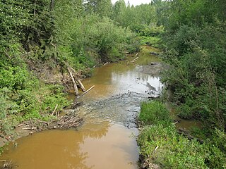
Chip Lake is a large lake in west-central Alberta. The Lobstick River flows through the lake. It in turn is a tributary of the Pembina River, which eventually flows into the Athabasca River.
The Maligne River is a medium-sized river in the Canadian Rockies. It runs through parts of Jasper National Park in Alberta, Canada. The Maligne is a major tributary of the Athabasca River. The river takes from the French word for malignant or wicked. It is theorised that a Belgian priest voyageur created this name in reference to the current of the river near its confluence with the Athabasca River.
The Assineau River is a short river forming in central Alberta. The Assineau flows into Lesser Slave Lake, which flows out through the Lesser Slave River, a major tributary of the Athabasca River. The name for the river was in use by 1904. It is suggested that Assineau is a version of the Cree word for nobody.

The Driftpile River is a medium-length river forming in central Alberta. The Drifpile flows into Lesser Slave Lake, which flows out through the Lesser Slave River, a major tributary of the Athabasca River. The Geological Survey of Canada was using the name Driftpile by 1892. The river was named because of the large amount of driftwood that collected at the river's mouth.
The Marten River is a short river in central Alberta. The Marten is one of the major inflows of Lesser Slave Lake, which drains through the Lesser Slave River, a major tributary of the Athabasca River. Significant debate exists regarding the origin of the river's name. One theory suggests the river, as well as nearby Marten Mountain were named for a local trapper. The other theory suggests the river and mountain were named for martens, a weasel that inhabits the region. The Geological Survey of Canada used the name Martin River on an 1892 map.
The Jackpine River is an early tributary of the Smoky River. It forms in the Canadian Rockies, within Willmore Wilderness Park, in the province of Alberta, north of Jasper National Park. The river collects the runoff from Resthaven Mountain, Barricade Mountain, Jackpine Mountain, Mount Holmes, Perseverance Mountain, and Draco Peak.

The Snake Indian River is a large tributary of the Athabasca River, exiting entirely within Jasper National Park. The Snake Indian forms at Snake Indian Pass, south of Monte Christo Mountain and Snake Indian Mountain, north of Calumet Peak. The river travels in a general northwest direction before turning sharply south. The river plummets over the massive Snake Indian Falls before joining the Athabasca River downstream of Jasper Lake, near the east gate of Jasper National Park.

The Snaring River is a medium-sized river in the Canadian Rockies. It runs through parts of Jasper National Park in Alberta, Canada. The Snaring River is a significant tributary of the Athabasca River. The Snaring is named after a former local tribe of first nations people who lived in dugouts and trapped animals with snares.

The White Goat Wilderness Area is a provincially designated wilderness area in the Canadian Rockies of Alberta. It was established in 1961 and it, as one of the three wilderness areas of Alberta, has the strictest form of government protection available in Canada. All development is forbidden and only travel by foot is permitted. Hunting and fishing are not allowed. The other two wilderness areas are Ghost River Wilderness Area and Siffleur Wilderness Area and together the three areas total 249,548.80 acres (100,988.82 ha).

The Siffleur Wilderness Area is a provincially designated wilderness area in the Canadian Rockies of Alberta. It was established in 1961 and it, as one of the three wilderness areas of Alberta, has the strictest form of government protection available in Canada. All development is forbidden and only travel by foot is permitted. Hunting and fishing are not allowed. The other two wilderness areas are White Goat Wilderness Area and Ghost River Wilderness Area and together the three areas total 249,548.80 acres (100,988.82 ha).

Siffleur Mountain is a 3,129-metre (10,266 ft) mountain summit located in the North Saskatchewan River valley of Alberta, Canada. Siffleur Mountain is situated in the Siffleur Wilderness Area of the Canadian Rockies. Its nearest higher peak is Mount Loudon, 3 km (1.9 mi) to the southwest. The mountain can be seen from Highway 11, the David Thompson Highway. Precipitation runoff from Siffleur Mountain flows north via Loudon Creek and Siffleur River.
Woody Lake is a lake in the Canadian province of Saskatchewan. It is located in the east-central part of the province in the Porcupine Hills and Porcupine Provincial Forest. The entire lake is in the Woody River Block of Porcupine Hills Provincial Park. Highway 980 provides access to the lake.
Clarence-Steepbank Lakes Provincial Park is a remote wilderness park in the Canadian province of Saskatchewan. It is located in the boreal forest ecozone east of Prince Albert National Park and Montreal Lake, west of the Cub Hills and Narrow Hills Provincial Park, south of Nipekamew and East Trout Lakes, and north of Whiteswan Lakes and Candle Lake Provincial Park. The city of Prince Albert is approximately 150 kilometres (93 mi) to the south and access to the park is from Highway 927.


