Spring Lake | |
|---|---|
| Coordinates: 47°38′33″N93°52′05″W / 47.64250°N 93.86806°W Coordinates: 47°38′33″N93°52′05″W / 47.64250°N 93.86806°W | |
| Country | United States |
| State | Minnesota |
| County | Itasca |
| Township | Lake Jessie Township |
| Elevation | 1,352 ft (412 m) |
| Population | |
| • Total | 50 |
| Time zone | UTC-6 (Central (CST)) |
| • Summer (DST) | UTC-5 (CDT) |
| ZIP code | 56680 |
| Area code(s) | 218 |
| GNIS feature ID | 658416 [1] |
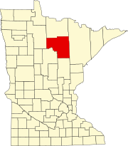
Spring Lake is an unincorporated community in Lake Jessie Township, Itasca County, Minnesota, United States; located within the Chippewa National Forest.

In law, an unincorporated area is a region of land that is not governed by a local municipal corporation; similarly an unincorporated community is a settlement that is not governed by its own local municipal corporation, but rather is administered as part of larger administrative divisions, such as a township, parish, borough, county, city, canton, state, province or country. Occasionally, municipalities dissolve or disincorporate, which may happen if they become fiscally insolvent, and services become the responsibility of a higher administration. Widespread unincorporated communities and areas are a distinguishing feature of the United States and Canada. In most other countries of the world, there are either no unincorporated areas at all, or these are very rare; typically remote, outlying, sparsely populated or uninhabited areas.

Lake Jessie Township is a township in Itasca County, Minnesota, United States. The population was 303 at the 2010 census.

Itasca County is a county located in the State of Minnesota. As of the 2010 United States Census, the population was 45,058. Its county seat is Grand Rapids. The county is named after Lake Itasca, which is in turn a shortened version of the Latin words veritas caput, meaning 'truth' and 'head', a reference to the source of the Mississippi River. Portions of the Bois Forte and Leech Lake Indian reservations are in the county.
The community is located 6 miles west of Talmoon; at the junction of Itasca County Roads 4 and 29.

A junction, when discussed in the context of transport, is a location where traffic can change between different routes, directions, or sometimes modes, of travel.
Nearby places include Bowstring, Talmoon, and Marcell. Spring Lake is located 26 miles north of Deer River; and 12 miles east of Squaw Lake. Spring Lake is 10 miles southeast of Wirt.

Bowstring is an unincorporated community in Bowstring Township, Itasca County, Minnesota, United States.

Talmoon is an unincorporated community in Itasca County, Minnesota, United States.

Marcell is an unincorporated community in Marcell Township, Itasca County, Minnesota, United States.
Spring Lake has a post office with ZIP code 56680. [2]
A post office is a public department that provides a customer service to the public and handles their mail needs. Post offices offer mail-related services such as acceptance of letters and parcels; provision of post office boxes; and sale of postage stamps, packaging, and stationery. In addition, many post offices offer additional services: providing and accepting government forms, processing government services and fees, and banking services. The chief administrator of a post office is called a postmaster.


