
Monaro Highway is a 285-kilometre-long (177 mi) highway in Victoria, New South Wales, and the Australian Capital Territory, in Australia, linking Cann River in Victoria to Canberra in the Australian Capital Territory (ACT) via the Monaro region. From its southern terminus, it follows the nearby Cann River upstream towards the New South Wales border through heavily forested terrain. Within New South Wales (NSW), it makes its way through further forest before reaching the pastures typical of the Monaro. There are multiple towns and villages along the highway, including Bombala, Nimmitabel and Cooma. The terrain within the Monaro is largely hilly, and there are numerous crossings. The road also parallels the former Bombala railway line in several locations. Within the ACT, the road becomes a high volume roadway and serves the southern suburbs of Canberra. The highway has more recently had a grade-separated dual carriageway extension constructed within Canberra, as part of the Eastern Parkway construction project. It is designated part of route M23, and route A23 within Canberra, and route B23 within Victoria and New South Wales, with a concurrency where it also carries route B72 between the two sections of Snowy Mountains Highway.

Cooma is a town in the south of New South Wales, Australia. It is located 114 kilometres (71 mi) south of the national capital, Canberra, via the Monaro Highway. It is also on the Snowy Mountains Highway, connecting Bega with the Riverina.

Snowy Mountains Highway is a 333-kilometre-long (207 mi) state highway located in New South Wales, Australia. Its two sections connect the New South Wales South Coast to the Monaro region, and the Monaro to the South Western Slopes via the Snowy Mountains. The higher altitude regions of this road are subject to snow over the winter months, and the road also provides access to many parts of the Snowy Mountains Scheme. The highway bears the B72 shield along its entire length.

Bombala is a town in the Monaro region of far southern New South Wales, Australia, in Snowy Monaro Regional Council. It is approximately 485 kilometres (301 mi) south-southwest of the state capital, Sydney, and 80 kilometres (50 mi) south of the town of Cooma. The name derives from an Aboriginal word meaning "Meeting of the waters". The town lies on the banks of the Bombala River. At the 2021 census, Bombala had a population of 1,892.

Monaro, once frequently spelt "Manaro", or in early years of settlement "Maneroo" is a region in the south of New South Wales, Australia. A small area of Victoria near Snowy River National Park is geographically part of the Monaro. While the Australian Capital Territory is not considered part of the region, some towns in the Monaro have close links with Canberra.
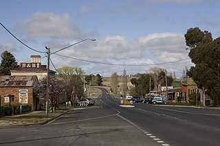
Nimmitabel is a small town in the Monaro region in southeast New South Wales, Australia, in the Snowy Monaro Regional Council local government area. At the 2021 census, Nimmitabel had a population of 324.

Jindabyne is a town in south-east New South Wales, Australia that overlooks Lake Jindabyne near the Snowy Mountains, in Snowy Monaro Regional Council. It is a popular holiday destination year round, especially in winter. This is due to its proximity to major ski resort developments within the Kosciuszko National Park, including Thredbo, Perisher and Charlotte Pass.

Cooma-Monaro Shire was a local government area located in the Monaro region of southern New South Wales, Australia. The area was named after the former Cooma Municipality and the former Monaro Shire, that were amalgamated to create it. The Municipality of Cooma was established in 1879, and the Monaro Shire was one of several shires established in 1906. The Monaro Shire and Cooma Municipal Council amalgamated in 1981. On 11 February 2004, Cooma-Monaro Shire absorbed a small part of the former Yarrowlumla Shire, near Michelago.

The Snowy River Shire was a local government area in the Australian Alps region of New South Wales, Australia from 1939 until May 2016. It was named after the Snowy River that runs through it. Prior to 1936, it had been named as Dalgety Shire since establishment in 1906.

Smiggin Holes is a village in the ski resort area of Snowy Mountains of New South Wales, Australia, in the Snowy Monaro Regional Council. It is primarily a winter-only resort village. It is within the Kosciuszko National Park, and is administered by New South Wales Department of Environment and Climate Change. Access to the village is via road. There is an access fee payable to the national park, and motor vehicles are not permitted to stay overnight in the winter months.

The Bombala Shire was a local government area in the Monaro region of south-eastern New South Wales, Australia. The Shire includes the town of Bombala, the villages of Delegate, Cathcart, Bibbenluke and the localities of Ando, Bungarby, Craigie, Mila, Rockton and Creewah. Bombala Shire was formed on 1 October 1977 by the amalgamation of the Municipality of Bombala and Bibbenluke Shire.
Springfield, Australia, may refer to the following places:

Shannons Flat is a locality in the Monaro region of New South Wales, Australia. The town is in the Snowy Monaro Regional Council local government area, sandwiched between the southern border of the Namadgi National Park in the Australian Capital Territory and the Murrumbidgee River. Shannons Flat also adjoins the NSW localities of Yaouk, Bolaro, Murrumbucca, Bredbo and Billilingra. It is about 308 kilometres (191 mi) south west of the state capital, Sydney, and 70 kilometres (40 mi) from the Australian national capital of Canberra. It is just over 40 kilometres (25 mi) north west of the regional centre, Cooma.

The Snowy Monaro Regional Council is a local government area located in the Snowy Mountains and Monaro regions of New South Wales, Australia. The council was formed on 12 May 2016 through a forced merger of the Bombala, Cooma-Monaro and Snowy River shires.

Bunyan is a locality in the Snowy Monaro Region, New South Wales, Australia. It lies on the eastern side of the Murrumbidgee River and on both sides of the Monaro Highway about 110 km south of Canberra and about 10 km north of Cooma. At the 2016 census, it had a population of 152.

Tinderry is a locality in the Snowy Monaro Region, New South Wales, Australia. It lies to the east of Michelago and South West of Captains Flat. At the 2016 census, it had a population of 66. The western part of the locality lies on the Tinderry Range, which includes Tinderry Peak and Tinderry Twin Peak. A large part of the mountainous terrain forms Tinderry Nature Reserve. Further east the terrain is more open and includes grazing country and the small settlement of Little Tinderry. A public school was located at Little Tinderry from 1899 to 1913, generally described as "half-time", but "provisional" in 1900 and early 1901.

Tantangara is a locality in the Snowy Monaro Regional Council region of New South Wales, Australia. At the 2016 census, Tantangara had a population of zero. It is the location of the Tantangara Dam on the Murrumbidgee River, part of the Snowy Mountains Scheme.
Eucumbene is a locality in the Snowy Monaro Regional Council in New South Wales, Australia. In the 2016 census, Eucumbene had a population of 12 people.
Rhine Falls is a locality within the Snowy Monaro Regional Council, halfway between Wambrook and Dry Plain at an altitude of 1,320 metres (4,330 ft); ranking as one of the highest-elevated localities in Australia. Snow occurs frequently from May through to September, and can occur at any time of the year. At the 2016 census, it had a population of 42, the same as neighbouring Dry Plain.

Coolringdon is a locality in the Local Government Area of the Snowy Monaro Regional Council, in the Monaro region of New South Wales, Australia. It lies in the foothills of the Snowy Mountains, west of Cooma. At the 2021 census, there were 73 people usually residing in Coolringdon. The Cooma-Snowy Mountains Airport is located within the locality. Coolringdon is notable as being one of the proposed sites for Australia's national capital, prior to the selection of Canberra.
