Mongarlowe is a village in the Southern Tablelands of New South Wales, Australia in Queanbeyan-Palerang Regional Council. It was formerly known as Little River.

Aberdare is a suburb of Cessnock, a large town based on coal mining in the Lower Hunter Region, New South Wales, Australia. Aberdare is a small suburb just 15 minutes’ from beautiful wine country, 45 minutes to Newcastle and two hours to Sydney. George Brown found coal in the area in 1800's.Coal mining created the land boom of 1903-23 and by 1926 Cessnock had a population of 12,000 within a one mile radius

Brayton is a locality in the Southern Tablelands of New South Wales, Australia, in the Upper Lachlan Shire. At the 2016 census, it had a population of 173.

Abermain is a town 8 km ENE of Cessnock and 3 km west of Weston, in New South Wales, Australia. Abermain is adjacent to Werakata National Park.

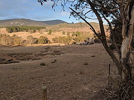
Majors Creek is a small village in the Southern Tablelands region of New South Wales, Australia. The nearest major town is Braidwood, 16 km (9.9 mi) to the north. At the 2016 census, the population of Majors Creek was 249.

Jerangle is a locality in New South Wales, Australia. The locality is in the Snowy Monaro Regional Council local government area, 366 kilometres (227 mi) south of the state capital, Sydney and 112 kilometres (70 mi) south east of the national capital, Canberra. At the 2016 census, Jerangle had a population of 96.

Hoskinstown is a locality in Queanbeyan-Palerang Regional Council, New South Wales, Australia. The town is 38 km southeast of Canberra the Capital city of Australia, and 299 km southwest of Sydney. At the 2016 census, it had a population of 189.

Bywong is a rural residential area in the Southern Tablelands of New South Wales, Australia in the Queanbeyan-Palerang Regional Council LGA. It is approximately 24 kilometres north-east of the Australian city of Canberra on the Federal Highway. It is also traversed by Macs Reef Road, Shingle Hill Way and Bungendore Road, the last two roads connecting Gundaroo and Bungendore. Its name is derived from an aboriginal word for "big hill". At the 2016 census, it had a population of 1,322. It had a public school from 1895 to 1906. It has a community association called Bywong Community Inc. http://www.bywongcommunity.org.au Its local Pony Club is called Gearys Gap Pony Club, which meets at the Les Reardon Reserve, Bywong. https://www.gearysgapponyclub.org.au

Carrick is a locality in the Goulburn Mulwaree Council, New South Wales, Australia. It is located on the northern side of the Hume Highway to the east of Goulburn. At the 2016 census, it had a population of 136. Carrick railway station was a station on the Main Southern railway line from 1869 to 1975. It had a public school from 1873 to 1909, operating as a "half-time" school from 1887.
Rose Valley is a locality in the Municipality of Kiama, in the Illawarra region of New South Wales, Australia. It lies west of the Princes Highway to the west of Gerringong about 130 km south of Sydney. At the 2016 census, it had a population of 76. It had a public school from 1868 to 1877 and 1884 to 1904.

Jingera is a locality in the Snowy Monaro Region, New South Wales, Australia. It lies south of Captains Flat and northeast of Bredbo. At the 2016 census, it had a population of 39. It had a public school from 1889 to 1911 and from 1914 to 1941, often operating "half-time".
Mulloon is a locality in the Queanbeyan-Palerang Region, Southern Tablelands, New South Wales, Australia.

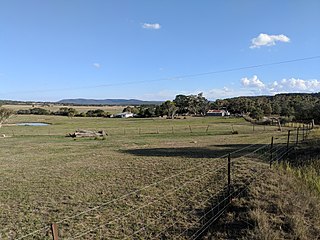
Manar is a locality in the Queanbeyan-Palerang Region, Southern Tablelands, New South Wales, Australia. It lies on both sides of the Kings Highway between Bungendore and Braidwood at the intersection with the Braidwood–Goulburn road. At the 2016 census, it had a population of 118.

Kiora is a locality in the Eurobodalla Shire, New South Wales, Australia. It is located about 11 km west of Moruya on the road to Araluen at the point where the Deua River becomes estuarine and changes its name to the Moruya River. At the 2016 census, it had a population of 54. Its name derives from "Kiora House", which belonged to John Hawdon. It had a public school from 1868 to 1928.

Richlands is a locality in the Upper Lachlan Shire, New South Wales, Australia. It lies about 5 km north of Taralga and about 95 km south of Oberon on the road from Goulburn to Oberon and Bathurst. At the 2016 census, it had a population of 34. It had a school from June 1868 to August 1879, which was designated as a "provisional school" for eight months and then as a "half-time" school. It also had a school from 1884 to 1915 and from 1918 to 1953, classified most commonly as a "provisional school", but for periods as a "house to house", "half-time" or "public" school. It was called Abercrombie school until 1894.

Curraweela is a locality in the Upper Lachlan Shire, New South Wales, Australia. It lies about 20 km (12 mi) north of Taralga and about 80 km (50 mi) south Oberon on the road from Goulburn to Oberon and Bathurst. At the 2016 census, it had a population of 47. It had a school from 1878 to 1900, which was variously designated as a "half-time", "provisional" and "house to house" school.
Booral is a locality in the Mid-Coast Council of New South Wales, Australia. It had a population of 407 as of the 2016 census.

Yerriyong is a locality in the City of Shoalhaven in New South Wales, Australia. It lies about 17 km to the southwest of Nowra on the road to Nerriga and Canberra. It is largely made up of eucalyptus forest. At the 2016 census, it had a population of 25.
Far Meadow is a locality in the City of Shoalhaven in New South Wales, Australia. It lies to the south of Coolangatta Road to the southeast of Berry. At the 2016 census, it had a population of 215.
Bolong is a locality in the City of Shoalhaven in New South Wales, Australia. It lies to the north of the Shoalhaven River and to the west of Broughton Creek. It is northeast of Nowra. At the 2016 census, it had a population of 104.