
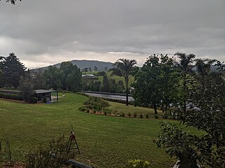
Binda is a village in the Southern Tablelands region of New South Wales, Australia in Upper Lachlan Shire. At the 2016 census, Binda had a population of 280 people.

Brothers Thomas and John Clarke were Australian bushrangers from the Braidwood district of New South Wales. They committed a series of high-profile crimes which led to the enacting of the Felons' Apprehension Act (1866), a law that introduced the concept of outlawry in the colony and authorised citizens to kill bushrangers on sight.

Sutton, meaning 'South Settlement' in Saxon, is a small village in the Southern Tablelands of New South Wales, Australia in Yass Valley Shire. It is situated on the west bank of the Yass River, about 17 kilometres south of Gundaroo, near the Federal Highway, not far from Canberra. It has a primary school, an Anglican church, a general store, an estate agent, a rural supply store and a baker. Sutton has its own volunteer Bush Fire Brigade located in the village.

Araluen is a small town near Braidwood in the Southern Tablelands of New South Wales, Australia, in Queanbeyan-Palerang Regional Council. It lies in the valley of Araluen Creek, that joins the Deua River at roughly the midpoint in its course. At the 2016 census, Araluen had a population of 168 people.

Aberdare is a suburb of Cessnock, a large town based on coal mining in the Lower Hunter Region, New South Wales, Australia. Aberdare is a small suburb just 15 minutes’ from beautiful wine country, 45 minutes to Newcastle and two hours to Sydney. George Brown found coal in the area in 1800's.Coal mining created the land boom of 1903-23 and by 1926 Cessnock had a population of 12,000 within a one mile radius

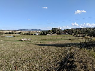
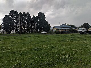
Brayton is a locality in the Southern Tablelands of New South Wales, Australia, in the Upper Lachlan Shire. At the 2016 census, it had a population of 173.

Abermain is a town 8 km ENE of Cessnock and 3 km west of Weston, in New South Wales, Australia. Abermain is adjacent to Werakata National Park.

Jerangle is a locality in New South Wales, Australia. The locality is in the Snowy Monaro Regional Council local government area, 366 kilometres (227 mi) south of the state capital, Sydney and 112 kilometres (70 mi) south east of the national capital, Canberra. At the 2016 census, Jerangle had a population of 96.

Hoskinstown is a locality in Queanbeyan-Palerang Regional Council, New South Wales, Australia. The town is 38 km southeast of Canberra the Capital city of Australia, and 299 km southwest of Sydney. At the 2016 census, it had a population of 189.

Carrick is a locality in the Goulburn Mulwaree Council, New South Wales, Australia. It is located on the northern side of the Hume Highway to the east of Goulburn. At the 2016 census, it had a population of 136. Carrick railway station was a station on the Main Southern railway line from 1869 to 1975. It had a public school from 1873 to 1909, operating as a "half-time" school from 1887.
Rose Valley is a locality in the Municipality of Kiama, in the Illawarra region of New South Wales, Australia. It lies west of the Princes Highway to the west of Gerringong about 130 km south of Sydney. At the 2016 census, it had a population of 76. It had a public school from 1868 to 1877 and 1884 to 1904.

Anembo is a locality in the Snowy Monaro Region, New South Wales, Australia. It lies south of Captains Flat and northeast of Bredbo. At the 2016 census, it had a population of 66. It had a public school from 1868 to 1942, often operating "half-time" or "house to house".
Mulloon is a locality in the Queanbeyan-Palerang Region, Southern Tablelands, New South Wales, Australia.

Ballalaba is a locality in the Queanbeyan–Palerang Regional Council, New South Wales, Australia. It is located about 30 km southwest of Braidwood on the road to Cooma and on the Shoalhaven River. At the 2016 census, it had a population of 22. It had a "half-time" school from 1867 to 1870; from 1879 to 1940, it operated either as a "provisional" or a "half-time" school".
Farringdon is a locality in the Queanbeyan–Palerang Regional Council, New South Wales, Australia. It is located about 17 km southwest of Braidwood on the western bank of the Shoalhaven River. At the 2016 census, it had a population of 14. It had a "half-time" school from 1867 to 1894.
Marlowe is a locality in the Queanbeyan–Palerang Regional Council, New South Wales, Australia. It is located on the south side of the Mongarlowe River on the road from Braidwood to Nowra about 24 km north of Braidwood and 96 km southwest of Nowra. At the 2016 census, The Australian Bureau of Statistics recorded it as having a population of nil, although it does have at least one house. It consists mainly of forest and grazing country. Marlowe includes the "rural place" of Charleyong in a loop of the Mongarlowe River at 35°14′57″S149°55′02″E.
Tomboye is a locality in the Queanbeyan–Palerang Regional Council, New South Wales, Australia. It is located on the north side of the Mongarlowe River on the road from Braidwood to Nowra about 28 km north of Braidwood and 93 km southwest of Nowra. At the 2016 census, it had a population of 40. It consists mainly of forest and grazing country.

Tinderry is a locality in the Snowy Monaro Region, New South Wales, Australia. It lies to the east of Michelago and South West of Captains Flat. At the 2016 census, it had a population of 66. The western part of the locality lies on the Tinderry Range, which includes Tinderry Peak and Tinderry Twin Peak. A large part of the mountainous terrain forms Tinderry Nature Reserve. Further east the terrain is more open and includes grazing country and the small settlement of Little Tinderry. A public school was located at Little Tinderry from 1899 to 1913, generally described as "half-time", but "provisional" in 1900 and early 1901.
Far Meadow is a locality in the City of Shoalhaven in New South Wales, Australia. It lies to the south of Coolangatta Road to the southeast of Berry. At the 2016 census, it had a population of 215.
Bolong is a locality in the City of Shoalhaven in New South Wales, Australia. It lies to the north of the Shoalhaven River and to the west of Broughton Creek. It is northeast of Nowra. At the 2016 census, it had a population of 104.

