
The Molonglo River is a perennial river that is part of the Murrumbidgee catchment within the Murray–Darling basin. It is located in the Monaro and Capital Country regions of New South Wales and the Australian Capital Territory, in Australia.

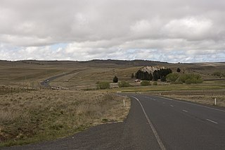
Monaro Highway is a 285-kilometre-long (177 mi) highway in Victoria, New South Wales, and the Australian Capital Territory, in Australia, linking Cann River in Victoria to Canberra in the Australian Capital Territory (ACT) via the Monaro region. From its southern terminus, it follows the nearby Cann River upstream towards the New South Wales border through heavily forested terrain. Within New South Wales (NSW), it makes its way through further forest before reaching the pastures typical of the Monaro. There are multiple towns and villages along the highway, including Bombala, Nimmitabel, and Cooma. The terrain within the Monaro is largely hilly, and there are numerous crossings. The road also parallels the former Bombala railway line in several locations. Within the ACT, the road becomes a high volume roadway and serves the southern suburbs of Canberra. The highway has more recently had a grade-separated dual carriageway extension constructed within Canberra, as part of the Eastern Parkway construction project. It is designated part of route M23, and route A23 within Canberra, and route B23 within Victoria and New South Wales, with a concurrency where it also carries route B72 between the two sections of Snowy Mountains Highway.

Bombala is a town in the Monaro region of south-eastern New South Wales, Australia, in Snowy Monaro Regional Council. It is approximately 485 kilometres (301 mi) south of the state capital, Sydney, and 80 kilometres (50 mi) south of the town of Cooma. The name derives from an Aboriginal word meaning "Meeting of the waters". The town lies on the banks of the Bombala River. At the 2021 census, Bombala had a population of 1,892.

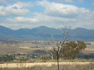
Monaro, once frequently spelt "Manaro", or in early years of settlement "Maneroo" is a region in the south of New South Wales, Australia. A small area of Victoria near Snowy River National Park is geographically part of the Monaro. While the Australian Capital Territory is not considered part of the region, some towns in the Monaro have close links with Canberra.
Michelago is a village in the Monaro region of New South Wales, Australia. The village is in the Snowy Monaro Regional Council local government area, 54 kilometres (34 mi) south of Canberra on the Monaro Highway. It was founded in the 1820s, on the main route from Sydney to the Snowy Mountains. At the 2016 census, Michelago had a population of 562.
The Seat of Government Acceptance Act 1909 is an Australian Commonwealth Government act, that in conjunction with the Seat of Government Surrender Act 1909 transferred land from the state of New South Wales to the Commonwealth for the creation of the Federal Capital Territory.

Williamsdale is a town in the district of Tuggeranong, in the Australian Capital Territory in Australia. Is situated on the northwest side of the Australian Capital Territory border abutting the town of Williamsdale in the Southern Tablelands region of New South Wales, Australia. The Monaro Highway and the former Bombala railway pass through the area. A railway station saw service until 1975. The postcode is 2620.

The Bombala railway line is a branch railway line in the south of New South Wales, Australia. The northern part of it forms part of the main line from Sydney to Canberra, but the southern part is closed. It branches off the Main South line at Joppa Junction, south of Goulburn. The line is used by NSW TrainLink Xplorer services running between Sydney Central and Canberra station.

Burra is an Australian locality of rural smallholdings lying 20 kilometres to the south of Queanbeyan, New South Wales in the Queanbeyan-Palerang Region. At the 2021 census, Burra had a population of 790 people.
Williamsdale is a locality situated immediately on the south-east side of the New South Wales border abutting the locality of Williamsdale in south-eastern Australian Capital Territory, Australia. The Monaro Highway and the former Bombala railway pass through the village. A railway station saw service from 1891 until 1975. The postcode is 2620.

Shannons Flat is a locality in the Monaro region of New South Wales, Australia. The town is in the Snowy Monaro Regional Council local government area, sandwiched between the southern border of the Namadgi National Park in the Australian Capital Territory and the Murrumbidgee River. Shannons Flat also adjoins the NSW localities of Yaouk, Bolaro, Murrumbucca, Bredbo and Billilingra. It is about 308 kilometres (191 mi) south west of the state capital, Sydney, and 70 kilometres (40 mi) from the Australian national capital of Canberra. It is just over 40 kilometres (25 mi) north west of the regional centre, Cooma.

Currawang is a rural locality, located to the north of Lake George. in New South Wales, Australia. It lies on the intersection between three councils, with the majority straddling the boundary between the Queanbeyan–Palerang Regional Council and Goulburn-Mulwaree Council and a small portion of the locality in the Upper Lachlan Shire. It shares its name with the Currawang Parish of Argyle County, in which it is located. This was formerly known as the parish of Currowang. Both names derive from an Aboriginal word for the spearwood tree.
The Burra Creek, a mostly–perennial river that is part of the Murrumbidgee catchment within the Murray–Darling basin, is located in the Monaro and Southern Tablelands regions of New South Wales, Australia.
Rock Flat Creek is a watercourse that is part of the Murrumbidgee catchment within the Murray–Darling basin. It is located in the Monaro region of New South Wales, Australia.

The Snowy Monaro Regional Council is a local government area located in the Snowy Mountains and Monaro regions of New South Wales, Australia. The council was formed on 12 May 2016 through a forced merger of the Bombala, Cooma-Monaro and Snowy River shires.

Colinton is a locality in the Snowy Monaro Region, New South Wales, Australia. At the 2016 census, it had a population of 127. There was once a village and railway station of the same name.

Bunyan is a locality in the Snowy Monaro Region, New South Wales, Australia. It lies on the eastern side of the Murrumbidgee River and on both sides of the Monaro Highway about 110 km south of Canberra and about 10 km north of Cooma. At the 2016 census, it had a population of 152.
Numeralla, is a village in Snowy Monaro Region of New South Wales, Australia. The name is also applied to the surrounding area, for postal and statistical purposes. In 2016, the population of the village and its surrounding area was 258. The village was known as Umaralla until 1972.

Coolringdon is a locality in the Local Government Area of the Snowy Monaro Regional Council, in the Monaro region of New South Wales, Australia. It lies in the foothills of the Snowy Mountains, west of Cooma. At the 2021 census, there were 73 people usually residing in Coolringdon. The Cooma-Snowy Mountains Airport is located within the locality. Coolringdon is notable as being one of the proposed sites for Australia's national capital, prior to the selection of Canberra.

