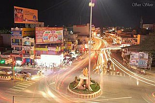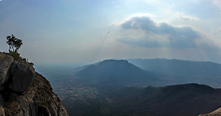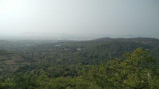
Dharmapuri is a city in the north western part of Tamil Nadu, India. It serves as the administrative headquarters of Dharmapuri district which is the first district created in Tamil Nadu after the independence of India by splitting it from then Salem district on 2 October 1965. The city is located at 50 km from Krishnagiri, 69 km from Salem, 90 km from Hosur, 117 km from Thiruvannamalai, 126 km from Bangalore and Erode, 181 km from Tiruppur, 200 km from Coimbatore and Tiruchirappalli, 300 km from Madurai and the state capital Chennai. It is located between latitudes N 11 47’ and 12 33’ and longitudes E 77 02’ and 78 40’. It is one of the leading major cultivator and producer of mango in the state along with Krishnagiri often referred as Mango Capital of India.

The Javadhu Hills are an extension of the Eastern Ghats spread across parts of Vellore and Tiruvannamalai districts in the northern part of the state of Tamil Nadu in southeastern India. This range separates Vellore and Tiruvannamalai districts. Tirupattur district lies on the north-western side and Tiruvannamalai district lies on the south-eastern side of this range. The towns of Tirupattur, Vaniyambadi and Ambur of Tirupattur district are located on the north western side and the towns of Chengam and Polur of Tiruvannamalai district are located on the south eastern side.

Hogenakkal Falls is a waterfall in South India on the Kaveri river on the border between Dharmapuri district of Tamil Nadu and Chamrajnagar district of Karnataka. It is located 127 km (79 mi) from Bangalore, 165 km (103 mi) from Kollegal, 147 km (91 mi) from Kolar, 152 km (94 mi) from Kolar Gold Fields, 46 km (29 mi), 181 km from Mysore, and 46 km from Dharmapuri. It is sometimes referred to as the "Niagara Falls of India," it is known for bathing areas and hired boat rides and as a major tourist attraction. Carbonatite rocks in this site are considered to be the oldest of its kind in South Asia and one of the oldest in the world. The Government of Tamil Nadu made a proposal to convert the falls into providing drinking water for the state.

Krishnagiri district is one of the 38 districts of the state of Tamil Nadu, in India. This district is carved out from Dharmapuri District by 2004. The municipal town of Krishnagiri is the district headquarters. In Tamil Nadu, e-Governance was first introduced at Krishnagiri district under the National e-Governance Project (NEGP) in revenue and social welfare departments on a pilot basis. The district is one of the largest producers of mangoes in India. As of 2011, the district had a population of 1,879,809 with a sex-ratio of 958 females for every 1,000 males.

Vaniyambadi is a town in the Tirupattur district of Tamil Nadu and the headquarter for the Vaniyambadi Revenue district comprising Vaniyambadi and Ambur. It is located about 200 km from Chennai and 178 kilometer from Bengaluru. The Vaniyambadi Municipality was formed by the G.O. MS. No. 421 Local & Municipality Dept. in April 1886. In 1996 this Municipality was upgraded to Grade II Municipality by G.O. MS. NO. 118 Rural Development Local Administration Dept. dated 01.05.1996. In 1998 this Municipality was upgraded to 1st Grade.
Chengam or Chengamma as on British records, is an important market town and a taluk headquarter in the Foot hills of Eastern ghats in Tiruvannamalai district of Tamil Nadu, India. Chengam is the gateway to the Chengam pass in the Eastern ghats between Javvadhu hills to the north and Chennakesava hills to the south. The town is also the center for various industrial activities which includes Sathanur dam hydro-electric project, Aavin milk processing plant and Periya Kolappadi SIDCO estate.

Oddanchatram is a town in Dindigul district in the Indian state of Tamil Nadu. Oddanchatram is a region in the southwest of Tamil Nadu. The Town was carved out of Madurai District in 1985. Oddanchatram is also famous for vegetable and cattle market. As of 2011, the town had a population of 30,064. It is known as vegetable city of Tamil Nadu. Oddanchatram vegetable market is the largest supplying of vegetables in Tamilnadu and Kerala. Agriculture is the major economic support for the town.
Pennagaram is a town in Dharmapuri district in the Indian state of Tamil Nadu. It is the headquarters of Pennagaram taluk (sub-district).
Tamil Nadu State Highway 25 (SH-25) is a State Highway maintained by the Highways Department of Government of Tamil Nadu. It connects Trichy with Namakkal Town in the north – western part of Tamil Nadu.One of the busiest State Highway in Tamil Nadu, which connects Bangalore, Mumbai and Hyderabad from Trichy.
Hogenakkal is a hamlet in the Pennagaram taluk of Dharmapuri district, in the Indian state of Tamil Nadu.

Tamil Nadu Water Supply and Drainage Board is a public agency formed by the Government of Tamil Nadu, under the Ministry of Local Administration and Water Supply, assigned with the task of implementing all water supply and sewerage schemes to the state of Tamil Nadu.
Paiyampalli is a village in Tirupattur taluk of Tirupattur district in Tamil Nadu, India. It is located 5 km east of Barugur and 8 km west of Natrampalli. It is known for the excavation site in the region which has remains of Neolithic and Megalithic periods. The excavations in the region carried out by the Archaeological Survey of India headed by Shikaripura Ranganatha Rao in the year 1964-65 and 1967-68.
Tamil Nadu State Highway 26 (SH-26) is a State Highway maintained by the Highways Department of Government of Tamil Nadu. It connects Trichy with Mimisal in the south – eastern part of Tamil Nadu.
Tamil Nadu State Highway 30 (SH-30) is a State Highway maintained by the Highways Department of the Government of Tamil Nadu. It connects Musiri with Attur in the northwestern part of Tamil Nadu.
Tamil Nadu State Highway 71 (SH-71) is a State Highway maintained by the Highways Department of Government of Tamil Nadu. It connects Musiri with Sethubavachathiram in Tamil Nadu.
Tamil Nadu State Highway 71A (SH-71A) is a State Highway maintained by the Highways Department of Government of Tamil Nadu. It connects Manapparai with Thuvarankurichi, via Ammachathiram in Tamil Nadu.
Tamil Nadu State Highway 142 (SH-142) is a State Highway maintained by the Highways Department of Government of Tamil Nadu. It connects Thuraiyur with Perambalur road in Tamil Nadu.
Tamil Nadu State Highway 161 (SH-161) is a State Highway maintained by the Highways Department of Government of Tamil Nadu. It connects Namakkal with Kannanur in Tamil Nadu.

Tirupattur district, or Tirupathur district, is one of the 38 districts in the southern Indian state of Tamil Nadu. The district was formed in 2019 by the division of Vellore district into three smaller districts. Its creation alongside Ranipet district was announced on 15 August 2019, and it was officially declared on 28 November 2019. The town of Tirupattur serves as the district headquarters.

Vaniyambadi Revenue District in the southern state of Tamil Nadu is one of the major leather export hubs in India. The district comprises two towns viz. Vaniyambadi and Ambur.


