
Stonehaven is a town in Aberdeenshire, Scotland. It lies on Scotland's northeast coast and had a population of 11,602 . After the demise of the town of Kincardine, which was gradually abandoned after the destruction of its royal castle in the Wars of Independence, the Scottish Parliament made Stonehaven the successor county town of Kincardineshire. Stonehaven had grown around an Iron Age fishing village, now the "Auld Toon", and expanded inland from the seaside. As late as the 16th century, old maps indicate the town was called Stonehyve,Stonehive, Pont also adding the alternative Duniness. It is known informally to locals as Stoney.
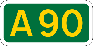
The A90 road is a major north to south highway in eastern Scotland, running from Edinburgh to Fraserburgh, running through Dundee and Aberdeen.
Earl of Kintore is a title in the Peerage of Scotland. It was created in 1677 for Sir John Keith, third son of William Keith, 6th Earl Marischal. He was made Lord Keith of Inverurie and Keith Hall at the same time, also in the Peerage of Scotland. At the death of William, the fourth Earl, in 1761 the earldom became dormant as no-one could prove a claim to it. In 1778, it was decided that the earldom should pass to Anthony Adrian Falconer, Lord Falconer of Halkerton, who changed his surname to Keith-Falconer. The Lordship Falconer of Halkerton and the Earldom of Kintore remained united until 1966, when, at the death of the tenth Earl, the Lordship became dormant.

The A92 is a major highway that runs through Fife, Dundee, Angus, Aberdeenshire, and Aberdeen City in Scotland. From south to north, it runs from Dunfermline to Blackdog, just north of Aberdeen.

The Mounth is the range of hills on the southern edge of Strathdee in northeast Scotland. It was usually referred to with the article, i.e. "the Mounth". The name is a corruption of the Scottish Gaelic monadh which in turn is akin to the Welsh mynydd, and may be of Pictish origin. Traditionally the people of northern Scotland did not consider the Grampians to be a single range, but several, and these were known as the Mounth or the Mounths. Mountain ranges to the west are known as Monadh Liath and the Monadh Ruadh, which could be glossed as the Grey Mounth and the Red Mounth.

Findon or Finnan is a fishing village eight miles south of Aberdeen, famous for originating the smoked haddock known as Finnan haddie. The Findon moor has a number of paths through it, many of which run along the cliffs. Deer can often be seen there. Nearby features include the Portlethen Moss Nature Reserve.
Eagleson Road is a northwest-southeast road in Ottawa's west end in Kanata. It starts at Highway 417 and ends at Brophy Drive south of Richmond. North of Highway 417 it becomes March Road. It is a key link, primarily for residents of Bridlewood, between both ends of Kanata where housing developments are growing steadily in the north and the south. The primary segment of Eagleson Road is divided and six lanes wide between Highway 417 and Abbeyhill Drive, while between Abbeyhill Drive and just south of Stonehaven Drive it is a four-lane divided arterial. South of that, Eagleson is a two-lane undivided rural road.

Johnshaven is a coastal village along the North Sea located in Aberdeenshire, Scotland. It is accessed off the A92 coast road that connects Fife and Stonehaven, where it joins the A90 and continues northward to Aberdeen and beyond. About two miles southwest of Johnshaven lies Milton Ness, which includes a red sandstone cliff landform.

Newtonhill is a commuter village in Kincardineshire, Scotland. It is popular due to its location, just six miles south of Aberdeen with easy reach of Stonehaven and with views over the North Sea.
Portlethen Village is a settlement along the North Sea coast in Aberdeenshire, Scotland. The village is also known as Old Portlethen. The skerry of Craigmaroinn is situated just off the coastline near Portlethen Village.

Mackie Academy is a secondary school in Stonehaven, Aberdeenshire. As of 2015, Mackie Academy had roughly 1170 pupils and 80 teaching staff. The feeder primary schools are Arduthie, Bervie, Catterline, Dunnottar, Glenbervie, Gourdon, Johnshaven, Kinneff, Lairhillock, and Mill O'Forest.
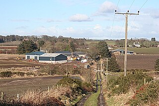
The Causey Mounth is an ancient drovers' road over the coastal fringe of the Grampian Mountains in Aberdeenshire, Scotland. This route was developed as the main highway between Stonehaven and Aberdeen around the 12th century AD and it continued to function as the principal route connecting these two cities until the mid 20th century, when modern highway construction of the A90 road occurred in this area. There are extant paved and usable sections of this road over part of the alignment; however, many parts of the ancient route are no more than footpaths, and in some cases the road has vanished into agricultural fields. Constructed in the Middle Ages, the Causey Mounth was created as an elevated rock causeway to span many of the boggy areas such as the Portlethen Moss. A considerable portion of the alignment of the Causey Mounth is illustrated on the UK Ordnance Survey Map, although a large fraction of the route cannot be navigated by a conventional passenger vehicle.
Cammachmore is a hamlet in the coastal region near the North Sea in Aberdeenshire. It lies slightly west of the A90 road and the ancient Causey Mounth passes through the community. Historic Elsick House is situated due west of Cammachmore. Other nearby historic features include Gillybrands, Saint Ternan's Church, Muchalls Castle and the Lairhillock Inn.
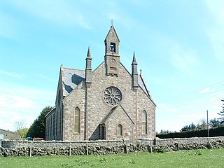
Cookney is a hamlet in Aberdeenshire, Scotland in proximity to Netherley in the Mounth of the Grampian Highlands. The community is situated on a hilltop approximately five miles northwest of Stonehaven and about three miles northwest of the Bridge of Muchalls. Cookney lies about two miles west of Muchalls Castle. From Cookney a portion of the ancient route of the Causey Mounth is visible to the east near Whinward Farm, although the track is not truly recognizable from that distance of about two miles. The Cookney Church is a prominent historic landmark of Cookney.
Banchory-Devenick is a village approximately two kilometres south of the city of Aberdeen, Scotland in the Lower Deeside area of Aberdeenshire. The village should not be confused with the historic civil parish of the same name which spanned the River Dee until 1891, its northern part lying in Aberdeenshire and its southern part in Kincardineshire. In that year the northern part became part of the neighbouring parish of Peterculter, the southern part remaining as the parish of Banchory-Devenick. The village of Banchory-Devenick lies slightly west of the A90 road, and the ancient Causey Mounth passes directly through the village. An historic graveyard dating to 1157 AD is present at the village of Banchory-Devenick. Other historic features in the vicinity include Saint Ternan's Church, Muchalls Castle and the Lairhillock Inn.

The A957 road, commonly called the Slug Road, is a two lane paved public roadway in Aberdeenshire, Scotland connecting Stonehaven to the A93 road near Crathes after crossing the River Dee, Aberdeenshire over Durris Bridge.
The Lairhillock Inn is an historic coaching inn along an old carriage route approximately four miles north of Netherley, Aberdeenshire, Scotland.
Gillybrands is an historic coaching inn and present day farm steading near Cammachmore, Scotland. It was operating as a coaching inn along the ancient Causey Mounth drovers' road as early as the twelfth century AD, and original stone foundations from that era are extant. Other nearby historic structures are Elsick House, St. Ternan's Church and Muchalls Castle.

Dunnottar Parish Church is a parish church of the Church of Scotland, serving Stonehaven in the south of Aberdeenshire, Scotland. It is within the Church of Scotland's Presbytery of Kincardine and Deeside.
Stonehaven is a town in Aberdeenshire, Scotland.


