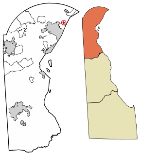
Bellefonte is a town in New Castle County, Delaware, United States. According to the 2010 Census, the population of the town is 1,193.

Elsmere is a town in New Castle County, Delaware, United States, bordering the city of Wilmington along Wilmington's western border. According to the 2010 Census, the population of the town is 6,131.
Delaware Route 2 (DE 2) is a 10.81-mile-long (17.40 km) east–west highway located in northern New Castle County, Delaware. It runs from DE 72 and DE 273 on the eastern edge of Newark east to DE 52 in Wilmington. Between Newark and Wilmington, the route is a four- to six-lane divided highway called Capitol Trail and Kirkwood Highway that passes through suburban areas, running through Marshallton, Prices Corner, and Elsmere. In Wilmington, DE 2 is routed along the one-way pair of Lincoln Street eastbound and Union Street westbound, passing through urban areas.

Delaware Route 141 (DE 141) is a state highway that serves as a western bypass of Wilmington, Delaware. Its southern terminus is at DE 9 and DE 273 in New Castle and its northern terminus is an interchange with U.S. Route 202 (US 202) and DE 261 in Fairfax. The route heads north from DE 9/DE 273 on four-lane divided Basin Road, becoming concurrent with US 202 at an interchange with US 13/US 40 and passes to the east of Wilmington Airport. The highway becomes a freeway and reaches an interchange with Interstate 95 (I-95) and I-295, at which point US 202 splits from DE 141. The DE 141 freeway continues north through Newport to Prices Corner. Here, the freeway segment ends and DE 141 continues northeast as a surface road, with another brief freeway segment in Greenville. The route heads east across the Brandywine Creek on the Tyler McConnell Bridge and continues to US 202/DE 261.
Delaware Route 9 (DE 9) is a 57.83-mile (93.07 km) state highway that runs from DE 1 at the Dover Air Force Base in Kent County north to DE 2 in the city of Wilmington in New Castle County. DE 9 is a designated scenic highway known as the Delaware Bayshore Byway south of New Castle, running through mostly rural areas to the west of the Delaware Bay and the Delaware River as a two-lane undivided road. Between New Castle and Wilmington, DE 9 is a four-lane road that runs through urban and suburban areas. DE 9 passes through several cities and towns including Little Creek, Leipsic, Port Penn, Delaware City, and New Castle. DE 9 has an auxiliary route, DE 9A, that provides access to the Port of Wilmington. In addition, it has a truck route, DE 9 Truck, located to the south of New Castle.
U.S. Route 301 (US 301) is a US Highway running from Sarasota, Florida north to Biddles Corner, Delaware. In the state of Delaware, the route runs 11.9 mi (19.2 km) from the Maryland border southwest of Middletown northeast to its northern terminus at Delaware Route 1 (DE 1) in Biddles Corner, just south of the Senator William V. Roth Jr. Bridge that carries DE 1 over the Chesapeake & Delaware Canal in St. Georges. US 301 in Delaware is a four-lane freeway that is tolled. The toll road has interchanges with DE 299 west of Middletown, DE 71 north of Middletown, and Jamison Corner Road. The freeway uses all-electronic tolling, with tolls paid by E-ZPass or toll-by-plate. A mainline toll gantry is located north of the Maryland border while there are ramp tolls on the southbound exits and northbound entrances at the three interchanges.

Delaware Route 62 (DE 62) is a state highway in New Castle County, Delaware in the United States. The route runs from DE 2 and the southern terminus of DE 41 in Prices Corner east to a dead end near Newport; however, DE 62 signage ends at the DE 4 intersection. The road runs through suburban areas along Newport Gap Pike and Boxwood Road, meeting DE 141 at an interchange. The Newport Gap Pike portion of road was built as a state highway by 1925 and became part of DE 41 by 1936. Boxwood Road was improved in 1946. DE 62 was assigned to its current alignment by 1981.

Delaware Route 58 (DE 58), also known as Churchmans Road, is a state highway in New Castle County, Delaware. The route runs from DE 4 adjacent to the Christiana Hospital in Christiana southeast to DE 273 near Hares Corner. The road passes through suburban areas between Wilmington and Newark, intersecting DE 7 and Interstate 95 (I-95) in Christiana and DE 37 near the Wilmington Airport. Churchmans Road was originally a county road that was paved in the 1930s and realigned twice in the 1950s. DE 58 was designated onto it in the 1980s.

U.S. Route 13 (US 13) is a U.S. highway running from Fayetteville, North Carolina north to Morrisville, Pennsylvania. In the U.S. state of Delaware, the route runs for 103.33 mi (166.29 km). It traverses the entire north–south length of the state from the Maryland state line in Delmar, Sussex County north to the Pennsylvania state line in Claymont, New Castle County. US 13 connects many important cities and towns in Delaware, including Seaford, Dover, and Wilmington. The entire length of US 13 in Delaware is a multilane divided highway with the exceptions of the segment through Wilmington and parts of Philadelphia Pike in Claymont. Between the Maryland border and Dover, US 13 serves as one of the main north–south routes across the Delmarva Peninsula. From Dover north to Tybouts Corner, the route is followed by the controlled-access Delaware Route 1 (DE 1) toll road, which crosses the route several times and has multiple interchanges with it. US 13 bypasses downtown Wilmington to the east before it heads northeast of the city parallel to Interstate 495 (I-495) and the Delaware River to Claymont. US 13 is the longest numbered highway in the state of Delaware.

Talleyville is an unincorporated community in New Castle County, Delaware, United States. Talleyville is located at the intersection of U.S. Route 202, Mt. Lebanon Road, and Silverside Road to the north of Wilmington. Its ZIP code is 19803.
Brandywine is an unincorporated community in New Castle County, Delaware, United States. Brandywine is located at the intersection of Delaware Route 92 and Shipley Road to the north of Wilmington.
Ways Corner is an unincorporated community in New Castle County, Delaware, United States. Ways Corner is located at the intersection of Delaware Route 92 and Delaware Route 261 northeast of Wilmington.
Guyencourt is an unincorporated community in New Castle County, Delaware, United States. Guyencourt is located at the intersection of Delaware Route 100 and Guyencourt Road north of Wilmington and south of the Pennsylvania border.
Brackenville is an unincorporated community in New Castle County, Delaware, United States. Brackenville is located at the intersection of Brackenville Road and Old Wilmington Road east of Hockessin.

State Road is an unincorporated community in New Castle County, Delaware, United States. State Road is located at the intersection of U.S. Route 13 and U.S. Route 40 southwest of New Castle.
Hares Corner is an unincorporated community in New Castle County, Delaware, United States. Hares Corner is located at the intersection of U.S. Route 13/U.S. Route 40 and Delaware Route 273 west of New Castle and immediately south of Wilmington Airport.

Prices Corner is an unincorporated community in New Castle County, Delaware, United States. Prices Corner is located at the intersection of Delaware Route 2 and Delaware Route 141 west of Wilmington. The Prices Corner Shopping Center is located in Prices Corner.
Farnhurst is an unincorporated community in New Castle County, Delaware, United States. The site of two historic hospitals and a number of cemeteries, the community once had a post office, school, and rail station.

The Delaware State Route System consists of roads in the U.S. state of Delaware that are maintained by the Delaware Department of Transportation (DelDOT). The system includes the portions of the Interstate Highway System and United States Numbered Highways system located in the state along with state routes and other roads maintained by DelDOT. All roads maintained by the state are assigned a maintenance road number that is only marked on little white markers at intersections and on auxiliary plates below warning signs approaching intersections. These numbers are only unique in a specific county; some roads can be designated with multiple road numbers, and numbers do not necessarily correspond to the signed Interstate, U.S., or state route numbers. DelDOT maintains a total of 5,386.14 miles (8,668.15 km) of roads, comprising 89 percent of the roads within the state. Some large bridges in the state are maintained by other agencies including the U.S. Army Corps of Engineers and the Delaware River and Bay Authority. Roads in the system include multilane freeways, multilane surface divided highways, and two-lane undivided roads serving urban, suburban, and rural areas. Some of the roads maintained by DelDOT are toll roads, in which motorists must pay to use.
Milltown is an unincorporated community in New Castle County, Delaware, United States. Milltown is located at the intersection of Delaware Route 7 and Milltown Road west of Wilmington.


