
Bucks County is a county located in the Commonwealth of Pennsylvania. As of the 2010 census, the population was 625,249, making it the fourth-most populous county in Pennsylvania. The county seat is Doylestown. The county is named after the English county of Buckinghamshire or more precisely, its abbreviation.

Delaware County is a county located in the central portion of the U.S. state of Ohio. It is a frequent placeholder on the List of highest-income counties in the United States. As of the 2020 census, the population was 214,124. Its county seat is Delaware. The county was formed in 1808 from Franklin County, Ohio. Both the county and its seat are named after the Delaware Indian tribe. Delaware County was listed as the 35th wealthiest county in the United States in 2020.

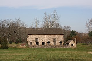
Buckingham Township is a township in Bucks County, Pennsylvania, United States. The population was 20,075 at the 2010 census. Buckingham takes its name from Buckingham in Buckinghamshire, England. Buckingham Township was once known as Greenville and was once the historic county seat of the English Bucks County.
Solebury Township is a township in Bucks County, Pennsylvania, United States. The population was 8,692 at the 2010 census.

Chester Heights is a borough in Delaware County, Pennsylvania, United States. The population was 2,531 at the 2010 census. Most of the borough lies south of U.S. 1, about a mile southwest of Wawa.

Clifton Heights is a borough in Delaware County, Pennsylvania, United States, located on Darby Creek 5 miles (8 km) west of downtown Philadelphia. As of the 2010 census the population was 6,652.
Buckingham is a town in Buckinghamshire, England, United Kingdom.

Cornwells Heights is a census-designated place located in Bensalem Township in Bucks County, Pennsylvania. The community was formerly part of Cornwells Heights-Eddington, but was split into two separate CDP's. As of the 2010 census, the population was 1,391. The Cornwells Heights station is located in the community and serves SEPTA Regional Rail's Trenton Line and Amtrak's Keystone Service and Northeast Regional services along the Northeast Corridor. The train station also has a park-and-ride with access from Interstate 95.

Pineville is a village on the border between Buckingham and Wrightstown townships in Bucks County, Pennsylvania, United States.

The neighborhoods of Albany, New York are listed below.

Yorklyn is an unincorporated community in northern New Castle County, Delaware, United States. It lies along Delaware Route 82 northwest of the city of Wilmington, the county seat of New Castle County. Its elevation is 174 feet (53 m). It has a post office with the ZIP code 19736.

McDaniel Heights is an unincorporated community in New Castle County, Delaware, United States. McDaniel Heights is located east of U.S. Route 202 between Fairfax and Talleyville.
Silverside Heights is an unincorporated community in New Castle County, Delaware, United States. Silverside Heights is located north of the intersection of U.S. Route 13 Business and Silverside Road northeast of Wilmington and southwest of Claymont.
Shipley Heights is an unincorporated community in New Castle County, Delaware, United States. Shipley Heights is located northwest of the intersection of Shipley Road and Weldin Road to the northeast of Wilmington.
Phillips Heights is an unincorporated community in New Castle County, Delaware, United States. Phillips Heights is located east of the intersection of U.S. Route 13 Business and Marsh Road northeast of Wilmington.
Gordon Heights is an unincorporated community in New Castle County, Delaware, United States. Gordon Heights is located east of the intersection of Delaware Route 3 and Marsh Road north of Edgemoor.
Cleland Heights is an unincorporated community in New Castle County, Delaware, United States. Cleland Heights is located to the north of Delaware Route 4 just southwest of the Wilmington city limit.
Belvedere is an unincorporated community in New Castle County, Delaware, United States. Belvedere is at the junction of Delaware Route 62 and Delaware Route 141 north of Newport and south of Prices Corner, 7 miles (11 km) from downtown Wilmington. Belvedere uses the Wilmington ZIP code of 19804.

Auburn Valley State Park is a state park, located in Yorklyn, Delaware, United States. The park, which is around 360 acres, preserves the former home and estate of the Marshall family as well as portions of the family's former mills alongside the Red Clay Creek and additional land purchased by the state. The preserve contains several miles of trails open to walking, biking, and antique cars, and the state owns conservation easements on 160 acres of privately owned land adjacent to the park to help maintain the park's rural character.


