Stonewall Formation

Last updated
Stonewall Formation
Stratigraphic range: Ashgill to Alexandrian
Type Geological formation
Underlies Interlake Group
Overlies Stony Mountain Formation
Thicknessup to 34 metres (110 ft) [1]
Lithology
Primary dolomite
Other Sandstone, anhydrite
Location
Coordinates 50°07′07″N97°43′26″W / 50.1186°N 97.7239°W / 50.1186; -97.7239 (Stonewall Formation)
Region WCSB
Williston Basin
CountryFlag of Canada (Pantone).svg  Canada
Type section
Named for Stonewall, Manitoba
Named byE.M. Kindle, 1914
Stonewall Formation within Williston Basin stratigraphy Williston Basin stratigraphic column.jpg
Stonewall Formation within Williston Basin stratigraphy

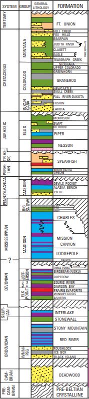
The Stonewall Formation is a stratigraphical unit of Late Ordovician to Early Silurian age in the Western Canadian Sedimentary Basin.

Contents

It takes the name from Stonewall, Manitoba, and was first described in the Stonewall quarry by E.M. Kindle in 1914. [2]

Lithology

The Stonewall Formation is composed of finely crystalline dolomite, with a basal argillaceous and sandy dolomite (the Williams Member). Two thin sandstone beds occur in the middle and at the top of the formation. [1] In the central Williston basin, the base is marked by an anhydrite bed.

Distribution

The Stonewall Formation occurs at surface in the Manitoba outcrop belt and in the sub-surface in the Williston Basin. [1] It reaches a maximum thickness of 34 metres (110 ft).

Relationship to other units

The Stonewall Formation is overlain by the Interlake Group (conformably in the south, disconformably in the north) and sharply overlays the Stony Mountain Formation. [1]

Related Research Articles

<span class="mw-page-title-main">Williston Basin</span> Sedimentary basin in Montana, United States

The Williston Basin is a large intracratonic sedimentary basin in eastern Montana, western North Dakota, South Dakota, southern Saskatchewan, and south-western Manitoba that is known for its rich deposits of petroleum and potash. The basin is a geologic structural basin but not a topographic depression; it is transected by the Missouri River. The oval-shaped depression extends approximately 475 miles (764 km) north-south and 300 miles (480 km) east-west.

<span class="mw-page-title-main">Madison Group</span> Geologic formation in the western United States

The Madison Limestone is a thick sequence of mostly carbonate rocks of Mississippian age in the Rocky Mountain and Great Plains areas of the western United States. The rocks serve as an important aquifer as well as an oil reservoir in places. The Madison and its equivalent strata extend from the Black Hills of western South Dakota to western Montana and eastern Idaho, and from the Canada–United States border to western Colorado and the Grand Canyon of Arizona.

The Muskeg Formation is a geologic formation of Middle Devonian (Givetian) age in the Western Canada Sedimentary Basin. It extends from the plains of northwestern Alberta to northeastern British Columbia, and includes important petroleum and natural gas reservoirs in the Zama lake and Rainbow Lake areas of northwestern Alberta.

The Belloy Formation is a stratigraphical unit of Permian age in the Western Canadian Sedimentary Basin.

The Baldonnel Formation is a stratigraphical unit of Carnian age in the Western Canadian Sedimentary Basin.

<span class="mw-page-title-main">Elk Point Group</span>

The Elk Point Group is a stratigraphic unit of Early to Middle Devonian age in the Western Canada and Williston sedimentary basins. It underlies a large area that extends from the southern boundary of the Northwest Territories in Canada to North Dakota in the United States. It has been subdivided into numerous formations, number of which host major petroleum and natural gas reservoirs.

The Shaunavon Formation is a stratigraphical unit of Bathonian age in the Western Canadian Sedimentary Basin.

The Manitoba Group is a stratigraphical unit of middle to late Devonian age in the Western Canadian Sedimentary Basin.

The Gravelbourg Formation is a stratigraphical unit of Bajocian age in the Western Canadian Sedimentary Basin.

The Interlake Formation is a stratigraphical unit of Silurian age in the Western Canadian Sedimentary Basin.

The Stony Mountain Formation is a stratigraphical unit of Ashgill age in the Western Canadian Sedimentary Basin.

The Liard Formation is a stratigraphic unit of Middle Triassic to Late Triassic age in the Western Canadian Sedimentary Basin that is present in northeastern British Columbia. It takes its name from the Liard River, and was first described from outcrops on the southern bank of that river, near Hell Gate Rapids in the Grand Canyon of the Liard, by E.D. Kindle in 1946.

The Herald Formation is a stratigraphical unit of Late Ordovician age in the Western Canadian Sedimentary Basin.

The Red River Formation is a stratigraphical unit of Late Ordovician age in the Williston Basin.

<span class="mw-page-title-main">Cairn Formation</span>

The Cairn Formation is a geologic formation of Late Devonian (Frasnian) age in the Western Canada Sedimentary Basin. It was named for the Cairn River near its junction with the Southesk River in Jasper National Park by D.J. McLaren in 1955.

The Beaverfoot Formation is a stratigraphic unit of Late Ordovician to Early Silurian (Llandovery) age. It is present on the western edge of the Western Canada Sedimentary Basin in the Rocky Mountains of British Columbia and Alberta, and the Purcell Mountains of British Columbia. It consists of carbonate rocks, and was named for the Beaverfoot Range at Pedley Pass southeast of Golden, British Columbia by L.D. Burling in 1922.

<span class="mw-page-title-main">Prairie Evaporite Formation</span> Geologic formation of Givetian age

The Prairie Evaporite Formation, also known as the Prairie Formation, is a geologic formation of Middle Devonian (Givetian) age that consists primarily of halite and other evaporite minerals. It is present beneath the plains of northern and eastern Alberta, southern Saskatchewan and southwestern Manitoba in Canada, and it extends into northwestern North Dakota and northeastern Montana in the United States.

<span class="mw-page-title-main">Spray River Group</span>

The Spray River Group is a stratigraphic unit of Triassic age. It is present on the western edge of the Western Canada Sedimentary Basin in the foothills and Rocky Mountains of western Alberta. It was originally described as the Spray River Formation by E.M. Kindle in 1924 and was later raised to group status. Its type section is located in the Spray River gorge at the southern end of Sulphur Mountain.

The Bertie Group or Bertie Limestone, also referred to as the Bertie Dolomite and the Bertie Formation, is an upper Silurian geologic group and Lagerstätte in southern Ontario, Canada, and western New York State, United States. Details of the type locality and of stratigraphic nomenclature for this unit as used by the U.S. Geological Survey are available on-line at the National Geologic Map Database. The formation comprises dolomites, limestones and shales and reaches a thickness of 495 feet (151 m) in the subsurface, while in outcrop the group can be 60 feet (18 m) thick.


The Owen Creek Formation is a stratigraphic unit of Middle Ordovician age. It is present on the western edge of the Western Canada Sedimentary Basin in the Canadian Rockies of Alberta and British Columbia. It consists primarily of dolomite and was named for Owen Creek near Mount Wilson in Banff National Park by B.S. Norford in 1969.

References

  1. 1 2 3 4 Lexicon of Canadian Geologic Units. "Stonewall Formation" . Retrieved 2010-02-03.
  2. Kindle, E.M., 1914. The Silurian and Devonian Section of Western Manitoba; Geological Survey of Canada, Summary Report 1912, pp. 247-261.