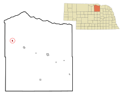
Stuart, Nebraska | |
---|---|
Coordinates: 42°36′03″N99°08′26″W / 42.60083°N 99.14056°W | |
Country | United States |
State | Nebraska |
County | Holt |
Area | |
• Total | 1.37 sq mi (3.54 km2) |
• Land | 1.37 sq mi (3.54 km2) |
• Water | 0.00 sq mi (0.00 km2) |
Elevation | 2,162 ft (659 m) |
Population (2020) | |
• Total | 486 |
• Density | 355.52/sq mi (137.32/km2) |
Time zone | UTC-6 (Central (CST)) |
• Summer (DST) | UTC-5 (CDT) |
ZIP code | 68780 |
Area code | 402 |
FIPS code | 31-47500 [3] |
GNIS feature ID | 2399923 [2] |
Stuart is a village in Holt County, Nebraska, United States. The population was 590 at the 2010 census.
Stuart was first settled in 1879. [4] The town was named for Peter Stuart, the first postmaster. . [5] Stuart grew around a depot established in 1881 on the Fremont, Elkhorn and Missouri Valley Railroad. [6]
According to the United States Census Bureau, the village has a total area of 1.34 square miles (3.47 km2), all land. [7]
Census | Pop. | Note | %± |
---|---|---|---|
1890 | 245 | — | |
1900 | 382 | 55.9% | |
1910 | 467 | 22.3% | |
1920 | 739 | 58.2% | |
1930 | 763 | 3.2% | |
1940 | 760 | −0.4% | |
1950 | 785 | 3.3% | |
1960 | 794 | 1.1% | |
1970 | 561 | −29.3% | |
1980 | 641 | 14.3% | |
1990 | 650 | 1.4% | |
2000 | 625 | −3.8% | |
2010 | 590 | −5.6% | |
2020 | 486 | −17.6% | |
U.S. Decennial Census [8] |
As of the census [9] of 2010, there were 590 people, 238 households, and 146 families living in the village. The population density was 440.3 inhabitants per square mile (170.0/km2). There were 267 housing units at an average density of 199.3 per square mile (77.0/km2). The racial makeup of the village was 99.0% White, 0.2% African American, 0.2% Asian, and 0.7% from two or more races. Hispanic or Latino of any race were 0.7% of the population.
There were 238 households, of which 28.2% had children under the age of 18 living with them, 53.4% were married couples living together, 4.6% had a female householder with no husband present, 3.4% had a male householder with no wife present, and 38.7% were non-families. 34.9% of all households were made up of individuals, and 18.5% had someone living alone who was 65 years of age or older. The average household size was 2.31 and the average family size was 3.01.
The median age in the village was 47 years. 22.9% of residents were under the age of 18; 6.4% were between the ages of 18 and 24; 17.6% were from 25 to 44; 26.2% were from 45 to 64; and 26.8% were 65 years of age or older. The gender makeup of the village was 49.0% male and 51.0% female.
As of the census [3] of 2000, there were 625 people, 237 households, and 154 families living in the village. The population density was 1,000.5 inhabitants per square mile (386.3/km2). There were 272 housing units at an average density of 435.4 per square mile (168.1/km2). The racial makeup of the village was 98.24% White, 0.96% Native American, 0.32% Asian, 0.16% Pacific Islander, and 0.32% from two or more races. Hispanic or Latino of any race were 0.64% of the population.
There were 237 households, out of which 30.8% had children under the age of 18 living with them, 55.3% were married couples living together, 5.9% had a female householder with no husband present, and 34.6% were non-families. 32.5% of all households were made up of individuals, and 18.1% had someone living alone who was 65 years of age or older. The average household size was 2.46 and the average family size was 3.14.
In the village, the population was spread out, with 27.7% under the age of 18, 5.3% from 18 to 24, 24.8% from 25 to 44, 16.3% from 45 to 64, and 25.9% who were 65 years of age or older. The median age was 39 years. For every 100 females, there were 100.3 males. For every 100 females age 18 and over, there were 93.2 males.
As of 2000 the median income for a household in the village was $27,321, and the median income for a family was $38,500. Males had a median income of $24,063 versus $16,667 for females. The per capita income for the village was $13,342. About 12.7% of families and 12.6% of the population were below the poverty line, including 13.2% of those under age 18 and 9.9% of those age 65 or over.
Rising City is a village in Butler County, Nebraska, United States. The population was 374 at the 2010 census.
Ulysses is a village in Butler County, Nebraska, United States. The population was 171 at the 2010 census.
Union is a village in southeast Cass County, Nebraska, United States. The population was 195 at the 2020 census.
Dixon is a rural village in Dixon County, Nebraska, United States. The population was 87 at the 2010 census. There is a granary at Dixon, a post office, a community center, a small cafe, and a fire and rescue department.
Hampton is a village in Hamilton County, in the state of Nebraska in the Midwestern United States. The population was 423 at the 2010 census.
Stamford is a village in Harlan County, Nebraska, United States. The population was 183 at the 2010 census.
Santee is the principal village of the Santee Sioux Reservation in Knox County, Nebraska, United States. The population was 346 at the 2010 census.
Verdel is a village in Knox County, Nebraska, United States. The population was 30 at the 2010 census.
Palmer is a village in Merrick County, Nebraska, United States. The population was 472 at the 2010 census. It is part of the Grand Island, Nebraska metropolitan area.
Loomis is a village in Phelps County, Nebraska, United States. The population was 383 at the 2010 census.
Platte Center is a village in Platte County, Nebraska, United States. The population was 336 at the 2010 census.
Ceresco is a farming village in Saunders County, Nebraska, United States. The population was 919 at the 2020 census. It is located near U.S. Highway 77, just north of Lincoln, just south of Wahoo, and a short distance southwest of Omaha.
Malmo is a village in Saunders County, Nebraska, United States. The population was 94 at the 2020 census.
Memphis is a village in Saunders County, Nebraska, United States. The population was 109 at the 2020 census.
Weston is a village in Saunders County, Nebraska, United States. The population was 250 at the 2020 census.
Staplehurst is a village in Seward County, Nebraska, United States. It is part of the Lincoln, Nebraska Metropolitan Statistical Area. The population was 242 at the 2010 census.
Elyria is a village in Valley County, Nebraska, United States. The population was 51 at the 2010 census.
Herman is a village in Washington County, Nebraska, United States. The population was 268 at the 2010 census.
Washington is a village in Washington County, Nebraska, United States. The population was 150 at the 2010 census.
Bartlett is a village in, and the county seat of, Wheeler County, Nebraska, United States. The population was 117 at the 2010 census.