Sugar Creek Township | |
|---|---|
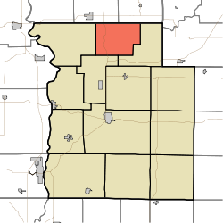 Location in Parke County | |
| Coordinates: 39°55′32″N87°12′29″W / 39.92556°N 87.20806°W | |
| Country | |
| State | |
| County | Parke |
| Government | |
| • Type | Indiana township |
| Area | |
• Total | 24.91 sq mi (64.5 km2) |
| • Land | 24.89 sq mi (64.5 km2) |
| • Water | 0.02 sq mi (0.052 km2) 0.08% |
| Elevation | 679 ft (207 m) |
| Population (2020) | |
• Total | 308 |
| • Density | 12.4/sq mi (4.78/km2) |
| Time zone | UTC-5 (Eastern (EST)) |
| • Summer (DST) | UTC-4 (EDT) |
| ZIP codes | 47832, 47859, 47952 |
| Area code | 765 |
| GNIS feature ID | 453884 |
Sugar Creek Township is one of thirteen townships in Parke County, Indiana, United States. As of the 2020 census, its population was 308 and it contained 139 housing units. [2] The township includes the north half of Turkey Run State Park.
Contents
- History
- Geography
- Unincorporated towns
- Cemeteries
- Major highways
- School districts
- Political districts
- References
- External links
| Census | Pop. | Note | %± |
|---|---|---|---|
| 1890 | 789 | — | |
| 1900 | 830 | 5.2% | |
| 1910 | 680 | −18.1% | |
| 1920 | 554 | −18.5% | |
| 1930 | 399 | −28.0% | |
| 1940 | 496 | 24.3% | |
| 1950 | 350 | −29.4% | |
| 1960 | 350 | 0.0% | |
| 1970 | 265 | −24.3% | |
| 1980 | 292 | 10.2% | |
| 1990 | 300 | 2.7% | |
| 2000 | 349 | 16.3% | |
| 2010 | 322 | −7.7% | |
| 2020 | 308 | −4.3% | |
| Source: US Decennial Census [3] | |||
