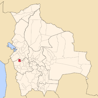
San Pedro de Totora is a province in the northern parts of the Bolivian department of Oruro.

Totora, Tutura or T'utura is a town in the Carrasco Province of the Cochabamba Department in Bolivia. It is the capital and most-populous place of the Totora Municipality. As of the 2012 census, the population is 1,925. The first settlers were Inca Indians. Totora was officially settled in 1876, and declared a town by the Government of Bolivia in 1894.
Caracollo, Q'araqullu or Q'ara Qullu is a small town in Bolivia. It is situated in the Cercado Province of the Oruro Department. In 2010 it had an estimated population of 5,429. Located at the place where the highway from La Paz splits into two roads towards Cochabamba and Oruro, the town is a frequent starting point for long marches intended to influence the Bolivian government.

Uma Jalanta is a mountain in the Cordillera Real in the Andes of Bolivia, about 5,723 metres (18,776 ft) high. It is located in the La Paz Department, Larecaja Province, Sorata Municipality. It lies south-east of the mountains Janq'u Uma and Janq'u Piti, near the mountain Misk'i T'ant'a.
Wiluyu Janq'u Uma or Wiluyu is a mountain in the Cordillera Real in the Andes of Bolivia, about 5,540 metres (18,176 ft) high. It is located in the La Paz Department, Larecaja Province, Sorata Municipality. It lies northwest of the mountain Yapuchañani, northeast of Misk'i T'ant'a and Uma Jalanta and east of Illampu.
Jach'a Jawira which upstream is called Anallajchi and Sura K'uchu and downstream successively is named Qincha Jawira and Achuta is a Bolivian river in the La Paz Department, Pacajes Province, Calacoto Municipality. It is a right tributary of the Achuta River which originates near the Chilean border and flows northeast to reach the Mauri River.
Wila Chullpa is a mountain in the Andes of Bolivia which reaches a height of approximately 4,380 m (14,370 ft). It is located in the Oruro Department, on the border of the Nor Carangas Province and the San Pedro de Totora Province, northeast of the village of Huacanapi.
Jach'a Ch'utu is a mountain in the Andes of Bolivia which reaches a height of approximately 4,160 m (13,650 ft). It is located in the Oruro Department, San Pedro de Totora Province. Jach'a Ch'utu lies southeast of Yapu Qullu. The Turi Jawira originates east of the mountain. It flows to the Jach'a Jawira in the southwest.
Yapu Qullu is a 4,206-metre-high (13,799 ft) mountain in the Andes of Bolivia. It is located in the Oruro Department, San Pedro de Totora Province, southwest of the village of Huacanapi.
Pukara is a mountain in the Andes of Bolivia which reaches a height of approximately 4,140 m (13,580 ft). It is located in the Oruro Department, San Pedro de Totora Province, west of the village of Huacanapi.
Pukara is a 4,019-metre-high (13,186 ft) mountain in the Andes of Bolivia. It is located in the Oruro Department, San Pedro de Totora Province, west of the village of Marquirivi.
Pukara is a mountain in the Andes of Bolivia which reaches a height of approximately 4,040 m (13,250 ft). It is located in the Oruro Department, San Pedro de Totora Province. Pukara lies west of T'iwu (Tibo), southwest of the village and the mountain named Antiti at a lake named Ch'uxña Quta.
Jach'a Jaqhi is a 4,248-metre-high (13,937 ft) mountain in the Andes of Bolivia. It is located in the Oruro Department, San Pedro de Totora Province.
Iru Willk'i is a 4,063-metre-high (13,330 ft) mountain in the Andes of Bolivia. It is located in the Oruro Department, San Pedro de Totora Province. It lies at the Q'ara Quta River.
Mañasu is a 4,171-metre-high (13,684 ft) mountain in the Andes of Bolivia. It is located in the Oruro Department, San Pedro de Totora Province. The Juch'us Jawira originates at the mountain. It flows to the northwest.
Janq'u Jaqhi is a mountain in the Andes of Bolivia which reaches a height of approximately 4,120 m (13,520 ft). It is located in the Oruro Department, San Pedro de Totora Province. Janq'u Jaqhi lies west of Mañasu and south of Pukara between the Milluri River in the east and the Sulluma River in the west.
Ch'alla Willk'i is a 4,182-metre-high (13,720 ft) mountain in the Andes of Bolivia. It is located in the Oruro Department, San Pedro de Totora Province. The Luk'i Jawira (Lokhe Jahuira) originates north of Ch'alla Willk'i. It flows to the northwest.
Japu Willk'i is a mountain in the Andes of Bolivia which reaches a height of approximately 4,200 m (13,800 ft). It is located in the Oruro Department, San Pedro de Totora Province. Japu Willk'i lies at the Sulluma River, southeast of Ch'alla Willk'i.
Lluqu Lluqu is a mountain in the Andes of Bolivia which reaches a height of approximately 4,040 m (13,250 ft). It is located in the Oruro Department, San Pedro de Totora Province. Lluqu Lluqu lies northeast of Japu Willk'i.
Tanka Tanka is a 4,014-metre-high (13,169 ft) mountain in the Andes of Bolivia. It is located in the Oruro Department, San Pedro de Totora Province. Tanka Tanka lies at the Sulluma River, southeast of Lluqu Lluqu.


