The Don River is a watercourse in southern Ontario, that empties into Lake Ontario, at Toronto Harbour. Its mouth was just east of the street grid of the town of York, Upper Canada, the municipality that evolved into Toronto, Ontario. The Don is one of the major watercourses draining Toronto that have headwaters in the Oak Ridges Moraine.

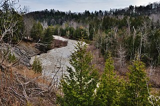
The Rouge River is a river in Markham, Pickering, Richmond Hill and Toronto in the Greater Toronto Area of Ontario, Canada. The river flows from the Oak Ridges Moraine to Lake Ontario at the eastern border of Toronto, and is the location of Rouge Park, the only national park in Canada within a municipality. At its southern end, the Rouge River is the boundary between Toronto and southwestern Pickering in the Regional Municipality of Durham.
The River Rouge is a 127-mile river in the Metro Detroit area of southeastern Michigan. It flows into the Detroit River at Zug Island, which is the boundary between the cities of River Rouge and Detroit.

Black Creek is a river in the Golden Horseshoe region of Ontario, Canada. It flows from the city of Vaughan in the Regional Municipality of York to the Humber River in Toronto. Black Creek is smaller than most of the waterways in the Greater Toronto Area.
Friends of the Don East (FODE) is a non-governmental organization based in Toronto, Ontario, Canada. They are an environmental group whose goal is to preserve and protect natural areas in the Don River watershed.

Daylighting can be defined as "opening up buried watercourses and restoring them to more natural conditions". An alternative definition refers to "the practice of removing streams from buried conditions and exposing them to the Earth's surface in order to directly or indirectly enhance the ecological, economic and/or socio-cultural well-being of a region and its inhabitants”. The term is used to refer to the restoration of an originally open-air watercourse, which had at some point been diverted below ground, back into an above-ground channel. Typically, the rationale behind returning the riparian environment of a stream, wash, or river to a more natural state is to reduce runoff, create habitat for species in need of it, or improve an area's aesthetics. In the UK, the practice is also known as deculverting.

O'Connor–Parkview is a neighbourhood in the East York area of Toronto, Ontario, Canada. While the name is taken from the definition used by the city of Toronto, local residents are more familiar with the niche areas that define the larger neighbourhood. It is a very diverse neighbourhood that includes English-speaking and Greeks in the west, to the Tamil speakers in the east and Bengali people in the south. It includes low-income highrises, to huge property lots. The smaller areas included inside the neighbourhood are Topham Park, Woodbine Gardens and Parkview Hills.
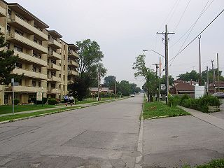
Ionview is a neighbourhood in Toronto, Ontario, Canada, in the district of Scarborough. It is bounded by Birchmount Road to the west, the hydro transmission corridor north of Ranstone Gardens to the north, the CNR railway to the east, and Eglinton Avenue East, Kennedy Road and the CNR railway to the south.

Still Creek is a long stream flowing across Central Burnaby, British Columbia and into Burnaby Lake. Still Creek's path lies mainly through the industrial area which contributes to its high level of pollution, although through dedicated work of local volunteers the creek is slowly recovering.
The Toronto ravine system is a distinctive feature of the city's geography, consisting of a network of deep ravines which forms a large urban forest that runs through most of Toronto. The ravine system is the largest in any city in the world, with the Ravine and Natural Feature Protection Bylaw protecting approximately 110 square kilometres (42 sq mi) of public and privately-owned land. The ravine system has been presented as a central characteristic of the city, with the size of the ravine system leading Toronto to be described as "a city within a park".

Mill Creek Ravine is located Edmonton, Alberta, Canada and is a part of the River Valley parks and trail system. It contains the last stretch of Mill Creek, before it flows into a culvert for its end run to the North Saskatchewan River. The ravine ends where the land opens onto the North Saskatchewan River valley near the west end of Cloverdale on the opposite bank from downtown.

The Ashbridges Bay Wastewater Treatment Plant is the city of Toronto's main sewage treatment facility, and the second largest such plant in Canada after Montreal's Jean-R. Marcotte facility. One of four plants that service the city of Toronto, it treats the wastewater produced by some 1.4 million of the city's residents and has a rated capacity of 818,000 cubic metres per day. Until 1999 it was officially known as the Main Treatment Plant. The plant has a 185 m (607 ft) high smokestack which is visible from most parts of the city.

Highland Creek is a river in the Scarborough district of Toronto, Ontario, emptying into Lake Ontario at the eastern end of the Scarborough Bluffs. It is home to several species of fish including trout, carp, bass and salmon. It is a meandering river which, like most rivers in Toronto, travels through a glacial ravine formed after the last Ice Age. The Highland Creek watershed, including tributaries, is almost entirely contained within Scarborough.

Aliso Creek is a 19.8-mile (31.9 km)-long, mostly urban stream in south Orange County, California. Originating in the Cleveland National Forest in the Santa Ana Mountains, it flows generally southwest and empties into the Pacific Ocean at Laguna Beach. The creek's watershed drains 34.9 square miles (90 km2), and it is joined by seven main tributaries. As of 2018, the watershed had a population of 144,000 divided among seven incorporated cities.
West Highland Creek is a river in Toronto, Ontario, Canada, a tributary of Highland Creek in the Lake Ontario drainage basin. The creek and its tributaries are entirely within the old City of Scarborough, and it provides the watershed for the northwest of the city.

Tanner Creek is a small tributary of the Willamette River in Portland in the U.S. state of Oregon. Named after a tannery owned by one of the city's founders, it begins in what is now the Sylvan–Highlands neighborhood in the Tualatin Mountains west of downtown. In the 19th century the creek flowed on the surface, running northeast across the city, past what later became Providence Park and into a shallow lake and wetlands in what became the Pearl District, bordering the river.
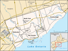
The Toronto waterway system comprises a series of natural and man-made watercourses in the Canadian city of Toronto. The city is dominated by a large river system spanning most of the city including the Don River, Etobicoke Creek, Highland Creek, Humber River, Mimico Creek and Rouge River.

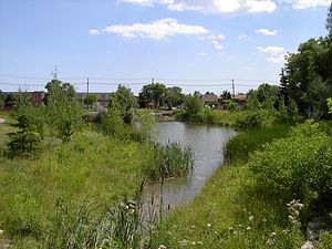
Yellow Creek, is a partially buried south-easterly tributary of the Don River in Toronto. It has also been known at different times as Silver Creek, Sylvan Creek, and also Rosedale Brook. The former source of Yellow Creek begins near Sheppard West station in the Downsview neighbourhood. Most of the creek and its sources are buried underground in storm sewers until they emerge into Avoca Ravine in the Deer Park neighbourhood and continues its way to the Don River.

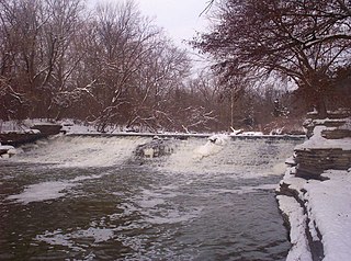
Mud Creek, is a mostly buried south-easterly tributary of the Don River in Toronto, Ontario, Canada. It has also been known at different times as Mount Pleasant Brook and Spring Valley Creek.

Dale Hodges Park is a 40.4686 hectares natural environment urban park, stormwater treatment, and public artwork in northwest Calgary, Alberta—an expansion of Bowmont Park— where stormwater from eight northwest upstream residential communities flows slowly through "water structures and landforms" inspired by "natural river morphology as well as hydrologic and sedimentation processes" that serve as filters. The park, which is connected to the regional pathway, has a boardwalk, cycling and walking trails, the Nautilus Pond, a polishing marsh, a wet meadow, man-made streams, vantage points of the Bow River, and wildlife habitat.