
Omasuyos or Uma Suyu is a province in the La Paz Department in Bolivia. Its capital is Achacachi.
Sabaya is a province in the central parts of the Bolivian Oruro Department. Its seat is Sabaya.

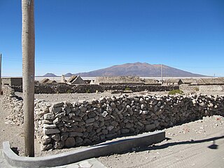
Puerto de Mejillones is a province in the western parts of the Bolivian department of Oruro. It is one of the sixteen provinces in the Oruro Department. Its seat is La Rivera.
Pichacani or Pichaqani is one of fifteen districts of the Puno Province in the Puno Region in Peru.

Wila Qullu is a mountain in the Bolivian Andes, about 4,600 metres (15,092 ft) high. It situated in the Cordillera Occidental near the border with Chile. It is located in the Oruro Department, Sabaya Province, Sabaya Municipality, Julo Canton. Wila Qullu lies south-east of the volcano Pukintika and north-west of the mountain Phaq'u Q'awa.
Kimsa Chata is a 5,245-metre-high (17,208 ft) mountain in the Andes of Bolivia. It is located in the Oruro Department, Sabaya Province, Sabaya Municipality, Negrillos Canton. It lies south-east of the mountain Qillwiri, east of Lliscaya, north-east of Taypi Qullu and north-west of the Laram Pukara, near the border with Chile.
Laram Pukara is a 5,292-metre-high (17,362 ft) mountain in the Cordillera Occidental in the Andes of Bolivia. It is located in the Oruro Department, Mejillones Province, La Rivera Municipality. Laram Pukara lies south-east of the mountain Kimsa Chata and north-east of the mountain Taypi Qullu.
Janq'u Qullu is a 4,822-metre-high (15,820 ft) mountain in the Cordillera Occidental in the Andes of Bolivia. It is located in the Oruro Department, Mejillones Province, La Rivera Municipality. Janq'u Qullu lies southeast of Laram Pukara and Taypi Qullu.
Ch'iyar T'ikhi is a mountain in the Cordillera Real in the Andes of Bolivia, about 5,092 metres (16,706 ft) high. It is situated in the La Paz Department, Los Andes Province, Batallas Municipality. Ch'iyar T'ikhi lies south-west of the mountain Jach'a Qullu, west of Qala T'uxu, north of Qullqi Chata and north-east of Taypi K'uchu. The rivers Pura Purani and Jayllawaya, both tributaries of Lake Titicaca, flow along its northern and southern slopes.
Tira Qullu is a 4,832-metre-high (15,853 ft) mountain in the western extension of the Cordillera Real in the Andes of Bolivia. It is located in the La Paz Department, Los Andes Province, Pucarani Municipality. Tira Qullu lies between the lakes Sura Quta and Taypi Chaka Quta in the west and Juri Quta in the east. It is situated south-west of the mountains Jach'a Jipiña and Milluni.
Taypi Qullu is a 5,062-metre-high (16,608 ft) mountain in the Cordillera Occidental in the Andes of Bolivia. It lies in the Oruro Department, Mejillones Province, La Rivera Municipality. Taypi Qullu is situated south of the mountain Chullumpiri, south-west of Laram Pukara and north-west of Janq'u Qullu. The river Ch'iyar Qullu Jawira flows along its slopes and then to the south-west.
Taypi Qullu may refer to:
Phaq'u Q'awa is a 5,203-metre-high (17,070 ft) mountain in the Cordillera Occidental in the Andes of Bolivia. It is situated in the Oruro Department, Sabaya Province, Sabaya Municipality. Phaq'u Q'awa lies southeast of Wila Qullu.
Taypi Qullu is a mountain in the Bolivian Andes, about 4,440 metres (14,567 ft) high. It is situated in the La Paz Department, Murillo Province, La Paz Municipality. Taypi Qullu lies south-east of the mountain Llamp'u.
Chuqu Chuquni is a 4,522-metre-high (14,836 ft) mountain in the Andes of Bolivia. It is located in the Oruro Department, Sabaya Province, Sabaya Municipality, southwest of the village of Tunapa. Pacha Qullu lies northwest of Inka Qhamachu. Chuqu Chuquni lies southwest of Pacha Qullu and northwest of Pumiri.
Pallall Qullu is a 4,033-metre-high (13,232 ft) mountain in the Andes of Bolivia. It is located in the Oruro Department, Mejillones Province, Carangas Municipality, and in the Sabaya Province, Sabaya Municipality.
Taypi Qullu is a mountain in the Andes of Bolivia which reaches a height of approximately 4,240 m (13,910 ft). It is located in the Oruro Department, Mejillones Province, Carangas Municipality, southeast of Carangas. Taypi Qullu lies northwest of Churi Qullu.
Janq'u Ch'utu is a 4,324-metre-high (14,186 ft) mountain in the Andes of Bolivia. It is located in the Oruro Department, Sabaya Province, Sabaya Municipality. Janq'u Ch'utu lies northeast of Churi Qullu.
Taypi Qullu is a mountain in the Andes of Bolivia which reaches a height of approximately 4,920 m (16,140 ft). It is located in the Oruro Department, Sajama Province, Turco Municipality. Taypi Qullu lies southwest of Jach'a Apachita.
Taypi Qullu is a 4,684-metre-high (15,367 ft) mountain in the Andes of Bolivia. It is located in the Oruro Department, Sajama Province, Turco Municipality, near Junt'u Uta. Taypi Qullu lies northeast of Asu Asuni.


