The Republic of Colombia is situated largely in the north-west of South America, with some territories falling within the boundaries of Central America. It is bordered to the north-west by Panama; to the east by Brazil and Venezuela; to the south by Ecuador and Peru; and it shares maritime limits with Costa Rica, Nicaragua, Honduras, Jamaica, the Dominican Republic, and Haiti.
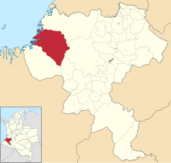
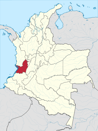
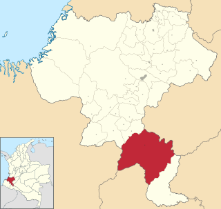
Cauca Department is a department of Southwestern Colombia. Located in the southwestern part of the country, facing the Pacific Ocean to the west, the Valle del Cauca Department to the north, Tolima Department to the northeast, Huila Department to the east, and Nariño Department to the south. Putumayo and Caqueta Departments border the southeast portion of Cauca Department as well. It covers a total area of 29,308 km2 (11,316 sq mi), the 13th largest in Colombia. Its capital is the city of Popayán. The offshore island of Malpelo belongs to the department. It is located in the southwest of the country, mainly in the Andean and Pacific regions plus a tiny part (Piamonte) in the Amazonian region. The area makes up 2.56% of the country.

Risaralda is a department of Colombia. It is located in the western central of the country, in the Andean region, It is part of the Coffee axis with Caldas and Quindío. Its capital is Pereira. Risaralda is very well known for the high quality of its coffee, and a booming industry: automotive, clothes, food, trading of goods and services.
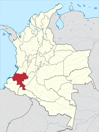
Valle del Cauca, or Cauca Valley, is a department in western Colombia abutting the Pacific Ocean. Its capital is Santiago de Cali. Other cities such as Buenaventura, Buga, Cartago, Palmira and Tuluá have great economical, political, social and cultural influence on the department's life. Valle del Cauca has the largest number of independent towns with over 100,000 inhabitants in the country, counting six within its borders. Buenaventura has the largest and busiest seaport in Colombia, moving about 8,500,000 tons of merchandise annually.
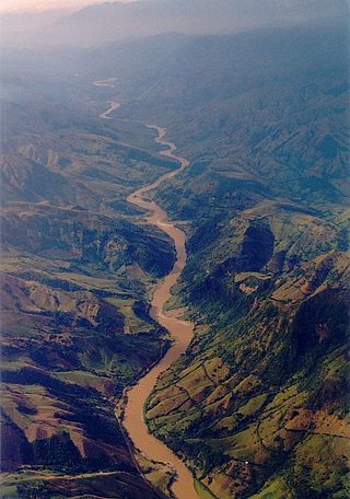
The Cauca River is a river in Colombia that lies between the Occidental and Central cordilleras. From its headwaters in southwestern Colombia near the city of Popayán, it joins the Magdalena River near Magangué in Bolívar Department, and the combined river eventually flows out into the Caribbean Sea. It has a length of 965 km (600 mi) to its junction with the Magdalena, for a total length of 1,350 km (840 mi). The river is under the supervision of the Cauca Regional Corporation and the Cauca Valley Regional Autonomous Corporation, and is navigable for 640 km (400 mi) above its junction with the Magdalena.

Popayán is the capital of the Colombian department of Cauca. It is located in the Pubenza Valley in southwestern Colombia between the Western Mountain Range and Central Mountain Range. The municipality has a population of 318,059, an area of 483 km2, is located 1760 meters above sea level, and has an average temperature of 18 °C.

Barbacoan is a language family spoken in Colombia and Ecuador.

Piamonte is a town and municipality in the Cauca Department, Colombia.

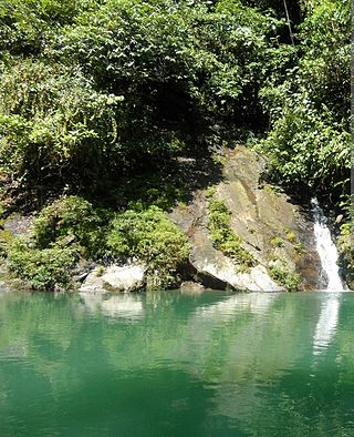
The Munchique National Natural Park is a national park located in the Cauca Department in the Cordillera Occidental range in the Andean Region of Colombia. There are 30 streams and rivers, and 40 waterfalls in the area. The diversity of thermal levels makes the park a paradise for birds, especially hummingbirds.

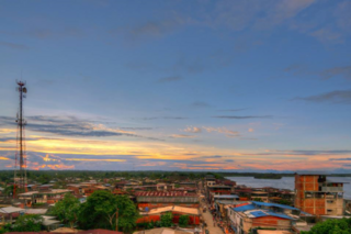
Buenaventura is a coastal seaport city located in the Pacific Region of the department of Valle del Cauca, Colombia. Buenaventura is the main port of Colombia in the Pacific Ocean.

The Pacific/Chocó region is one of the five major natural regions of Colombia. Ecologically, this region belongs entirely to the Chocó Biogeographic Region and is considered a biodiversity hotspot. It also has areas with the highest rainfall in the world, with areas near Quibdo, Chocó reaching up to 13,000 mm (510 in) annually.
Guapi is a town and municipality in the Cauca Department, Colombia. The municipality of Guapi is located on the Guapi River, 4 miles (6.4 km) from the Pacific Ocean, and also covers the island of Gorgona.

López de Micay is a town and municipality in the Cauca Department, Colombia. It is located on the Pacific Coast of the Cauca Department in the Naya Region on the foothills of the Colombian Western Cordillera. It is located 84 km from the departmental capital, Popayán.

Santa Rosa is a Colombian municipality located in the department of Cauca, in the region known as the Bota Caucana. It is located on the eastern slope of the Colombian Massif, the mountainous area where the Central and Oriental Cordilleras merge. Its economy is based on agriculture, its main products are corn, sugar cane, plantain and livestock. It includes the corregiments of Carmelo, San Juan de Villalobos and Descanse.

Because of its natural structure, Colombia can be divided into six distinct natural regions. These consist of the Andean Region, covering the three branches of the Andes mountains found in Colombia; the Caribbean Region, covering the area adjacent to the Caribbean Sea; the Pacific Region adjacent to the Pacific Ocean; the Orinoquía Region, part of the Llanos plains mainly in the Orinoco river basin along the border with Venezuela; the Amazon Region, part of the Amazon rainforest; and finally the Insular Region, comprising the islands in both the Atlantic and Pacific Oceans. Colombia is located in South America.
The Serranía del Pinche are part of the Western Ranges of the Colombian Andes. The mountains consist of several high peaks with small patches of isolated páramo and provide a corridor between the Pacific and Andean biogeographic regions. It is located municipality of Argelia in the Department of Cauca. This area is under consideration for protection as a Flora and Fauna Sanctuary by the Colombian government. This area is important for its incredible biodiversity and high percentage of primary forest. An endemic hummingbird - the gorgeted puffleg - is only found here and the population is considered to be critically endangered.

The Patía River is a river in southwestern Colombia. It flows over 400 kilometres (250 mi) to drain into the Pacific Ocean north of Tumaco. The Patía River is the longest river on the Colombian Pacific Coast. The last 90 kilometres (56 mi) is navigable by boat.
The Naya River is a river in Colombia that flows into the Pacific Ocean.
The Naya-Micay Fault is a dextral oblique thrust fault in the departments of Cauca and Valle del Cauca in Colombia. The fault has a total length of 158.2 kilometres (98.3 mi) and runs along an average northeast to southwest strike of 034.1 ± 12 in the Tumaco Basin along the Pacific Coast of Colombia.
Descanse is a corregiment in the south of the department of Cauca in the region known as Media Bota Caucana, municipality of Santa Rosa located near the borders of Cauca with the department of Putumayo. Descanse has a population of 1,326 inhabitants including the rural area. The town was settled around year 1560. Despite its antiquity, it is one of the most isolated towns of the department of Cauca due to its location in the Colombian Massif and the lack of access roads since it is only connected to other population centers through horseshoe tracks.