Tolley, North Dakota

Last updated

Tolley, North Dakota
Tolley North Dakota 5-22-2008.jpg
Street in Tolley North Dakota
ND Renville County Tolley.svg
Location of Tolley, North Dakota
Coordinates: 48°43′49″N101°49′38″W / 48.73028°N 101.82722°W / 48.73028; -101.82722
CountryUnited States
State North Dakota
County Renville
Founded1905
Government
  MayorRick Tohm [ citation needed ]
Area
[1]
  Total0.13 sq mi (0.32 km2)
  Land0.13 sq mi (0.32 km2)
  Water0.00 sq mi (0.00 km2)
Elevation
[2]
1,850 ft (560 m)
Population
 (2020)
  Total41
  Density328.00/sq mi (126.33/km2)
Time zone UTC-6 (CST)
  Summer (DST) UTC-5 (CDT)
ZIP code
58787
Area code 701
FIPS code 38-79140
GNIS feature ID1036296 [2]

Tolley is a city in Renville County, North Dakota, United States. The population was 41 at the 2020 census. [3] It is part of the Minot Micropolitan Statistical Area. Tolley was founded by Eli Crane Tolley in 1905.[ citation needed ]

Contents

Geography

According to the United States Census Bureau, the city has a total area of 0.13 square miles (0.34 km2), all land. [4]

Demographics

Historical population
CensusPop.Note
1910 250
1920 32530.0%
1930 225−30.8%
1940 177−21.3%
1950 24840.1%
1960 189−23.8%
1970 163−13.8%
1980 103−36.8%
1990 79−23.3%
2000 63−20.3%
2010 47−25.4%
2020 41−12.8%
2021 (est.)40 [5] −2.4%
U.S. Decennial Census [6]
2020 Census [3]

2010 census

As of the census of 2010, there were 47 people, 26 households, and 13 families residing in the city. The population density was 361.5 inhabitants per square mile (139.6/km2). There were 40 housing units at an average density of 307.7 per square mile (118.8/km2). The racial makeup of the city was 100.0% White.

There were 26 households, of which 11.5% had children under the age of 18 living with them, 46.2% were married couples living together, 3.8% had a female householder with no husband present, and 50.0% were non-families. 46.2% of all households were made up of individuals, and 7.6% had someone living alone who was 65 years of age or older. The average household size was 1.81 and the average family size was 2.54.

The median age in the city was 48.3 years. 12.8% of residents were under the age of 18; 2.2% were between the ages of 18 and 24; 29.8% were from 25 to 44; 34.1% were from 45 to 64; and 21.3% were 65 years of age or older. The gender makeup of the city was 61.7% male and 38.3% female.

2000 census

As of the census of 2000, there were 63 people, 32 households, and 15 families residing in the city. The population density was 490.9 inhabitants per square mile (189.5/km2). There were 39 housing units at an average density of 303.9 per square mile (117.3/km2). The racial makeup of the city was 85.71% White, 7.94% Native American, and 6.35% from two or more races.

There were 32 households, out of which 15.6% had children under the age of 18 living with them, 46.9% were married couples living together, and 53.1% were non-families. 46.9% of all households were made up of individuals, and 21.9% had someone living alone who was 65 years of age or older. The average household size was 1.97 and the average family size was 2.93.

In the city, the population was spread out, with 20.6% under the age of 18, 1.6% from 18 to 24, 27.0% from 25 to 44, 28.6% from 45 to 64, and 22.2% who were 65 years of age or older. The median age was 46 years. For every 100 females, there were 133.3 males. For every 100 females age 18 and over, there were 127.3 males.

The median income for a household in the city was $18,750, and the median income for a family was $18,750. Males had a median income of $23,750 versus $18,125 for females. The per capita income for the city was $9,835. There were 20.0% of families and 39.4% of the population living below the poverty line, including 84.6% of under eighteens and 63.6% of those over 64.

Climate

This climatic region is typified by large seasonal temperature differences, with warm to hot (and often humid) summers and cold (sometimes severely cold) winters. According to the Köppen Climate Classification system, Tolley has a humid continental climate, abbreviated "Dfb" on climate maps. [7]

Related Research Articles

<span class="mw-page-title-main">Buck Grove, Iowa</span> City in Iowa, United States

Buck Grove is a city in Crawford County, Iowa, United States. The population was 34 at the 2020 census.

<span class="mw-page-title-main">Kinross, Iowa</span> City in Iowa, United States

Kinross is a city in Keokuk County, Iowa, United States. The population was 80 at the time of the 2020 census. The community is named after Kinross in Scotland.

<span class="mw-page-title-main">Coyville, Kansas</span> City in Wilson County, Kansas

Coyville is a city in Wilson County, Kansas, United States. As of the 2020 census, the population of the city was 60.

<span class="mw-page-title-main">Trommald, Minnesota</span> City in Minnesota, United States

Trommald is a city in Crow Wing County, Minnesota, United States. The population was 98 at the 2010 census. It is part of the Brainerd Micropolitan Statistical Area.

<span class="mw-page-title-main">Ainsworth, Nebraska</span> City in and county seat of Brown County, Nebraska, United States

Ainsworth is a city and county seat of Brown County, Nebraska, United States. The population was 1,728 at the 2010 census.

<span class="mw-page-title-main">Dodge, North Dakota</span> City in North Dakota, United States

Dodge is a city in Dunn County, North Dakota, United States. The population was 89 at the 2020 census. Dodge was founded in 1915.

<span class="mw-page-title-main">Hazelton, North Dakota</span> City in North Dakota, United States

Hazelton is a city in Emmons County, North Dakota, United States. The population was 223 at the 2020 census.

<span class="mw-page-title-main">Upham, North Dakota</span> City in North Dakota, United States

Upham is a city in McHenry County, North Dakota, United States. The population was 135 at the 2020 census. It is part of the Minot Micropolitan Statistical Area. Upham was founded in 1905.

<span class="mw-page-title-main">Ross, North Dakota</span> City in North Dakota, United States

Ross is a city in Mountrail County, North Dakota, United States. The population was 95 at the 2020 census.

<span class="mw-page-title-main">Martin, North Dakota</span> City in North Dakota, United States

Martin is a city in Sheridan County, North Dakota, United States. The population was 63 at the 2020 census.

<span class="mw-page-title-main">Richardton, North Dakota</span> City in North Dakota, United States

Richardton is a city in Stark County, North Dakota, United States. The population was 692 at the 2020 census. Richardton was founded in 1883. It is part of the Dickinson Micropolitan Statistical Area.

<span class="mw-page-title-main">Sharon, North Dakota</span> City in North Dakota, United States

Sharon is a city in Steele County, North Dakota, United States. The population was 86 at the 2020 census. Sharon was founded in 1896.

<span class="mw-page-title-main">Haines, Oregon</span> City in Oregon, United States

Haines is a city in Baker County, Oregon, United States. The population was 416 at the 2010 census.

<span class="mw-page-title-main">Vienna, South Dakota</span> Town in South Dakota, United States

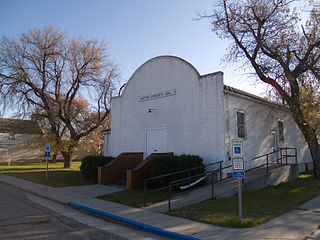
Vienna is a town in Clark County, South Dakota, United States. The population was 49 at the 2020 census.

<span class="mw-page-title-main">Isabel, South Dakota</span> Town in South Dakota, United States

Isabel is a town in Dewey County, South Dakota, United States. The population was 145 at the 2020 census.

<span class="mw-page-title-main">Menno, South Dakota</span> City in South Dakota, United States

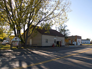
Menno is a city in Hutchinson County, South Dakota, United States. The population was 614 at the 2020 census.

<span class="mw-page-title-main">Kadoka, South Dakota</span> City in South Dakota, United States

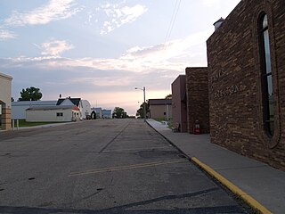
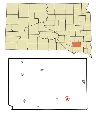
Kadoka is a city in, and the county seat of, Jackson County, South Dakota, United States. The population was 543 at the 2020 census. The town occupies about 2.3 square miles.

<span class="mw-page-title-main">Tieton, Washington</span> City in Washington, United States

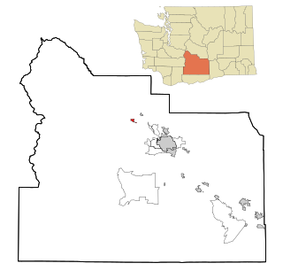
Tieton is a city in Yakima County, Washington, United States. The population was 1,389 at the 2020 census.

<span class="mw-page-title-main">Wilton, North Dakota</span> City in North Dakota, United States

Wilton is a city in Burleigh and McLean counties in North Dakota, United States. It is part of the "Bismarck, ND Metropolitan Statistical Area" or "Bismarck-Mandan". The population was 718 at the 2020 census. Founded in 1899, Wilton was named by General W. D. Washburn after the town of Wilton in his native state of Maine.

<span class="mw-page-title-main">Reklaw, Texas</span> City in Texas, United States

Reklaw is a city in Cherokee and Rusk counties in the U.S. state of Texas. The population was 379 at the 2010 census.

References

  1. "ArcGIS REST Services Directory". United States Census Bureau. Retrieved September 20, 2022.
  2. 1 2 U.S. Geological Survey Geographic Names Information System: Tolley, North Dakota
  3. 1 2 "Explore Census Data". American FactFinder. United States Census Bureau . Retrieved July 17, 2022.
  4. "US Gazetteer files 2010". United States Census Bureau. Archived from the original on July 2, 2012. Retrieved June 14, 2012.
  5. "City and Town Population Totals: 2020-2021". United States Census Bureau. July 17, 2022. Retrieved July 17, 2022.
  6. United States Census Bureau. "Census of Population and Housing" . Retrieved October 23, 2013.
  7. Climate Summary for Tolley, North Dakota