Trincheras Formation

Last updated
Trincheras Formation
Stratigraphic range: Early Aptian
~120–115  Ma
Є
O
S
D
C
P
T
J
K
Pg
N
Type Geological formation
Unit of Villeta Group
Sub-units Anapoima Mb., El Tigre Mb.
Underlies Socotá Fm., El Peñón Fm.
Overlies Murca Fm., La Naveta Fm., Útica Fm.
Thickness up to 1,260 m (4,130 ft)
Lithology
Primary Shale
Other Sandstone, limestone
Location
Coordinates 4°30′13″N74°36′22″W / 4.50361°N 74.60611°W / 4.50361; -74.60611 Coordinates: 4°30′13″N74°36′22″W / 4.50361°N 74.60611°W / 4.50361; -74.60611
Region Altiplano Cundiboyacense
Eastern Ranges, Andes
CountryFlag of Colombia.svg  Colombia
Type section
Named for Quebrada Trincheras
Named by Cáceres & Etayo
Location Apulo
Year defined 1969
Coordinates 4°30′13″N74°36′22″W / 4.50361°N 74.60611°W / 4.50361; -74.60611
Region Cundinamarca
CountryFlag of Colombia.svg  Colombia
Blakey 120Ma - COL.jpg
Paleogeography of Northern South America
120 Ma, by Ron Blakey

The Trincheras Formation (Spanish : Formación Trincheras, Kitr) is a geological formation of the Altiplano Cundiboyacense, Eastern Ranges of the Colombian Andes. The formation consisting of a lower unit of calcareous shales and an upper sequence of shales dates to the Early Cretaceous period; Early Aptian epoch and has a maximum thickness of 1,260 metres (4,130 ft). The formation, deposited in a marine platform environment, part of a transgressive cycle, hosts ammonite, bryozoan, mollusc and echinoid fossils.

Spanish language Romance language

Spanish or Castilian, is a Western Romance language that originated in the Castile region of Spain and today has hundreds of millions of native speakers in the Americas and Spain. It is a global language and the world's second-most spoken native language, after Mandarin Chinese.

Altiplano Cundiboyacense

The Altiplano Cundiboyacense[altiˈplano kundiβoʝaˈsense] is a high plateau located in the Eastern Cordillera of the Colombian Andes covering parts of the departments of Cundinamarca and Boyacá. The altiplano corresponds to the ancient territory of the Muisca. The Altiplano Cundiboyacense comprises three distinctive flat regions; the Bogotá savanna, the valleys of Ubaté and Chiquinquirá, and the valleys of Duitama and Sogamoso. The average altitude of the altiplano is about 2,600 metres (8,500 ft) above sea level but ranges from roughly 2,500 metres (8,200 ft) to 4,000 metres (13,000 ft).

Cordillera Oriental (Colombia) mountain range in Colombia

The Cordillera Oriental is the widest of the three branches of the Colombian Andes. The range extends from south to north dividing from the Colombian Massif in Huila Department to Norte de Santander Department where it splits into the Serranía del Perijá and the Cordillera de Mérida in Venezuelan Andes. The highest peak is Ritacuba Blanco at 5,410 m (17,750 ft) in the Sierra Nevada del Cocuy.

Contents

Etymology

The formation was defined and named in 1969 by Cáceres and Etayo after Quebrada Trincheras, Apulo, Cundinamarca. [1]

Fernando Etayo Serna is a Colombian paleontologist and geologist. His contributions on the paleontology in Colombia has been mainly on the descriptions of ammonites and Etayo has helped describing many fossiliferous geologic formations of Colombia. Etayo obtained his MSc. degree in geology and geophysics from the Universidad Nacional de Colombia in 1963, and his PhD in paleontology from the University of California, Berkeley in 1975.

Apulo Municipality and town in Cundinamarca, Colombia

Apulo is a Colombian town and municipality in the Cundinamarca Department.

Cundinamarca Department Department in Andean Region, Colombia

Department of Cundinamarca is one of the departments of Colombia. Its area covers 22,623 square kilometres (8,735 sq mi) and it has a population of 2,598,245 as of 2013. It was created on August 5, 1886 under the constitutional terms presented on the same year. Cundinamarca is located in the center of Colombia.

Description

Lithologies

The Trincheras Formation has a maximum thickness of 1,260 metres (4,130 ft), [2] and is characterised by a sequence of claystones with intercalated limestones and sandstones. Fossils of the ammonites Heinzia sp. , Pseudohaploceras sp. , Heminautilus etheringtoni , Cheloniceras sp. and bryozoans, molluscs and echinoids have been found in the Trincheras Formation. [3]

Limestone Sedimentary rocks made of calcium carbonate

Limestone is a carbonate sedimentary rock that is often composed of the skeletal fragments of marine organisms such as coral, foraminifera, and molluscs. Its major materials are the minerals calcite and aragonite, which are different crystal forms of calcium carbonate (CaCO3). A closely related rock is dolostone, which contains a high percentage of the mineral dolomite, CaMg(CO3)2. In fact, in old USGS publications, dolostone was referred to as magnesian limestone, a term now reserved for magnesium-deficient dolostones or magnesium-rich limestones.

Sandstone A clastic sedimentary rock composed mostly of sand-sized particles

Sandstone is a clastic sedimentary rock composed mainly of sand-sized mineral particles or rock fragments.

<i>Heinzia</i> genus of molluscs (fossil)

Heinzia is an extinct ammonoid cephalopod genus belonging to the family Pulchelliidae. They lived during the Cretaceous, in the Barremian age.

Stratigraphy and depositional environment

The Trincheras Formation is the lowermost unit of the Villeta Group, [4] and conformably overlies the Murca, La Naveta and Útica Formations. The formation is overlain in a transitional pattern by the Socotá and El Peñón Formations. [2] The Trincheras Formation is subdivided into the El Tigre and Anapoima Members. The age has been estimated to be Early Aptian. Stratigraphically, the formation is time equivalent with the fossiliferous Paja Formation of Boyacá and the Las Juntas Formation. [5] The formation has been deposited in a marine well oxygenated platform environment. [3] In terms of sequence stratigraphy, this phase was transgressional. [5]

Villeta Group

The Villeta Group is a geological group of the Eastern Ranges of the Colombian Andes, to the west of the Altiplano Cundiboyacense. The group, a sequence of shales, limestones and sandstones, is subdivided into various formations; Conejo, La Frontera, Simijaca, Hiló, Pacho, Chiquinquirá, Capotes, Socotá, El Peñón, and Trincheras, and dates to the Cretaceous period; Aptian-Coniacian epochs. The group stretches out across four departments, from Huila in the south, through Cundinamarca and Boyacá to southern Santander in the north. The upper part of the Villeta Group is time-equivalent with the La Luna Formation of the Middle Magdalena Valley (VMM) and Sierra Nevada del Cocuy, the Oliní and Güagüaquí Groups of the Guaduas-Vélez synclinal and the Chipaque Formation of the Altiplano Cundiboyacense. The lower part has been correlated with the Simití, Tablazo and Paja Formations of the VMM, the upper Tibasosa, Une and Fómeque Formations of the Altiplano Cundiboyacense and the Capacho, Aguardiente, Tibú-Mercedes and upper Río Negro Formations of the Sierra Nevada del Cocuy.

The Murca Formation is a geological formation of the Altiplano Cundiboyacense, Eastern Ranges of the Colombian Andes. The predominantly subarkose sandstone with claystones and siltstones formation dates to the Early Cretaceous period; Valanginian epoch and has a maximum thickness of 924 metres (3,031 ft).

The La Naveta Formation is a geological formation of the Altiplano Cundiboyacense, Eastern Ranges of the Colombian Andes. The formation consists of a lower part of coraline limestones and an upper sequence of quartzitic sandstones with intercalated black shales and dates to the Early Cretaceous period; Hauterivian to Barremian epochs.

Outcrops

The Trincheras Formation is apart from its type locality in Apulo, found near La Mesa and Anapoima, [3] in the Villeta Anticlinal, the Murca-Guayabal-Nimaima Anticlinal and along the roads between Pacho and La Palma and Útica-La Peña. [2] The formation also crops out around San Joaquín east of La Mesa, [6] and on the right bank of the Bogotá River near Apulo. [7]

Type locality, also called type area, or type section, is the locality where a particular rock type, stratigraphic unit or mineral species is first identified. If the stratigraphic unit in a locality is layered, it is called a stratotype, whereas the standard of reference for unlayered rocks is the type locality.

La Mesa, Cundinamarca Place in Cundinamarca, Colombia

La Mesa is a municipality and town of Colombia in the Tequendama Province of the department of Cundinamarca. The urban centre is located 65 kilometres (40 mi) from Bogotá.

Anapoima Place in Cundinamarca, Colombia

Anapoima is a Colombian municipality in the department of Cundinamarca located 87 km (54 mi) from Bogotá.

The reverse Bituima Fault thrusts the Trincheras Formation on top of the Güagüaquí Group, [6] while the Bogotá River Fault laterally displaces the formation near Anapoima. [7]

Regional correlations

Cretaceous stratigraphy of the central Colombian Eastern Ranges
AgePaleomap VMM Guaduas-Vélez W Emerald Belt Villeta anticlinal Chiquinquirá-
Arcabuco
Tunja-
Duitama
Altiplano Cundiboyacense El Cocuy
Maastrichtian Blakey 065Ma - COL.jpg Umir Fm. Córdoba Fm. Seca Fm. eroded Guadalupe Gp. Colón-Mito Juan Fm.
Umir Fm.
Campanian Córdoba Fm.
Oliní Gp.
Santonian La Luna Fm. Cimarrona Fm. - La Tabla Fm. La Luna Fm.
Coniacian Oliní Gp. Conejo Fm. Chipaque Fm.
Loma Gorda Fm. undefined La Frontera Fm.
Turonian Blakey 090Ma - COL.jpg Hondita Fm. La Frontera Fm. Otanche Fm.
Cenomanian Simití Fm. hiatus La Corona Gb. Simijaca Fm. Capacho Fm.
Pacho Fm. Hiló Fm. - Pacho Fm. Churuvita Fm. Une Fm. Aguardiente Fm.
Albian Blakey 105Ma - COL.jpg Hiló Fm. Chiquinquirá Sst. Tibasosa Fm. Une Fm.
Tablazo Fm. Tablazo Fm. Capotes Fm. - La Palma Fm. - Simití Fm. Simití Fm. Tibú-Mercedes Fm.
Aptian Capotes Fm. Socotá Fm. - El Peñón Fm. Paja Fm. Fómeque Fm.
Paja Fm. Paja Fm. El Peñón Fm. Trincheras Fm. Río Negro Fm.
La Naveta Fm.
Barremian Blakey 120Ma - COL.jpg
Hauterivian Muzo Fm. Las Juntas Fm.
Rosablanca Fm. Ritoque Fm.
Valanginian Ritoque Fm. Furatena Fm. Útica Fm. - Murca Fm. Rosablanca Fm. Girón Fm. Macanal Fm.
Rosablanca Fm.
Berriasian Blakey 150Ma - COL.jpg Cumbre Fm. Cumbre Fm. Los Medios Fm. Guavio Fm.
Tambor Fm. Arcabuco Fm. Cumbre Fm.
Sources

See also

Cscr-candidate.svg Geology of the Eastern Hills
Symbol b class.svg Geology of the Ocetá Páramo
Symbol c class.svg Geology of the Altiplano Cundiboyacense

Related Research Articles

Simijaca Formation

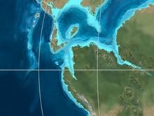
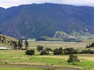
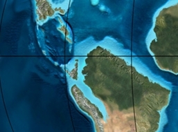
The Simijaca Formation (Spanish: Formación Simijaca, K2S, Kss) is a geological formation of the Altiplano Cundiboyacense, Eastern Ranges of the Colombian Andes. The predominantly mudstone formation dates to the Late Cretaceous period; Turonian and Cenomanian epochs, and has a maximum thickness of 693 metres (2,274 ft).

Chipaque Formation

The Chipaque Formation (Spanish: Formación Chipaque, K2cp, Kc) is a geological formation of the Altiplano Cundiboyacense, Eastern Ranges of the Colombian Andes. The predominantly organic shale formation dates to the Late Cretaceous period; Cenomanian-Turonian epochs and has a maximum thickness of 1,700 metres (5,600 ft). The formation, rich in TOC, is an important oil and gas generating unit for the giant oilfields Cupiagua and Cusiana of the Eastern Ranges as well as in the Llanos Orientales.

Guadalupe Group

The Guadalupe Group (Spanish: Grupo Guadalupe, K2G, Ksg) is a geological group of the Altiplano Cundiboyacense, Eastern Ranges of the Colombian Andes. The group, a sequence of shales and sandstones, is subdivided into three formations; Arenisca Dura, Plaeners and Arenisca Labor-Tierna, and dates to the Late Cretaceous period; Campanian-Maastrichtian epochs and at its type section has a thickness of 750 metres (2,460 ft).

Guaduas Formation

The Guaduas Formation (Spanish: Formación Guaduas, K2P1G, K2E1G, KPgg, KTg, TKg, Ktg) is a geological formation of the Middle Magdalena Basin and the Altiplano Cundiboyacense, Eastern Ranges of the Colombian Andes. The predominantly shale with coalbed formation dates to the Late Cretaceous and Paleogene periods; Maastrichtian-Paleocene epochs, and has a maximum thickness of 1,090 metres (3,580 ft). Fossils of Coussapoa camargoi, Ficus andrewsi, Berhamniphyllum sp. and Archaeopaliurus boyacensis have been found in coalbeds in Zipaquirá and Tasco, Boyacá.

La Frontera Formation

The La Frontera Formation (Spanish: Formación La Frontera, K2F, Ksf) is a geological formation, part of the Villeta Group, of the Altiplano Cundiboyacense and neighbouring areas of the Eastern Ranges of the Colombian Andes. The sequence of limestones and lydites dates to the Late Cretaceous period; Turonian epoch and has a maximum thickness of 206 metres (676 ft).

Conejo Formation

The Conejo Formation (Spanish: Formación Conejo, K2C, Kscn) is a fossiliferous geological formation of the Altiplano Cundiboyacense, Eastern Ranges of the Colombian Andes. The uppermost unit of the Villeta Group, a sequence of shales and sandstones dates to the Late Cretaceous period; Turonian, Coniacian and Santonian epochs, and has a maximum thickness of 1,022 metres (3,353 ft).

Hiló Formation

The Hiló Formation is a geological formation of the Altiplano Cundiboyacense, Eastern Ranges of the Colombian Andes. The predominantly shale formation dates to the Middle Cretaceous period; Late Albian to Early Cenomanian epochs and has a measured thickness at its type section of 470 metres (1,540 ft). The fossiliferous formation has provided a great abundance of ammonites and other marine species.

Capotes Formation

The Capotes Formation is a geological formation of the Altiplano Cundiboyacense, Eastern Ranges of the Colombian Andes. The formation consists of calcareous black shales containing gypsum and ammonites and dates to the Early Cretaceous period; Early Albian epoch and has an approximate thickness at its type section of 550 metres (1,800 ft).

Socotá Formation

The Socotá Formation is a geological formation of the Altiplano Cundiboyacense, Eastern Ranges of the Colombian Andes. The formation consisting of a lower unit of calcareous sandstones and an upper sequence of shales dates to the Early Cretaceous period; Late Aptian epoch and in Quipile has a measured thickness of 255 metres (837 ft) with large regional variations. The formation hosts ammonite fossils.

El Peñón Formation

The El Peñón Formation is a geological formation of the Altiplano Cundiboyacense, Eastern Ranges of the Colombian Andes. The formation consists of calcareous shales and siltstones and dates to the Early Cretaceous period; Late Aptian epoch and has a measured thickness at its type section of 381 metres (1,250 ft). Ammonite fossils have been found in the formation, deposited in a shallow marine platform environment.

The Las Juntas Formation or Las Juntas Sandstone is a geological formation of the Altiplano Cundiboyacense and Tenza Valley, Eastern Ranges of the Colombian Andes. The Las Juntas Formation is found in the departments Cundinamarca, Boyacá and Casanare. The predominantly sandstone formation dates to the Early Cretaceous period; Hauterivian epoch, and has a maximum thickness of 910 metres (2,990 ft).

Fómeque Formation

The Fómeque Formation is a geological formation of the Altiplano Cundiboyacense, Eastern Ranges of the Colombian Andes. The predominantly organic shale formation dates to the Early Cretaceous period; Barremian to Late Aptian epochs and has a maximum thickness of 1,200 metres (3,900 ft).

Une Formation

The Une Formation is a geological formation of the Altiplano Cundiboyacense, Eastern Ranges of the Colombian Andes. The predominantly sandstone formation dates to the Middle Cretaceous period; Albian to Cenomanian epochs and has a maximum thickness of 1,100 metres (3,600 ft).

Pacho Formation

The Pacho Formation is a geological formation of the Altiplano Cundiboyacense, Eastern Ranges of the Colombian Andes. The formation consisting of alternating siltstones and shales with siderite concretions dates to the Middle Cretaceous period; Late Albian to Cenomanian epochs and has an approximate thickness of 1,050 metres (3,440 ft).

Guavio Formation

The Guavio Formation is a geological formation of the Altiplano Cundiboyacense, Eastern Ranges of the Colombian Andes. The formation consists of conglomerates, shales and limestones, dates to the Late Jurassic and Early Cretaceous periods; Tithonian to Berriasian epochs and has a maximum thickness of 1,000 metres (3,300 ft).

Hondita Formation

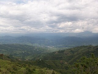
The Hondita Formation is a fossiliferous geological formation of the Upper Magdalena Valley (VSM) and surrounding Central and Eastern Ranges of the Colombian Andes, extending from Cundinamarca in the north to Huila and easternmost Tolima in the south. The lowermost unit of the Güagüaquí Group, a sequence of sandy limestones and shales, dates to the Late Cretaceous period; Turonian epoch, and has a maximum thickness of 90 metres (300 ft).

Oliní Group

The Oliní Group (Spanish: Grupo Oliní, K3k5o, K2ol, Kso) is a fossiliferous geological group of the VMM, VSM and the eastern flanks of the Central and western flanks of the Eastern Ranges of the Colombian Andes. The regional group stretches from north to south across approximately 700 kilometres (430 mi) and dates to the Late Cretaceous period; Coniacian, Santonian and Campanian epochs, and has a maximum thickness of 287 metres (942 ft). Fossils of Eonatator coellensis have been found in the unit, near Coello, Tolima.

References

  1. Acosta & Ulloa, 2002, p.39
  2. 1 2 3 Acosta & Ulloa, 2001, p.23
  3. 1 2 3 Acosta & Ulloa, 2002, p.40
  4. Acosta & Ulloa, 2001, p.22
  5. 1 2 Villamil, 2012, p.168
  6. 1 2 Plancha 227, 1998
  7. 1 2 Plancha 246, 1998

Bibliography

Maps